TopoQuest Logo
Do you find TopoQuest useful?
Help keep TopoQuest running and adding new maps/features by donating!
Bitcoin:  19c7KJd3qBynnjoSw5npx9KScwjBe4ifkT
Litecoin:  LXs6TkuXGGXo1vDsWCkWVdjQX94eUKd6ui
Home View Maps Find Maps Find Places Resources & Links


Rock Spring Peak, California Topographic Map

USGS Map Title: Rock Spring Peak, CA
USGS Map MRC: 36120D8
DRG (GeoTIFF) Download: o36120d8.tif


Neighboring USGS Topographic Map Quads:


  San Benito, CA  
36121E1
 

  Llanada, CA  
36120E8
 

  Panoche, CA  
36120E7
 

  Topo Valley, CA  
36121D1
 

  Rock Spring Peak, CA  
36120D8
 

  Hernandez Reservoir, CA  
36120D7
 

  Pinalito Canyon, CA  
36121C1
 

  Lonoak, CA  
36120C8
 

  Hepsedam Peak, CA  
36120C7


Map MRC Location:

N37°
W121°
N37°
W120°
H8 H7 H6 H5 H4 H3 H2 H1
G8 G7 G6 G5 G4 G3 G2 G1
F8 F7 F6 F5 F4 F3 F2 F1
E8 E7 E6 E5 E4 E3 E2 E1
D8 D7 D6 D5 D4 D3 D2 D1
C8 C7 C6 C5 C4 C3 C2 C1
B8 B7 B6 B5 B4 B3 B2 B1
A8 A7 A6 A5 A4 A3 A2 A1
N36°
W121°
N36°
W120°

Rock Spring Peak, CA USGS 1:24K Topographic Map Preview:
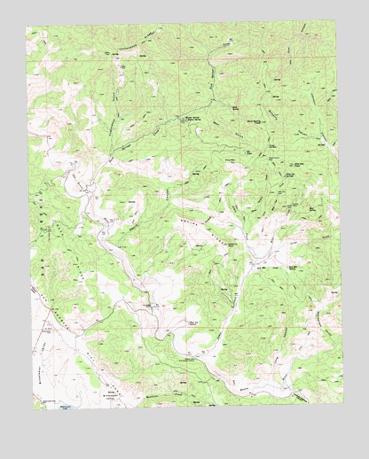
Rock Spring Peak, CA USGS Topographic Map
Click on map above to begin viewing in our Map Viewer.

This topographic map contains these locations and features:
Feature Name Type Latitude Longitude GNIS ID View Map
Bear GulchValleyN36.4711°W120.9288°239099View Map
Beaver Dam Fire Control StationLocaleN36.3902°W120.9349°239133View Map
Bitterwater - Tully Elementary SchoolSchoolN36.3766°W120.9970°239376View Map
Bitterwater CemeteryCemeteryN36.4005°W120.9927°239368View Map
Blue Jay SplashBendN36.4025°W120.9374°239497View Map
Butterfly CanyonValleyN36.4616°W120.8830°239905View Map
Cottonwood GulchValleyN36.4586°W120.9671°240986View Map
Cottonwood RidgeRidgeN36.4941°W120.9519°240992View Map
Devils CanyonValleyN36.4277°W120.9660°241456View Map
Fireflex MineMineN36.4397°W120.8949°242258View Map
Gorge CreekStreamN36.4205°W120.9085°242863View Map
Hunter SpringSpringN36.4691°W120.9374°243741View Map
James CreekStreamN36.3900°W120.9316°243997View Map
Lew Smith RanchLocaleN36.4077°W120.9516°244759View Map
Long CanyonValleyN36.3830°W120.9055°245063View Map
Lookout PeakSummitN36.4275°W120.9213°245102View Map
Lorenzo Vasquez CanyonValleyN36.3791°W120.8957°245120View Map
Mine CreekStreamN36.4202°W120.9102°245956View Map
Mud SpringSpringN36.4383°W120.8885°246330View Map
Pine MountainSummitN36.4544°W120.9191°247510View Map
Rattlesnake GulchValleyN36.3950°W120.8791°248002View Map
Red Mountain CreekStreamN36.4197°W120.9119°248060View Map
Red Mountain SpringSpringN36.4200°W120.8971°248063View Map
Rock SpringSpringN36.4722°W120.9185°248286View Map
Rock Spring PeakSummitN36.4672°W120.9066°248287View Map
Rock Springs CreekStreamN36.4483°W120.9744°248289View Map
Squire RidgeRidgeN36.4333°W120.9307°249849View Map
The BluffCliffN36.4350°W120.9285°250368View Map
The TulesSpringN36.4568°W120.9133°2786793View Map
Three CornersGapN36.4588°W120.9043°250469View Map
Three Corners CreekStreamN36.4341°W120.9141°250471View Map
Three Corners DamDamN36.4550°W120.9043°250472View Map
Wild Oat CreekStreamN36.4333°W120.9010°251538View Map
Wild Oat DamDamN36.4438°W120.9010°251539View Map
Wild Oat PeakSummitN36.4530°W120.8941°251540View Map
Wild Oat SpringsSpringN36.4494°W120.8974°251541View Map
Willow SpringSpringN36.4682°W120.9368°251651View Map

Note: Coordinates in the location and feature list above are referenced to NAD83 datum.


Copyright (C) 2008-2025 Ryan Niemi / Sunset Dynamics ... All Rights Reserved