TopoQuest Logo
Do you find TopoQuest useful?
Help keep TopoQuest running and adding new maps/features by donating!
Bitcoin:  19c7KJd3qBynnjoSw5npx9KScwjBe4ifkT
Litecoin:  LXs6TkuXGGXo1vDsWCkWVdjQX94eUKd6ui
Home View Maps Find Maps Find Places Resources & Links


Hernandez Reservoir, California Topographic Map

USGS Map Title: Hernandez Reservoir, CA
USGS Map MRC: 36120D7
DRG (GeoTIFF) Download: o36120d7.tif


Neighboring USGS Topographic Map Quads:


  Llanada, CA  
36120E8
 

  Panoche, CA  
36120E7
 

  Tumey Hills, CA  
36120E6
 

  Rock Spring Peak, CA  
36120D8
 

  Hernandez Reservoir, CA  
36120D7
 

  Idria, CA  
36120D6
 

  Lonoak, CA  
36120C8
 

  Hepsedam Peak, CA  
36120C7
 

  San Benito Mountain, CA  
36120C6


Map MRC Location:

N37°
W121°
N37°
W120°
H8 H7 H6 H5 H4 H3 H2 H1
G8 G7 G6 G5 G4 G3 G2 G1
F8 F7 F6 F5 F4 F3 F2 F1
E8 E7 E6 E5 E4 E3 E2 E1
D8 D7 D6 D5 D4 D3 D2 D1
C8 C7 C6 C5 C4 C3 C2 C1
B8 B7 B6 B5 B4 B3 B2 B1
A8 A7 A6 A5 A4 A3 A2 A1
N36°
W121°
N36°
W120°

Hernandez Reservoir, CA USGS 1:24K Topographic Map Preview:
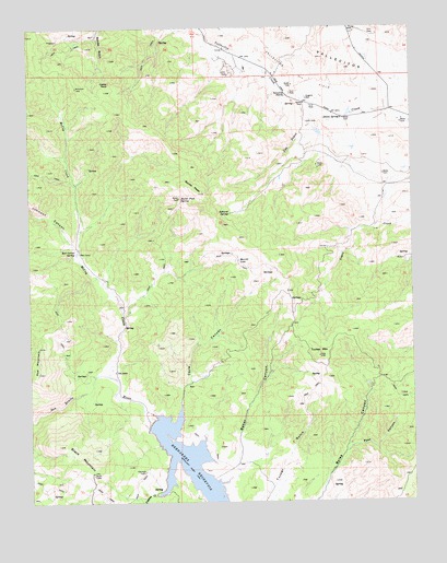
Hernandez Reservoir, CA USGS Topographic Map
Click on map above to begin viewing in our Map Viewer.

This topographic map contains these locations and features:
Feature Name Type Latitude Longitude GNIS ID View Map
Ashurst SpringSpringN36.4511°W120.8105°238806View Map
Baker CanyonValleyN36.3913°W120.8080°238896View Map
Black MountainSummitN36.3889°W120.8552°239428View Map
Bucks PeakSummitN36.4563°W120.8196°239779View Map
Bucks Peak SpringSpringN36.4546°W120.8263°239780View Map
Cane CanyonValleyN36.4075°W120.8235°240195View Map
Castle RockPillarN36.4858°W120.8485°240341View Map
Dogwood Lateral SixSpringN36.4761°W120.7732°241520View Map
Eugene WellWellN36.4811°W120.7846°242094View Map
Harrison CabinLocaleN36.3830°W120.8391°243254View Map
Hernandez 1025-002 DamDamN36.3980°W120.8352°1664165View Map
Hernandez ReservoirReservoirN36.3843°W120.8236°243384View Map
Johnson CanyonValleyN36.4427°W120.8616°244105View Map
Laguna CreekStreamN36.3769°W120.8349°244503View Map
McCoy CreekStreamN36.4083°W120.8521°245657View Map
Merrill LakeLakeN36.4386°W120.8077°245789View Map
Post CanyonValleyN36.3883°W120.7721°247724View Map
Red CorralLocaleN36.4408°W120.8596°248038View Map
Red Corral SpringSpringN36.4411°W120.8602°248039View Map
Red MountainSummitN36.4091°W120.8732°248058View Map
Syncline DivideGapN36.4822°W120.7905°250220View Map
The AdobeLocaleN36.4091°W120.8480°250363View Map
Tucker MountainSummitN36.4133°W120.7816°250654View Map

Note: Coordinates in the location and feature list above are referenced to NAD83 datum.


Copyright (C) 2008-2025 Ryan Niemi / Sunset Dynamics ... All Rights Reserved