TopoQuest Logo
Do you find TopoQuest useful?
Help keep TopoQuest running and adding new maps/features by donating!
Bitcoin:  19c7KJd3qBynnjoSw5npx9KScwjBe4ifkT
Litecoin:  LXs6TkuXGGXo1vDsWCkWVdjQX94eUKd6ui
Home View Maps Find Maps Find Places Resources & Links


Hepsedam Peak, California Topographic Map

USGS Map Title: Hepsedam Peak, CA
USGS Map MRC: 36120C7
DRG (GeoTIFF) Download: o36120c7.tif


Neighboring USGS Topographic Map Quads:


  Rock Spring Peak, CA  
36120D8
 

  Hernandez Reservoir, CA  
36120D7
 

  Idria, CA  
36120D6
 

  Lonoak, CA  
36120C8
 

  Hepsedam Peak, CA  
36120C7
 

  San Benito Mountain, CA  
36120C6
 

  Nattrass Valley, CA  
36120B8
 

  Monarch Peak, CA  
36120B7
 

  Priest Valley, CA  
36120B6


Map MRC Location:

N37°
W121°
N37°
W120°
H8 H7 H6 H5 H4 H3 H2 H1
G8 G7 G6 G5 G4 G3 G2 G1
F8 F7 F6 F5 F4 F3 F2 F1
E8 E7 E6 E5 E4 E3 E2 E1
D8 D7 D6 D5 D4 D3 D2 D1
C8 C7 C6 C5 C4 C3 C2 C1
B8 B7 B6 B5 B4 B3 B2 B1
A8 A7 A6 A5 A4 A3 A2 A1
N36°
W121°
N36°
W120°

Hepsedam Peak, CA USGS 1:24K Topographic Map Preview:
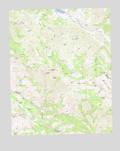
Hepsedam Peak, CA USGS Topographic Map
Click on map above to begin viewing in our Map Viewer.

This topographic map contains these locations and features:
Feature Name Type Latitude Longitude GNIS ID View Map
Abelardo CabinLocaleN36.3102°W120.7585°238395View Map
Airstrip PondLakeN36.3099°W120.7976°238460View Map
Augustine CreekStreamN36.3461°W120.7563°238829View Map
BadlandsAreaN36.2852°W120.7777°238882View Map
Bar B RanchLocaleN36.3675°W120.8005°238971View Map
Bootleg SpringSpringN36.2755°W120.8546°239572View Map
Byles CanyonValleyN36.3705°W120.7905°239917View Map
Calhoon CabinLocaleN36.3302°W120.8624°240006View Map
Cedar SpringSpringN36.3137°W120.7725°240391View Map
Clear CreekStreamN36.3588°W120.7863°240680View Map
Cottonwood SpringsSpringN36.3113°W120.8315°241000View Map
Dry LakeLakeN36.3205°W120.8479°241642View Map
Dunham SpringSpringN36.3017°W120.7595°241670View Map
Garcia CreekStreamN36.2750°W120.8391°242594View Map
Gull Neck RockSummitN36.2822°W120.8649°243084View Map
Hepsedam CreekStreamN36.2933°W120.8716°243370View Map
Hepsedam PeakSummitN36.3144°W120.8241°243371View Map
Hepsedam RanchLocaleN36.2752°W120.8380°243372View Map
Hepsedam SpringSpringN36.3062°W120.8194°243373View Map
Hernandez School (historical)SchoolN36.3638°W120.7891°1670166View Map
Hernandez ValleyValleyN36.3694°W120.8066°243385View Map
Hog HoleLakeN36.3005°W120.7750°243516View Map
Horsethief CanyonValleyN36.3422°W120.7555°243671View Map
James CanyonValleyN36.2597°W120.8291°243995View Map
John CabinLocaleN36.3358°W120.8280°244080View Map
Kenner LakeLakeN36.2682°W120.8495°244251View Map
Kenneth CabinLocaleN36.3275°W120.8238°244252View Map
Laguna LakeLakeN36.3103°W120.8083°244506View Map
Laguna MountainSummitN36.3391°W120.8088°244509View Map
Laguna RanchLocaleN36.3064°W120.7885°244514View Map
Lake SpringSpringN36.3014°W120.8017°244534View Map
Mail TrailTrailN36.3419°W120.7971°245387View Map
Mail Trail PondLakeN36.3444°W120.7945°245388View Map
Miller CanyonValleyN36.3683°W120.8396°245922View Map
North Fork Oak CanyonValleyN36.2569°W120.7757°246616View Map
Orejano FlatFlatN36.2755°W120.7527°246958View Map
Orejano SpringSpringN36.2745°W120.7531°246960View Map
Panther PeakSummitN36.3005°W120.7893°247222View Map
Rattlesnake GulchValleyN36.2897°W120.7685°248001View Map
Spanish FlatsFlatN36.2991°W120.8607°249787View Map
Split Oak SpringSpringN36.2859°W120.7593°249800View Map
Split RockSummitN36.3186°W120.7674°249801View Map
Sulphur CanyonValleyN36.3414°W120.8288°250034View Map
Sulphur SpringSpringN36.2975°W120.7730°250056View Map
Susie SpringSpringN36.2869°W120.8589°250159View Map
Sweetwater SpringSpringN36.3536°W120.8527°250183View Map
The GorgeValleyN36.3514°W120.8188°250380View Map
Tucker GulchValleyN36.3711°W120.8030°250653View Map
Vasquez CrossingCrossingN36.3177°W120.8546°1661627View Map
Vasquez RockSummitN36.3266°W120.8691°250962View Map

Note: Coordinates in the location and feature list above are referenced to NAD83 datum.


Copyright (C) 2008-2025 Ryan Niemi / Sunset Dynamics ... All Rights Reserved