TopoQuest Logo
Do you find TopoQuest useful?
Help keep TopoQuest running and adding new maps/features by donating!
Bitcoin:  19c7KJd3qBynnjoSw5npx9KScwjBe4ifkT
Litecoin:  LXs6TkuXGGXo1vDsWCkWVdjQX94eUKd6ui
Home View Maps Find Maps Find Places Resources & Links


Looneyville, West Virginia Topographic Map

USGS Map Title: Looneyville, WV
USGS Map MRC: 38081F3
DRG (GeoTIFF) Download: o38081f3.tif


Neighboring USGS Topographic Map Quads:


  Peniel, WV  
38081G4
 

  Spencer, WV  
38081G3
 

  Arnoldsburg, WV  
38081G2
 

  Walton, WV  
38081F4
 

  Looneyville, WV  
38081F3
 

  Tariff, WV  
38081F2
 

  Kettle, WV  
38081E4
 

  Clio, WV  
38081E3
 

  Newton, WV  
38081E2


Map MRC Location:

N39°
W82°
N39°
W81°
H8 H7 H6 H5 H4 H3 H2 H1
G8 G7 G6 G5 G4 G3 G2 G1
F8 F7 F6 F5 F4 F3 F2 F1
E8 E7 E6 E5 E4 E3 E2 E1
D8 D7 D6 D5 D4 D3 D2 D1
C8 C7 C6 C5 C4 C3 C2 C1
B8 B7 B6 B5 B4 B3 B2 B1
A8 A7 A6 A5 A4 A3 A2 A1
N38°
W82°
N38°
W81°

Looneyville, WV USGS 1:24K Topographic Map Preview:
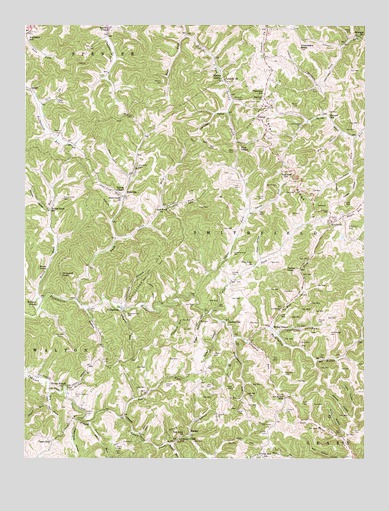
Looneyville, WV USGS Topographic Map
Click on map above to begin viewing in our Map Viewer.

This topographic map contains these locations and features:
Feature Name Type Latitude Longitude GNIS ID View Map
Banner ChurchChurchN38.7295°W81.2873°1535199View Map
Banner School (historical)SchoolN38.7240°W81.2629°1535201View Map
Bay's Chapel United Methodist ChurchChurchN38.7134°W81.2960°1535329View Map
Bays CemeteryCemeteryN38.7134°W81.2982°1535326View Map
Bays CemeteryCemeteryN38.7145°W81.3076°1535327View Map
Beelick RunStreamN38.6290°W81.3210°1535576View Map
Big HollowValleyN38.7187°W81.2587°1535860View Map
Boggs HollowValleyN38.6662°W81.3093°1536199View Map
Brannon CemeteryCemeteryN38.7281°W81.2951°1536308View Map
Buck KnobSummitN38.6798°W81.3698°1554018View Map
Buffalolick (historical)Populated PlaceN38.7043°W81.3473°1740861View Map
Cave HollowValleyN38.6823°W81.2882°1537111View Map
Chambers ForkStreamN38.7434°W81.2585°1537185View Map
Chambers KnobSummitN38.7429°W81.2735°1537186View Map
Chambers School (historical)SchoolN38.7301°W81.2873°1537187View Map
Clarkson ForkStreamN38.7176°W81.2540°1537359View Map
Claylick RunStreamN38.6690°W81.3198°1537373View Map
CloverPopulated PlaceN38.7231°W81.2896°1554159View Map
Clover - Roane Volunteer Fire DepartmentBuildingN38.7235°W81.2889°2577547View Map
Clover CemeteryCemeteryN38.7281°W81.2876°1537423View Map
Clover Post Office (historical)Post OfficeN38.7270°W81.2848°1740871View Map
Clover RidgeRidgeN38.7109°W81.2821°1537427View Map
Clover Ridge Oil FieldOilfieldN38.7273°W81.2862°1557817View Map
Coal Lick RunStreamN38.7004°W81.3393°1537457View Map
Coalstone RunStreamN38.6601°W81.2815°1537479View Map
Coe-Holland CemeteryCemeteryN38.7172°W81.2858°2586329View Map
Cook CemeteryCemeteryN38.6326°W81.2515°1537594View Map
Cox CemeteryCemeteryN38.7031°W81.2962°1537756View Map
Cranesnest RunStreamN38.6598°W81.2976°1537803View Map
Criner CemeteryCemeteryN38.6323°W81.2859°1537822View Map
Dalton ChapelChurchN38.7020°W81.3415°1537966View Map
Deverick CemeteryCemeteryN38.6448°W81.3309°1538150View Map
Dry ForkStreamN38.6443°W81.3654°1538353View Map
Eastern District (historical)CivilN38.6740°W81.2585°1928264View Map
Eplin Chapel CemeteryCemeteryN38.6635°W81.2817°2586174View Map
Epling ChapelChurchN38.6623°W81.2837°1538733View Map
Fairview School (historical)SchoolN38.7073°W81.2793°1538838View Map
Ferrell CemeteryCemeteryN38.6984°W81.2546°1538934View Map
Ferrell CemeteryCemeteryN38.7317°W81.2673°1538935View Map
Ferrell HollowValleyN38.6643°W81.3032°1538937View Map
Ferrell HollowValleyN38.7068°W81.2543°1538938View Map
Flat ForkStreamN38.6665°W81.3071°1551130View Map
Flat Fork ChurchChurchN38.6806°W81.2910°1539049View Map
Greathouse HollowValleyN38.6356°W81.3554°1539662View Map
Hall CemeteryCemeteryN38.6406°W81.2729°1539857View Map
HarleyPopulated PlaceN38.6318°W81.3140°1549728View Map
Harper CemeteryCemeteryN38.6456°W81.3232°1539992View Map
Hascue CemeteryCemeteryN38.6545°W81.3057°1540050View Map
Hershberger CemeteryCemeteryN38.6606°W81.2623°1540180View Map
Hickle HollowValleyN38.6309°W81.2565°1540195View Map
Hollywood ForkStreamN38.6312°W81.3148°1540401View Map
Hundley ChapelChurchN38.7493°W81.3440°1540583View Map
Jack ForkStreamN38.7265°W81.3698°1540761View Map
Jackson ForkStreamN38.6312°W81.3146°1740914View Map
Johnson Creek School (historical)SchoolN38.6306°W81.3179°1540978View Map
Keeley KnobSummitN38.6795°W81.2793°1554853View Map
Keffer CemeteryCemeteryN38.6529°W81.3457°1541110View Map
Kelley CemeteryCemeteryN38.6279°W81.3412°1541126View Map
Kelley CemeteryCemeteryN38.6387°W81.2946°1541127View Map
Kincaid CemeteryCemeteryN38.6998°W81.2873°1541201View Map
Laurel ForkStreamN38.6715°W81.3126°1541446View Map
Laurel RunStreamN38.6351°W81.3507°1541534View Map
Lawsons Farm Lake DamDamN38.6251°W81.3665°1559300View Map
Liberty ChurchChurchN38.7343°W81.3021°1541819View Map
Looney CemeteryCemeteryN38.6779°W81.2987°1542448View Map
LooneyvillePopulated PlaceN38.6645°W81.3032°1549798View Map
Looneyville Arch BridgeBridgeN38.6646°W81.3028°2647453View Map
Looneyville Post OfficePost OfficeN38.6592°W81.2923°1740939View Map
Lyehopper HollowValleyN38.7248°W81.3015°1542623View Map
Maldon RunStreamN38.6690°W81.3532°1542703View Map
Meadows CemeteryCemeteryN38.7087°W81.3337°1543091View Map
Millstone RunStreamN38.7465°W81.2521°1543428View Map
Millstone School (historical)SchoolN38.7470°W81.2521°1543430View Map
Monroe CemeteryCemeteryN38.6645°W81.2671°1543496View Map
Monroe HollowValleyN38.6370°W81.2548°1543498View Map
Mud ForkStreamN38.6620°W81.2848°1543901View Map
Mud ForkStreamN38.7470°W81.3165°1543902View Map
Nida CemeteryCemeteryN38.6426°W81.2926°1544171View Map
Oak Hill School (historical)SchoolN38.6254°W81.2873°1544301View Map
Oldham Lake DamDamN38.6251°W81.2998°1559299View Map
Pad (historical)Populated PlaceN38.6420°W81.3351°1740965View Map
Pad ForkStreamN38.6368°W81.3382°1544508View Map
Red Knob ChurchChurchN38.6318°W81.3162°1545456View Map
Roane CountyCivilN38.7140°W81.3483°1550050View Map
Rock HollowValleyN38.6337°W81.2571°1545914View Map
Rocky BranchStreamN38.6454°W81.3596°1546007View Map
Rocky Branch CemeteryCemeteryN38.6423°W81.3562°1546010View Map
Rocky Branch ChurchChurchN38.6448°W81.3604°1546011View Map
Roe HollowValleyN38.6251°W81.2607°1546041View Map
Round KnobSummitN38.6693°W81.3704°1555530View Map
Round Knob CemeteryCemeteryN38.6995°W81.3609°1546108View Map
Round Knob RunStreamN38.6676°W81.3701°1546109View Map
Round Knob School (historical)SchoolN38.6968°W81.3660°1546110View Map
RoxalanaPopulated PlaceN38.6931°W81.2621°1549906View Map
Rush CreekStreamN38.6701°W81.3560°1546158View Map
Rush Creek ChurchChurchN38.7004°W81.3396°1546160View Map
RushvillePopulated PlaceN38.7006°W81.3390°1549907View Map
Sergent CemeteryCemeteryN38.6376°W81.3501°1546578View Map
Shad (historical)Populated PlaceN38.6484°W81.3704°1740999View Map
Shamblings Mills (historical)LocaleN38.6681°W81.3687°1741001View Map
Shammon BranchStreamN38.6681°W81.3396°1546613View Map
Showens RunStreamN38.6676°W81.3390°1546743View Map
Simmons CemeteryCemeteryN38.6912°W81.2557°1546793View Map
Sinnett HollowValleyN38.6968°W81.3665°1546838View Map
Slab ForkStreamN38.6876°W81.3415°1546886View Map
Slab Fork ChurchChurchN38.6973°W81.3248°1546892View Map
Smith CemeteryCemeteryN38.7040°W81.2821°1546976View Map
Smith RunStreamN38.6962°W81.2929°1546998View Map
Stalnaker School (historical)SchoolN38.7454°W81.3737°1547320View Map
Stone CemeteryCemeteryN38.6937°W81.2601°1547449View Map
StringtownPopulated PlaceN38.6684°W81.3393°1549941View Map
Stringtown Oil FieldOilfieldN38.6506°W81.3446°1557895View Map
Sugar RunStreamN38.6406°W81.3657°1547655View Map
Summerfield CemeteryCemeteryN38.6659°W81.3373°1547729View Map
Summerfield CemeteryCemeteryN38.6837°W81.2982°1547730View Map
Summers ForkStreamN38.6973°W81.3254°1547735View Map
Swank CemeteryCemeteryN38.7179°W81.3629°1547793View Map
Taylor CemeteryCemeteryN38.7267°W81.2746°1547927View Map
Tiger GapGapN38.6301°W81.3654°1548091View Map
Vineyard CemeteryCemeteryN38.6390°W81.2787°1548676View Map
Vineyard CemeteryCemeteryN38.6493°W81.2793°1548677View Map
Vineyard CemeteryCemeteryN38.6601°W81.3629°1548678View Map
Vineyard GapGapN38.6426°W81.2790°1548679View Map
Vineyard KnobSummitN38.6779°W81.3618°1555892View Map
Vineyard RunStreamN38.6590°W81.2923°1548680View Map
Walnut GrovePopulated PlaceN38.7351°W81.3026°1555912View Map
Watson CemeteryCemeteryN38.7331°W81.3248°1548835View Map
WebbCemeteryN38.7479°W81.2551°1548860View Map

Note: Coordinates in the location and feature list above are referenced to NAD83 datum.


Copyright (C) 2008-2024 Ryan Niemi / Sunset Dynamics ... All Rights Reserved