TopoQuest Logo
Do you find TopoQuest useful?
Help keep TopoQuest running and adding new maps/features by donating!
Bitcoin:  19c7KJd3qBynnjoSw5npx9KScwjBe4ifkT
Litecoin:  LXs6TkuXGGXo1vDsWCkWVdjQX94eUKd6ui
Home View Maps Find Maps Find Places Resources & Links


Newton, West Virginia Topographic Map

USGS Map Title: Newton, WV
USGS Map MRC: 38081E2
DRG (GeoTIFF) Download: o38081e2.tif


Neighboring USGS Topographic Map Quads:


  Looneyville, WV  
38081F3
 

  Tariff, WV  
38081F2
 

  Chloe, WV  
38081F1
 

  Clio, WV  
38081E3
 

  Newton, WV  
38081E2
 

  Ivydale, WV  
38081E1
 

  Clendenin, WV  
38081D3
 

  Elkhurst, WV  
38081D2
 

  Clay, WV  
38081D1


Map MRC Location:

N39°
W82°
N39°
W81°
H8 H7 H6 H5 H4 H3 H2 H1
G8 G7 G6 G5 G4 G3 G2 G1
F8 F7 F6 F5 F4 F3 F2 F1
E8 E7 E6 E5 E4 E3 E2 E1
D8 D7 D6 D5 D4 D3 D2 D1
C8 C7 C6 C5 C4 C3 C2 C1
B8 B7 B6 B5 B4 B3 B2 B1
A8 A7 A6 A5 A4 A3 A2 A1
N38°
W82°
N38°
W81°

Newton, WV USGS 1:24K Topographic Map Preview:
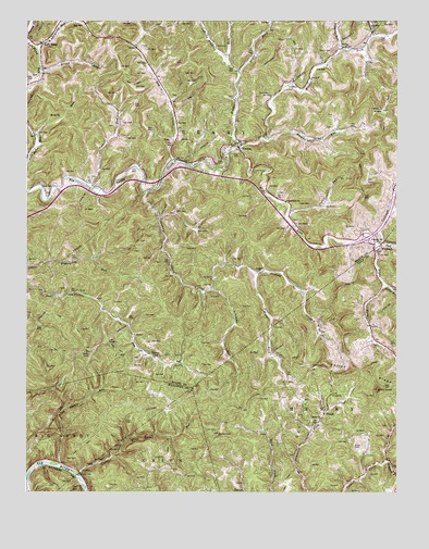
Newton, WV USGS Topographic Map
Click on map above to begin viewing in our Map Viewer.

This topographic map contains these locations and features:
Feature Name Type Latitude Longitude GNIS ID View Map
Anthony RunStreamN38.6209°W81.1321°1534972View Map
Ashcamp RunStreamN38.5534°W81.1893°1535056View Map
Ashleycamp RunStreamN38.6182°W81.2471°1535062View Map
Barton (historical)Populated PlaceN38.5187°W81.1701°1741264View Map
Bee RunStreamN38.5748°W81.1271°1535505View Map
Bethel Baptist ChurchChurchN38.5195°W81.1509°1535698View Map
Bloomington (historical)Populated PlaceN38.5840°W81.2365°1740850View Map
Blowntimber RunStreamN38.5934°W81.1682°1536117View Map
Broad RunStreamN38.6118°W81.2454°1536364View Map
Brush RunStreamN38.5948°W81.2482°1536468View Map
Camp RunStreamN38.5548°W81.1290°1536955View Map
Cookman ForkStreamN38.5643°W81.1318°1537597View Map
Cross Country Christian AcademySchoolN38.5969°W81.1792°2631495View Map
Cutoff RunStreamN38.5745°W81.1621°1537949View Map
Dog CreekStreamN38.5879°W81.2009°1538234View Map
Geary Elementary SchoolSchoolN38.6208°W81.2410°1740888View Map
Geary Public LibraryBuildingN38.6197°W81.2415°2727381View Map
Goodwill ChurchChurchN38.5584°W81.1712°1539512View Map
Granny CreekStreamN38.5795°W81.2096°1539583View Map
Grose CemeteryCemeteryN38.5123°W81.1396°1539763View Map
Hall CemeteryCemeteryN38.5312°W81.1604°1539856View Map
Hansford ForkStreamN38.5084°W81.1287°1539925View Map
Hill CemeteryCemeteryN38.5359°W81.1980°2586314View Map
Hively CemeteryCemeteryN38.5390°W81.1343°1540322View Map
Hollywood RunStreamN38.5915°W81.1784°1540403View Map
Interchange 34CrossingN38.5673°W81.1351°1740911View Map
KingPopulated PlaceN38.5018°W81.2312°1741318View Map
King CemeteryCemeteryN38.5609°W81.2043°1740924View Map
King Shoals RunStreamN38.5073°W81.2390°1541216View Map
Laurel Point CemeteryCemeteryN38.5854°W81.1743°1541488View Map
Left Fork Hollywood RunStreamN38.6157°W81.1834°1541665View Map
Left HandLocaleN38.6187°W81.2451°1541751View Map
Left Hand Independent Baptist ChurchChurchN38.6198°W81.2446°1740931View Map
Left Hand Post OfficePost OfficeN38.6192°W81.2483°1740932View Map
Middle Fork Big Sandy CreekStreamN38.5915°W81.1793°1543172View Map
NewtonPopulated PlaceN38.5915°W81.1787°1544162View Map
Newton Baptist ChurchChurchN38.5923°W81.1807°1740956View Map
Newton CemeteryCemeteryN38.5924°W81.1807°2586316View Map
Newton Post OfficePost OfficeN38.5917°W81.1791°1740957View Map
Newton Volunteer Fire DepartmentBuildingN38.5889°W81.1872°2577605View Map
OvapaPopulated PlaceN38.5215°W81.1487°1555285View Map
Ovapa ChurchChurchN38.5259°W81.1473°1544479View Map
Ovapa Post OfficePost OfficeN38.5215°W81.1490°1741347View Map
Phillips CemeteryCemeteryN38.5262°W81.1468°1741351View Map
PigeonPopulated PlaceN38.5368°W81.2084°1555345View Map
Pilot KnobSummitN38.5273°W81.1315°1555352View Map
Pleasant Hill CemeteryCemeteryN38.5676°W81.1315°1740973View Map
Pleasant Hill ChurchChurchN38.5665°W81.1307°1544995View Map
Rand (historical)Populated PlaceN38.5065°W81.2459°1741962View Map
Right Fork Big Sandy CreekStreamN38.5915°W81.1790°1545614View Map
Right Fork Granny CreekStreamN38.5582°W81.1729°1545646View Map
Roane County Emergency Squad 17BuildingN38.5891°W81.1876°2581201View Map
Rogers Fork School (historical)SchoolN38.5770°W81.1626°1740985View Map
Rogersfork ChurchChurchN38.5768°W81.1626°1546045View Map
Simmons RunStreamN38.6173°W81.1432°1546804View Map
Smith CemeteryCemeteryN38.6173°W81.1473°1546974View Map
Summers ForkStreamN38.5665°W81.1296°1547737View Map
Trace ForkStreamN38.6112°W81.1793°1548228View Map
Trudice Carper SpringSpringN38.6187°W81.2201°1678153View Map
Two RunStreamN38.5815°W81.2298°1548413View Map
UlerPopulated PlaceN38.6179°W81.1432°1549962View Map
Uler Post OfficePost OfficeN38.6179°W81.1434°1741026View Map
Upper King Shoals RunStreamN38.5045°W81.2326°1548528View Map
Valley ForkStreamN38.5084°W81.1284°1548593View Map
Valley RidgeRidgeN38.5290°W81.1259°1548598View Map
WallbackPopulated PlaceN38.5657°W81.1304°1555908View Map
Wallback Post OfficePost OfficeN38.5516°W81.1331°1741370View Map
Wallback United Methodist ChurchChurchN38.5659°W81.1296°1741371View Map
Wallback Wildlife Management AreaParkN38.5176°W81.2248°1742015View Map
Weedy KnobSummitN38.6012°W81.1298°1548878View Map
West Virginia Division of Forestry Roane - Clay County Field OfficeBuildingN38.5699°W81.1347°2577808View Map

Note: Coordinates in the location and feature list above are referenced to NAD83 datum.


Copyright (C) 2008-2025 Ryan Niemi / Sunset Dynamics ... All Rights Reserved