TopoQuest Logo
Do you find TopoQuest useful?
Help keep TopoQuest running and adding new maps/features by donating!
Bitcoin:  19c7KJd3qBynnjoSw5npx9KScwjBe4ifkT
Litecoin:  LXs6TkuXGGXo1vDsWCkWVdjQX94eUKd6ui
Home View Maps Find Maps Find Places Resources & Links


Howardstown, Kentucky Topographic Map

USGS Map Title: Howardstown, KY
USGS Map MRC: 37085E5
DRG (GeoTIFF) Download: o37085e5.tif


Neighboring USGS Topographic Map Quads:


  Nelsonville, KY  
37085F6
 

  New Haven, KY  
37085F5
 

  Loretto, KY  
37085F4
 

  Hodgenville, KY  
37085E6
 

  Howardstown, KY  
37085E5
 

  Raywick, KY  
37085E4
 

  Magnolia, KY  
37085D6
 

  Hibernia, KY  
37085D5
 

  Saloma, KY  
37085D4


Map MRC Location:

N38°
W86°
N38°
W85°
H8 H7 H6 H5 H4 H3 H2 H1
G8 G7 G6 G5 G4 G3 G2 G1
F8 F7 F6 F5 F4 F3 F2 F1
E8 E7 E6 E5 E4 E3 E2 E1
D8 D7 D6 D5 D4 D3 D2 D1
C8 C7 C6 C5 C4 C3 C2 C1
B8 B7 B6 B5 B4 B3 B2 B1
A8 A7 A6 A5 A4 A3 A2 A1
N37°
W86°
N37°
W85°

Howardstown, KY USGS 1:24K Topographic Map Preview:
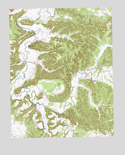
Howardstown, KY USGS Topographic Map
Click on map above to begin viewing in our Map Viewer.

This topographic map contains these locations and features:
Feature Name Type Latitude Longitude GNIS ID View Map
AttillaPopulated PlaceN37.5034°W85.5064°507427View Map
Attilla Post Office (historical)Post OfficeN37.5037°W85.5064°2555002View Map
Beech Grove ChurchChurchN37.5448°W85.5858°486726View Map
Bethel ChurchChurchN37.5034°W85.5152°486977View Map
Big Lick HollowValleyN37.5997°W85.5754°487216View Map
Brays Ford (historical)CrossingN37.5425°W85.5521°2569438View Map
Buffalo DivisionCivilN37.5108°W85.6000°1936897View Map
Cane RunStreamN37.6042°W85.5877°488790View Map
Cecil RidgeRidgeN37.5853°W85.5411°489158View Map
Christie CreekStreamN37.5478°W85.5489°489501View Map
Devils BackboneRidgeN37.6103°W85.5864°490835View Map
Flats BranchStreamN37.5482°W85.6056°2742388View Map
Gap HillSummitN37.6128°W85.5039°492681View Map
GinsengPopulated PlaceN37.5048°W85.5811°508091View Map
Ginseng Post Office (historical)Post OfficeN37.5049°W85.5814°2569444View Map
GleaningsPopulated PlaceN37.5584°W85.5339°492884View Map
Gleanings Post Office (historical)Post OfficeN37.5595°W85.5328°2569445View Map
Highview (historical)Populated PlaceN37.5630°W85.5040°2742294View Map
Howard HollowValleyN37.5744°W85.6093°494673View Map
HowardstownPopulated PlaceN37.5723°W85.5919°508287View Map
Keith HollowValleyN37.5867°W85.5110°495607View Map
Levelwood ChurchChurchN37.5031°W85.5472°496306View Map
Levelwood SchoolSchoolN37.5059°W85.5489°496307View Map
Lunar CreekStreamN37.5765°W85.6039°497347View Map
McGee and Boone FordCrossingN37.6140°W85.6155°2569460View Map
Miller SpringSpringN37.5865°W85.5056°498354View Map
Mobley Post Office (historical)Post OfficeN37.5236°W85.5882°2569461View Map
Mount PisgahSummitN37.5387°W85.5889°500771View Map
Newton PointCapeN37.5876°W85.6014°499455View Map
Old Coon HollowValleyN37.6170°W85.5283°499815View Map
Old Ford (historical)CrossingN37.6168°W85.5721°2569466View Map
Otter CreekStreamN37.5309°W85.5847°500024View Map
Rolling Fork Baptist ChurchChurchN37.5606°W85.5316°502294View Map
Rolling Fork Fire Department SubstationBuildingN37.5728°W85.5912°2637421View Map
Round KnobSummitN37.5515°W85.5666°502406View Map
Round KnobSummitN37.6142°W85.5008°502407View Map
Saint Ann CemeteryCemeteryN37.5781°W85.5902°502573View Map
Saint Vincent De Paul CemeteryCemeteryN37.6231°W85.5100°502758View Map
Salt Lick CreekStreamN37.5540°W85.5214°502827View Map
Salt Lick Post Office (historical)Post OfficeN37.5563°W85.5140°2566902View Map
School Number Nine (historical)SchoolN37.5466°W85.5445°2569478View Map
StilesPopulated PlaceN37.5395°W85.5805°509130View Map
Stillwell BranchStreamN37.5298°W85.5494°504426View Map
Sulphur Lick CreekStreamN37.5612°W85.5255°504742View Map
Thompson CreekStreamN37.6217°W85.6219°505205View Map
Trace CreekStreamN37.6165°W85.5705°505422View Map
West Fork Otter CreekStreamN37.5073°W85.5816°506442View Map

Note: Coordinates in the location and feature list above are referenced to NAD83 datum.


Copyright (C) 2008-2025 Ryan Niemi / Sunset Dynamics ... All Rights Reserved