TopoQuest Logo
Do you find TopoQuest useful?
Help keep TopoQuest running and adding new maps/features by donating!
Bitcoin:  19c7KJd3qBynnjoSw5npx9KScwjBe4ifkT
Litecoin:  LXs6TkuXGGXo1vDsWCkWVdjQX94eUKd6ui
Home View Maps Find Maps Find Places Resources & Links


Lost River, Oregon Topographic Map

USGS Map Title: Lost River, OR
USGS Map MRC: 42121A6
DRG (GeoTIFF) Download: o42121a6.tif


Neighboring USGS Topographic Map Quads:


  Klamath Falls, OR  
42121B7
 

  Altamont, OR  
42121B6
 

  Dairy, OR  
42121B5
 

  Worden, OR  
42121A7
 

  Lost River, OR  
42121A6
 

  Merrill, OR  
42121A5
 

  Sheepy Lake, CA  
41121H7
 

  Lower Klamath Lake, CA  
41121H6
 

  Hatfield, CA  
41121H5


Map MRC Location:

N43°
W122°
N43°
W121°
H8 H7 H6 H5 H4 H3 H2 H1
G8 G7 G6 G5 G4 G3 G2 G1
F8 F7 F6 F5 F4 F3 F2 F1
E8 E7 E6 E5 E4 E3 E2 E1
D8 D7 D6 D5 D4 D3 D2 D1
C8 C7 C6 C5 C4 C3 C2 C1
B8 B7 B6 B5 B4 B3 B2 B1
A8 A7 A6 A5 A4 A3 A2 A1
N42°
W122°
N42°
W121°

Lost River, OR USGS 1:24K Topographic Map Preview:
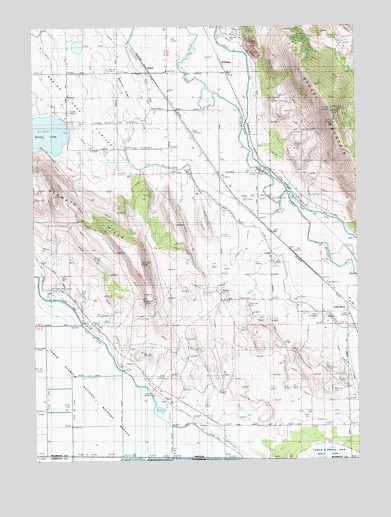
Lost River, OR USGS Topographic Map
Click on map above to begin viewing in our Map Viewer.

This topographic map contains these locations and features:
Feature Name Type Latitude Longitude GNIS ID View Map
C CanalCanalN42.1221°W121.7131°1118430View Map
Colson Post Office (historical)Post OfficeN42.1124°W121.6997°1165074View Map
Dehlinger (historical)LocaleN42.1146°W121.6786°1136212View Map
Dehlinger ReservoirReservoirN42.1204°W121.6316°1132680View Map
G CanalCanalN42.0982°W121.6681°1121027View Map
HosleyLocaleN42.0746°W121.6722°1136400View Map
Independent Order of Odd Fellows CemeteryCemeteryN42.0410°W121.6408°1133154View Map
Klamath HillsSummitN42.0757°W121.7436°1136446View Map
KOTI-TVTowerN42.0965°W121.6336°1158736View Map
Long Ranch AirportAirportN42.0185°W121.7035°1131626View Map
Lost RiverLocaleN42.0457°W121.6306°1136503View Map
Lost River Post Office (historical)Post OfficeN42.0457°W121.6306°1165565View Map
Manning RidgeRidgeN42.1068°W121.7161°1123733View Map
Merrill DivisionCivilN42.0710°W121.6629°1938058View Map
Mount Laki CemeteryCemeteryN42.1124°W121.7219°1124407View Map
Spring LakeLakeN42.0943°W121.7464°1127450View Map
StukelLocaleN42.1140°W121.7081°1136795View Map
Stukel BridgeBridgeN42.0828°W121.6618°1127673View Map
Stukel MountainSummitN42.1010°W121.6361°1127674View Map
White Lake City (historical)Populated PlaceN42.0040°W121.6456°1132681View Map
Whitelake Post Office (historical)Post OfficeN42.0040°W121.6456°1164783View Map

Note: Coordinates in the location and feature list above are referenced to NAD83 datum.


Copyright (C) 2008-2025 Ryan Niemi / Sunset Dynamics ... All Rights Reserved