TopoQuest Logo
Do you find TopoQuest useful?
Help keep TopoQuest running and adding new maps/features by donating!
Bitcoin:  19c7KJd3qBynnjoSw5npx9KScwjBe4ifkT
Litecoin:  LXs6TkuXGGXo1vDsWCkWVdjQX94eUKd6ui
Home View Maps Find Maps Find Places Resources & Links


Dairy, Oregon Topographic Map

USGS Map Title: Dairy, OR
USGS Map MRC: 42121B5
DRG (GeoTIFF) Download: o42121b5.tif


Neighboring USGS Topographic Map Quads:


  Whiteline Reservoir, OR  
42121C6
 

  Swan Lake, OR  
42121C5
 

  Yonna, OR  
42121C4
 

  Altamont, OR  
42121B6
 

  Dairy, OR  
42121B5
 

  Bonanza, OR  
42121B4
 

  Lost River, OR  
42121A6
 

  Merrill, OR  
42121A5
 

  Malin, OR  
42121A4


Map MRC Location:

N43°
W122°
N43°
W121°
H8 H7 H6 H5 H4 H3 H2 H1
G8 G7 G6 G5 G4 G3 G2 G1
F8 F7 F6 F5 F4 F3 F2 F1
E8 E7 E6 E5 E4 E3 E2 E1
D8 D7 D6 D5 D4 D3 D2 D1
C8 C7 C6 C5 C4 C3 C2 C1
B8 B7 B6 B5 B4 B3 B2 B1
A8 A7 A6 A5 A4 A3 A2 A1
N42°
W122°
N42°
W121°

Dairy, OR USGS 1:24K Topographic Map Preview:
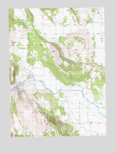
Dairy, OR USGS Topographic Map
Click on map above to begin viewing in our Map Viewer.

This topographic map contains these locations and features:
Feature Name Type Latitude Longitude GNIS ID View Map
Barton ReservoirReservoirN42.2429°W121.5456°1132674View Map
DairyPopulated PlaceN42.2351°W121.5211°1119660View Map
Dairy Post OfficePost OfficeN42.2351°W121.5211°1165125View Map
Dairy SidingLocaleN42.2446°W121.5117°1119666View Map
E CanalCanalN42.1954°W121.5994°1120252View Map
F CanalCanalN42.1304°W121.5211°1120549View Map
F-1 LateralCanalN42.1499°W121.5803°1132677View Map
Horton RimCliffN42.1957°W121.5428°1132671View Map
Keyser ReservoirReservoirN42.1915°W121.5511°1132670View Map
Modoc RidgeRidgeN42.1707°W121.6150°1132669View Map
Moyina (historical)LocaleN42.2332°W121.5497°1136556View Map
Olene Hot SpringsSpringN42.1731°W121.6187°1132675View Map
Oreoil (historical)LocaleN42.2346°W121.5039°1132673View Map
Pine FlatFlatN42.2365°W121.5653°1125398View Map
Poe ValleyValleyN42.1871°W121.5989°1125498View Map
Shook SpringsSpringN42.2061°W121.5145°1132672View Map
Sky Wagon Ranch LLC AirportAirportN42.1279°W121.5318°2646018View Map
Stevenson ParkParkN42.1832°W121.5997°1162473View Map
Swan Lake (historical)LocaleN42.2288°W121.5986°1699670View Map
The GapGapN42.1724°W121.6208°1127969View Map

Note: Coordinates in the location and feature list above are referenced to NAD83 datum.


Copyright (C) 2008-2025 Ryan Niemi / Sunset Dynamics ... All Rights Reserved