TopoQuest Logo
Do you find TopoQuest useful?
Help keep TopoQuest running and adding new maps/features by donating!
Bitcoin:  19c7KJd3qBynnjoSw5npx9KScwjBe4ifkT
Litecoin:  LXs6TkuXGGXo1vDsWCkWVdjQX94eUKd6ui
Home View Maps Find Maps Find Places Resources & Links


Louisville East, Illinois Topographic Map

USGS Map Title: Louisville East, IL
USGS Map MRC: 38088G4
DRG (GeoTIFF) Download: o38088g4.tif


Neighboring USGS Topographic Map Quads:


  Hord, IL  
38088H5
 

  Eberle, IL  
38088H4
 

  Latona, IL  
38088H3
 

  Louisville West, IL  
38088G5
 

  Louisville East, IL  
38088G4
 

  Sailor Springs, IL  
38088G3
 

  Xenia NE, IL  
38088F5
 

  Flora, IL  
38088F4
 

  Clay City, IL  
38088F3


Map MRC Location:

N39°
W89°
N39°
W88°
H8 H7 H6 H5 H4 H3 H2 H1
G8 G7 G6 G5 G4 G3 G2 G1
F8 F7 F6 F5 F4 F3 F2 F1
E8 E7 E6 E5 E4 E3 E2 E1
D8 D7 D6 D5 D4 D3 D2 D1
C8 C7 C6 C5 C4 C3 C2 C1
B8 B7 B6 B5 B4 B3 B2 B1
A8 A7 A6 A5 A4 A3 A2 A1
N38°
W89°
N38°
W88°

Louisville East, IL USGS 1:24K Topographic Map Preview:
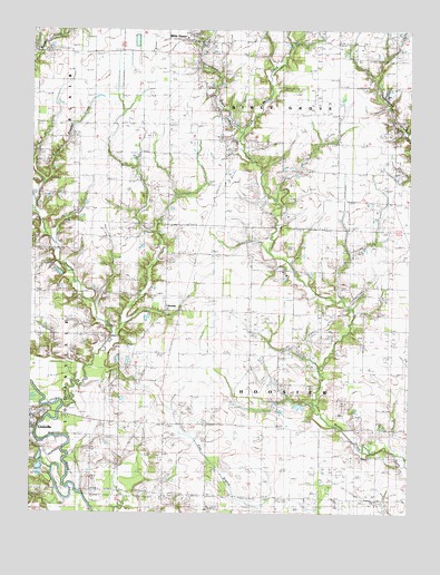
Louisville East, IL USGS Topographic Map
Click on map above to begin viewing in our Map Viewer.

This topographic map contains these locations and features:
Feature Name Type Latitude Longitude GNIS ID View Map
Bible GrovePopulated PlaceN38.8720°W88.4462°404371View Map
Brooks CemeteryCemeteryN38.8498°W88.3800°1952652View Map
Burke CemeteryCemeteryN38.8545°W88.4398°405222View Map
Clay CountyCivilN38.7542°W88.4902°424214View Map
Clay County Sheriff's OfficeBuildingN38.7726°W88.4991°2758941View Map
Coles Chapel (historical)ChurchN38.7734°W88.4667°406357View Map
Conley Chapel (historical)ChurchN38.7923°W88.4100°406472View Map
Conly CemeteryCemeteryN38.8725°W88.4900°406476View Map
Dillman CemeteryCemeteryN38.7631°W88.3789°407218View Map
Georgetown CreekStreamN38.8481°W88.4314°408957View Map
HoosierPopulated PlaceN38.8037°W88.4551°1747729View Map
Hoosier Prairie Baptist ChurchChurchN38.7937°W88.4125°410497View Map
Hoosier Prairie CemeteryCemeteryN38.7925°W88.4112°1821628View Map
Hoosier Town HallBuildingN38.8042°W88.4175°1747730View Map
Kinnamon CemeteryCemeteryN38.7873°W88.4587°411526View Map
Lewis CemeteryCemeteryN38.8514°W88.4364°411968View Map
Little Grove School (historical)SchoolN38.7548°W88.4200°412349View Map
Little Panther CreekStreamN38.8309°W88.4998°412385View Map
McKnight CemeteryCemeteryN38.7748°W88.4100°413318View Map
Panther CreekStreamN38.7781°W88.4898°415350View Map
Pleasant Hill ChurchChurchN38.8025°W88.4578°415834View Map
Sailor Springs Oil FieldOilfieldN38.7564°W88.3917°425433View Map
Sharon Church (historical)ChurchN38.7503°W88.4339°418290View Map
Shouse ChapelChurchN38.8412°W88.4009°418474View Map
Shouse Chapel CemeteryCemeteryN38.8406°W88.3995°1821639View Map
Township of Bible GroveCivilN38.8679°W88.4160°428669View Map
Township of HoosierCivilN38.7799°W88.4163°429146View Map

Note: Coordinates in the location and feature list above are referenced to NAD83 datum.


Copyright (C) 2008-2025 Ryan Niemi / Sunset Dynamics ... All Rights Reserved