TopoQuest Logo
Do you find TopoQuest useful?
Help keep TopoQuest running and adding new maps/features by donating!
Bitcoin:  19c7KJd3qBynnjoSw5npx9KScwjBe4ifkT
Litecoin:  LXs6TkuXGGXo1vDsWCkWVdjQX94eUKd6ui
Home View Maps Find Maps Find Places Resources & Links


Sailor Springs, Illinois Topographic Map

USGS Map Title: Sailor Springs, IL
USGS Map MRC: 38088G3
DRG (GeoTIFF) Download: o38088g3.tif


Neighboring USGS Topographic Map Quads:


  Eberle, IL  
38088H4
 

  Latona, IL  
38088H3
 

  Newton, IL  
38088H2
 

  Louisville East, IL  
38088G4
 

  Sailor Springs, IL  
38088G3
 

  Wakefield, IL  
38088G2
 

  Flora, IL  
38088F4
 

  Clay City, IL  
38088F3
 

  Noble, IL  
38088F2


Map MRC Location:

N39°
W89°
N39°
W88°
H8 H7 H6 H5 H4 H3 H2 H1
G8 G7 G6 G5 G4 G3 G2 G1
F8 F7 F6 F5 F4 F3 F2 F1
E8 E7 E6 E5 E4 E3 E2 E1
D8 D7 D6 D5 D4 D3 D2 D1
C8 C7 C6 C5 C4 C3 C2 C1
B8 B7 B6 B5 B4 B3 B2 B1
A8 A7 A6 A5 A4 A3 A2 A1
N38°
W89°
N38°
W88°

Sailor Springs, IL USGS 1:24K Topographic Map Preview:
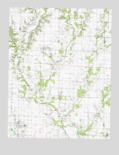
Sailor Springs, IL USGS Topographic Map
Click on map above to begin viewing in our Map Viewer.

This topographic map contains these locations and features:
Feature Name Type Latitude Longitude GNIS ID View Map
Cottonwood CreekStreamN38.8312°W88.3650°406633View Map
Ditter CemeteryCemeteryN38.7945°W88.3542°407238View Map
East Fork Wetweather CreekStreamN38.8364°W88.2675°407648View Map
Fehrenbacher FarmsLocaleN38.8603°W88.3247°2724429View Map
Hurricane CreekStreamN38.7548°W88.2862°410715View Map
Independence School (historical)SchoolN38.8573°W88.3245°410811View Map
Indian PointSummitN38.8292°W88.3092°410874View Map
IngrahamPopulated PlaceN38.8362°W88.3339°410899View Map
Ingraham CemeteryCemeteryN38.8348°W88.3242°1821629View Map
Ingraham Post OfficePost OfficeN38.8354°W88.3329°1747731View Map
Levitte CemeteryCemeteryN38.7684°W88.3211°411963View Map
Limestone CreekStreamN38.8637°W88.3403°412105View Map
McKinney CemeteryCemeteryN38.7553°W88.3575°413311View Map
Reed CemeteryCemeteryN38.8128°W88.2814°416485View Map
Sailor SpringsPopulated PlaceN38.7639°W88.3631°417116View Map
Sailor Springs Post OfficePost OfficeN38.7634°W88.3617°1747750View Map
Saint Johns CemeteryCemeteryN38.8077°W88.2657°417373View Map
Spring BranchStreamN38.7539°W88.3684°418925View Map
Township of PixleyCivilN38.7911°W88.3101°429573View Map
Turkey PointSummitN38.8270°W88.3639°419937View Map
Village of Sailor SpringsCivilN38.7644°W88.3600°2399156View Map
Wachtel CemeteryCemeteryN38.8075°W88.2659°1952492View Map
Weather CreekStreamN38.7914°W88.3439°420670View Map
Weidner CemeteryCemeteryN38.7792°W88.2911°1952691View Map
WendelinPopulated PlaceN38.8334°W88.2728°420746View Map
Wendelin-Holy Cross CemeteryCemeteryN38.8323°W88.2728°1821640View Map
Wesley CemeteryCemeteryN38.7945°W88.2611°420762View Map
West Fork Wetweather CreekStreamN38.8364°W88.2675°420840View Map
Wet Weather CreekStreamN38.7695°W88.3098°420978View Map
White CemeteryCemeteryN38.7728°W88.3692°421023View Map
Wolf CreekStreamN38.8506°W88.2975°421373View Map
Woods CemeteryCemeteryN38.8323°W88.3345°421474View Map

Note: Coordinates in the location and feature list above are referenced to NAD83 datum.


Copyright (C) 2008-2024 Ryan Niemi / Sunset Dynamics ... All Rights Reserved