TopoQuest Logo
Do you find TopoQuest useful?
Help keep TopoQuest running and adding new maps/features by donating!
Bitcoin:  19c7KJd3qBynnjoSw5npx9KScwjBe4ifkT
Litecoin:  LXs6TkuXGGXo1vDsWCkWVdjQX94eUKd6ui
Home View Maps Find Maps Find Places Resources & Links


Xenia NE, Illinois Topographic Map

USGS Map Title: Xenia NE, IL
USGS Map MRC: 38088F5
DRG (GeoTIFF) Download: o38088f5.tif


Neighboring USGS Topographic Map Quads:


  Oskaloosa, IL  
38088G6
 

  Louisville West, IL  
38088G5
 

  Louisville East, IL  
38088G4
 

  Xenia, IL  
38088F6
 

  Xenia NE, IL  
38088F5
 

  Flora, IL  
38088F4
 

  Orchardville, IL  
38088E6
 

  Johnsonville, IL  
38088E5
 

  Cisne, IL  
38088E4


Map MRC Location:

N39°
W89°
N39°
W88°
H8 H7 H6 H5 H4 H3 H2 H1
G8 G7 G6 G5 G4 G3 G2 G1
F8 F7 F6 F5 F4 F3 F2 F1
E8 E7 E6 E5 E4 E3 E2 E1
D8 D7 D6 D5 D4 D3 D2 D1
C8 C7 C6 C5 C4 C3 C2 C1
B8 B7 B6 B5 B4 B3 B2 B1
A8 A7 A6 A5 A4 A3 A2 A1
N38°
W89°
N38°
W88°

Xenia NE, IL USGS 1:24K Topographic Map Preview:
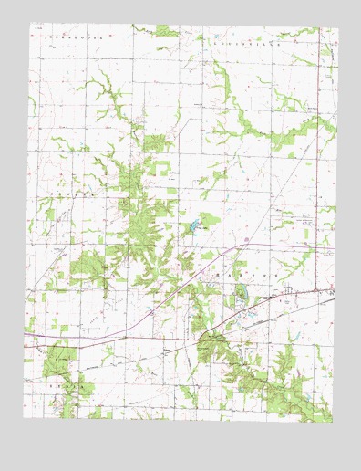
Xenia NE, IL USGS Topographic Map
Click on map above to begin viewing in our Map Viewer.

This topographic map contains these locations and features:
Feature Name Type Latitude Longitude GNIS ID View Map
Camp Ground CemeteryCemeteryN38.6334°W88.6081°405470View Map
Charley Brown ParkParkN38.6648°W88.5381°405984View Map
Charley Brown Park LakeReservoirN38.6661°W88.5362°1691106View Map
Charley Brown Park Lake DamDamN38.6634°W88.5350°1691105View Map
Dayton School (historical)SchoolN38.7164°W88.6014°1747718View Map
Garden of Memories CemeteryCemeteryN38.6887°W88.5087°408876View Map
Golden CemeteryCemeteryN38.7245°W88.5553°1821627View Map
Golden ChurchChurchN38.7250°W88.5550°409120View Map
Golden School (historical)SchoolN38.7164°W88.5626°1747727View Map
KennerPopulated PlaceN38.6459°W88.5681°422869View Map
Kenner Oil FieldOilfieldN38.6587°W88.5934°425076View Map
Kenner West Oil FieldOilfieldN38.6870°W88.6114°425077View Map
Lincoln SchoolSchoolN38.6645°W88.5256°412149View Map
Logan Family CemeteryCemeteryN38.6667°W88.5242°1952679View Map
Martin T Snyder Memorial Nature PreserveParkN38.6375°W88.5306°1993499View Map
McCabe ChapelChurchN38.6639°W88.5267°413184View Map
Meisenheimer CemeteryCemeteryN38.6475°W88.5550°413371View Map
North Harter ChurchChurchN38.7234°W88.5114°414616View Map
North Kenner Oil FieldOilfieldN38.7053°W88.5528°1747740View Map
Oak Mound CemeteryCemeteryN38.6778°W88.6095°414841View Map
Oak Mound Church (historical)ChurchN38.6798°W88.6073°1747743View Map
Oak Mound School (historical)SchoolN38.6742°W88.6067°1747744View Map
Petwyler School (historical)SchoolN38.7459°W88.5270°1747746View Map
Shiloh School (historical)SchoolN38.6292°W88.5637°1747752View Map
South Kenner Oil FieldOilfieldN38.6725°W88.5745°1747754View Map
Township of HarterCivilN38.6718°W88.5270°429117View Map
Trago LakeReservoirN38.6869°W88.5571°419816View Map
Trago Lake DamDamN38.6853°W88.5584°1691107View Map

Note: Coordinates in the location and feature list above are referenced to NAD83 datum.


Copyright (C) 2008-2025 Ryan Niemi / Sunset Dynamics ... All Rights Reserved