TopoQuest Logo
Do you find TopoQuest useful?
Help keep TopoQuest running and adding new maps/features by donating!
Bitcoin:  19c7KJd3qBynnjoSw5npx9KScwjBe4ifkT
Litecoin:  LXs6TkuXGGXo1vDsWCkWVdjQX94eUKd6ui
Home View Maps Find Maps Find Places Resources & Links


Louisville North, Mississippi Topographic Map

USGS Map Title: Louisville North, MS
USGS Map MRC: 33089B1
DRG (GeoTIFF) Download: o33089b1.tif


Neighboring USGS Topographic Map Quads:


  Ackerman, MS  
33089C2
 

  Sturgis, MS  
33089C1
 

  Bradley, MS  
33088C8
 

  Highpoint, MS  
33089B2
 

  Louisville North, MS  
33089B1
 

  Betheden, MS  
33088B8
 

  Louisville SW, MS  
33089A2
 

  Louisville South, MS  
33089A1
 

  Boon, MS  
33088A8


Map MRC Location:

N34°
W90°
N34°
W89°
H8 H7 H6 H5 H4 H3 H2 H1
G8 G7 G6 G5 G4 G3 G2 G1
F8 F7 F6 F5 F4 F3 F2 F1
E8 E7 E6 E5 E4 E3 E2 E1
D8 D7 D6 D5 D4 D3 D2 D1
C8 C7 C6 C5 C4 C3 C2 C1
B8 B7 B6 B5 B4 B3 B2 B1
A8 A7 A6 A5 A4 A3 A2 A1
N33°
W90°
N33°
W89°

Louisville North, MS USGS 1:24K Topographic Map Preview:
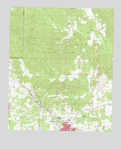
Louisville North, MS USGS Topographic Map
Click on map above to begin viewing in our Map Viewer.

This topographic map contains these locations and features:
Feature Name Type Latitude Longitude GNIS ID View Map
EvergreenPopulated PlaceN33.1812°W89.0070°711059View Map
Evergreen Baptist ChurchChurchN33.1840°W89.0078°705532View Map
First United Pentecostal ChurchChurchN33.1329°W89.0620°705533View Map
Greenboro ChurchChurchN33.1485°W89.0856°693358View Map
Gum SpringsPopulated PlaceN33.2337°W89.0523°693386View Map
Gum Springs ChurchChurchN33.2496°W89.0520°693387View Map
Legion Lake DamDamN33.1568°W89.0467°695473View Map
Little Noxubee RiverStreamN33.2207°W89.0184°693773View Map
Little Rock CemeteryCemeteryN33.2185°W89.0970°693779View Map
Louisville Winston County AirportAirportN33.1447°W89.0614°695272View Map
McMillanPopulated PlaceN33.1701°W89.1092°693931View Map
Mill CreekStreamN33.2257°W89.0153°693998View Map
Noxubee Hill CemeteryCemeteryN33.2079°W89.0753°694217View Map
Poplar Flat ChurchChurchN33.1693°W89.0592°694456View Map
Supervisor District 1CivilN33.2185°W89.0405°712143View Map
Tallahaga Watershed Structure 4 DamDamN33.1435°W89.1234°695471View Map
Tanksley CemeteryCemeteryN33.2182°W89.1095°694940View Map
Taylor ChurchChurchN33.1382°W89.0623°694949View Map
Tombigbee National ForestForestN33.2365°W89.0481°711475View Map
Union Chapel Baptist ChurchChurchN33.1565°W89.0959°695038View Map
Wess ChapelChurchN33.1526°W89.0039°695123View Map
West Union ChurchChurchN33.1829°W89.1198°695139View Map
Winston - Choctaw County / Regional Correctional FacilityBuildingN33.1695°W89.0554°2739808View Map
Winston AcademySchoolN33.1398°W89.0342°695197View Map
Winston Lookout TowerTowerN33.1693°W89.0881°705597View Map

Note: Coordinates in the location and feature list above are referenced to NAD83 datum.


Copyright (C) 2008-2025 Ryan Niemi / Sunset Dynamics ... All Rights Reserved