TopoQuest Logo
Do you find TopoQuest useful?
Help keep TopoQuest running and adding new maps/features by donating!
Bitcoin:  19c7KJd3qBynnjoSw5npx9KScwjBe4ifkT
Litecoin:  LXs6TkuXGGXo1vDsWCkWVdjQX94eUKd6ui
Home View Maps Find Maps Find Places Resources & Links


Highpoint, Mississippi Topographic Map

USGS Map Title: Highpoint, MS
USGS Map MRC: 33089B2
DRG (GeoTIFF) Download: o33089b2.tif


Neighboring USGS Topographic Map Quads:


  Weir, MS  
33089C3
 

  Ackerman, MS  
33089C2
 

  Sturgis, MS  
33089C1
 

  McCool, MS  
33089B3
 

  Highpoint, MS  
33089B2
 

  Louisville North, MS  
33089B1
 

  Ethel SE, MS  
33089A3
 

  Louisville SW, MS  
33089A2
 

  Louisville South, MS  
33089A1


Map MRC Location:

N34°
W90°
N34°
W89°
H8 H7 H6 H5 H4 H3 H2 H1
G8 G7 G6 G5 G4 G3 G2 G1
F8 F7 F6 F5 F4 F3 F2 F1
E8 E7 E6 E5 E4 E3 E2 E1
D8 D7 D6 D5 D4 D3 D2 D1
C8 C7 C6 C5 C4 C3 C2 C1
B8 B7 B6 B5 B4 B3 B2 B1
A8 A7 A6 A5 A4 A3 A2 A1
N33°
W90°
N33°
W89°

Highpoint, MS USGS 1:24K Topographic Map Preview:
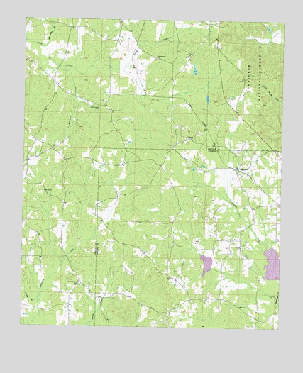
Highpoint, MS USGS Topographic Map
Click on map above to begin viewing in our Map Viewer.

This topographic map contains these locations and features:
Feature Name Type Latitude Longitude GNIS ID View Map
Aubry Epps Lake DamDamN33.2285°W89.1684°695477View Map
Bay BranchStreamN33.1510°W89.2301°705142View Map
Bethany ChurchChurchN33.1457°W89.1790°692547View Map
Bethsalem CemeteryCemeteryN33.1982°W89.1776°707493View Map
Bethsalem ChurchChurchN33.1990°W89.1773°692579View Map
Big Jerusalem CemeteryCemeteryN33.2346°W89.1867°707510View Map
Big Jerusalem Missionary Baptist ChurchChurchN33.2346°W89.1856°692603View Map
Big John BranchStreamN33.2382°W89.2409°692604View Map
Charlie Ray Lake DamDamN33.2201°W89.1651°695476View Map
Concord ChurchChurchN33.2365°W89.1695°692958View Map
County Line School (historical)SchoolN33.1426°W89.2223°705149View Map
Ebenezer ChurchChurchN33.1337°W89.1442°693158View Map
Head School (historical)SchoolN33.2473°W89.2267°705152View Map
High Point Volunteer Fire DepartmentBuildingN33.1882°W89.1460°2665864View Map
HighpointPopulated PlaceN33.1882°W89.1462°693477View Map
Hutchinson School (historical)SchoolN33.2143°W89.2401°705153View Map
Irvin Spur (historical)LocaleN33.2210°W89.1917°705154View Map
Moore BranchStreamN33.1596°W89.2220°705157View Map
Mount Nebo ChurchChurchN33.1798°W89.2398°694074View Map
New Jerusalem Church (historical)ChurchN33.2260°W89.2237°705159View Map
New Prospect (historical)LocaleN33.2404°W89.1570°707520View Map
New Zion CemeteryCemeteryN33.1571°W89.1434°710058View Map
New Zion Missionary Baptist ChurchChurchN33.1576°W89.1440°694195View Map
Noxubee Grange Hall School (historical)SchoolN33.2460°W89.1570°705160View Map
Old Concord CemeteryCemeteryN33.2143°W89.2140°694257View Map
Opel Blane Lake DamDamN33.2451°W89.1301°695479View Map
Owens ChapelChurchN33.1426°W89.2228°694289View Map
Owens Chapel (historical)ChurchN33.1432°W89.2228°705162View Map
Owens Chapel CemeteryCemeteryN33.1426°W89.2228°694290View Map
Robinson BranchStreamN33.2307°W89.2337°694581View Map
Rockport ChurchChurchN33.2023°W89.1684°694592View Map
Salem CemeteryCemeteryN33.1971°W89.2353°707526View Map
Salem ChurchChurchN33.1979°W89.2351°694681View Map
Sister Jerusalem ChurchChurchN33.2129°W89.2078°694803View Map
Spay School (historical)SchoolN33.1807°W89.2401°705165View Map
Spring BranchStreamN33.1348°W89.2415°694861View Map
Tallahaga Creek 3 DamDamN33.1251°W89.1501°695470View Map
Tallahaga Watershed Structure 6 DamDamN33.1501°W89.1601°695472View Map
Turner CemeteryCemeteryN33.2260°W89.1431°695026View Map

Note: Coordinates in the location and feature list above are referenced to NAD83 datum.


Copyright (C) 2008-2024 Ryan Niemi / Sunset Dynamics ... All Rights Reserved