TopoQuest Logo
Do you find TopoQuest useful?
Help keep TopoQuest running and adding new maps/features by donating!
Bitcoin:  19c7KJd3qBynnjoSw5npx9KScwjBe4ifkT
Litecoin:  LXs6TkuXGGXo1vDsWCkWVdjQX94eUKd6ui
Home View Maps Find Maps Find Places Resources & Links


Boon, Mississippi Topographic Map

USGS Map Title: Boon, MS
USGS Map MRC: 33088A8
DRG (GeoTIFF) Download: o33088a8.tif


Neighboring USGS Topographic Map Quads:


  Louisville North, MS  
33089B1
 

  Betheden, MS  
33088B8
 

  Barge Lake, MS  
33088B7
 

  Louisville South, MS  
33089A1
 

  Boon, MS  
33088A8
 

  Fearns Springs, MS  
33088A7
 

  Noxapater, MS  
32089H1
 

  Vernon, MS  
32088H8
 

  Preston, MS  
32088H7


Map MRC Location:

N34°
W89°
N34°
W88°
H8 H7 H6 H5 H4 H3 H2 H1
G8 G7 G6 G5 G4 G3 G2 G1
F8 F7 F6 F5 F4 F3 F2 F1
E8 E7 E6 E5 E4 E3 E2 E1
D8 D7 D6 D5 D4 D3 D2 D1
C8 C7 C6 C5 C4 C3 C2 C1
B8 B7 B6 B5 B4 B3 B2 B1
A8 A7 A6 A5 A4 A3 A2 A1
N33°
W89°
N33°
W88°

Boon, MS USGS 1:24K Topographic Map Preview:
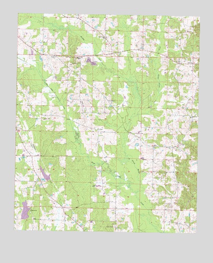
Boon, MS USGS Topographic Map
Click on map above to begin viewing in our Map Viewer.

This topographic map contains these locations and features:
Feature Name Type Latitude Longitude GNIS ID View Map
Bethel ChurchChurchN33.0501°W88.9053°666927View Map
Bethel ChurchChurchN33.0982°W88.8801°666928View Map
BoonPopulated PlaceN33.1007°W88.9564°667435View Map
Crystal Ridge ChurchChurchN33.0757°W88.9367°668999View Map
Crystal Ridge Indian Reservation (historical)CivilN33.0279°W88.9459°690820View Map
East Winston Volunteer Fire DepartmentBuildingN33.0977°W88.8882°2665787View Map
Ellison RidgePopulated PlaceN33.0679°W88.8812°710034View Map
Ellison Ridge CemeteryCemeteryN33.0657°W88.8787°710035View Map
Ellison Ridge ChurchChurchN33.0671°W88.8803°669743View Map
Kirk CemeteryCemeteryN33.0960°W88.8801°710043View Map
Murphy CreekStreamN33.0668°W88.9212°694135View Map
Murphy Creek CemeteryCemeteryN33.1112°W88.9401°710056View Map
Murphy Creek ChurchChurchN33.1115°W88.9406°674483View Map
New Hope CemeteryCemeteryN33.1007°W88.9726°710057View Map
New Hope ChurchChurchN33.1007°W88.9728°674708View Map
Randalls Bluff (historical)Populated PlaceN33.0640°W88.9056°687703View Map
Reed LakeDamN33.0968°W88.9484°681844View Map
Rocky Hill CemeteryCemeteryN33.0104°W88.9889°710070View Map
Rocky Hill ChurchChurchN33.0115°W88.9887°676796View Map
Supervisor District 2CivilN33.0207°W88.9235°712144View Map
Tallahaga Creek Watershed Structure 12 DamDamN33.0885°W88.9951°681838View Map
Tallahaga Creek Watershed Structure 13 DamDamN33.0368°W88.9834°681802View Map
Town CreekStreamN33.0229°W88.9173°694998View Map
Town Creek CanalCanalN33.0946°W88.9884°694999View Map
Zion ChapelChurchN33.0590°W88.9442°679987View Map

Note: Coordinates in the location and feature list above are referenced to NAD83 datum.


Copyright (C) 2008-2025 Ryan Niemi / Sunset Dynamics ... All Rights Reserved