TopoQuest Logo
Do you find TopoQuest useful?
Help keep TopoQuest running and adding new maps/features by donating!
Bitcoin:  19c7KJd3qBynnjoSw5npx9KScwjBe4ifkT
Litecoin:  LXs6TkuXGGXo1vDsWCkWVdjQX94eUKd6ui
Home View Maps Find Maps Find Places Resources & Links


Lovejoy, North Carolina Topographic Map

USGS Map Title: Lovejoy, NC
USGS Map MRC: 35079D8
DRG (GeoTIFF) Download: o35079d8.tif


Neighboring USGS Topographic Map Quads:


  Handy, NC  
35080E1
 

  Eleazer, NC  
35079E8
 

  Seagrove, NC  
35079E7
 

  Badin, NC  
35080D1
 

  Lovejoy, NC  
35079D8
 

  Star, NC  
35079D7
 

  Morrow Mountain, NC  
35080C1
 

  Troy, NC  
35079C8
 

  Biscoe, NC  
35079C7


Map MRC Location:

N36°
W80°
N36°
W79°
H8 H7 H6 H5 H4 H3 H2 H1
G8 G7 G6 G5 G4 G3 G2 G1
F8 F7 F6 F5 F4 F3 F2 F1
E8 E7 E6 E5 E4 E3 E2 E1
D8 D7 D6 D5 D4 D3 D2 D1
C8 C7 C6 C5 C4 C3 C2 C1
B8 B7 B6 B5 B4 B3 B2 B1
A8 A7 A6 A5 A4 A3 A2 A1
N35°
W80°
N35°
W79°

Lovejoy, NC USGS 1:24K Topographic Map Preview:
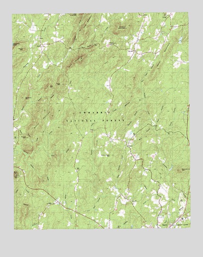
Lovejoy, NC USGS Topographic Map
Click on map above to begin viewing in our Map Viewer.

This topographic map contains these locations and features:
Feature Name Type Latitude Longitude GNIS ID View Map
AbnerPopulated PlaceN35.4982°W79.9078°1008648View Map
Abner MountainSummitN35.4676°W79.8978°1008649View Map
Arnett BranchStreamN35.4260°W79.8953°1008772View Map
Bishop CreekStreamN35.3949°W79.8995°1009426View Map
Buck MountainSummitN35.4068°W79.9987°1023856View Map
Buck Mountain Lookout TowerTowerN35.4068°W79.9989°1017875View Map
Bud Cagle BranchStreamN35.4549°W79.9073°1023858View Map
Bunnel MountainSummitN35.4285°W79.9906°1024515View Map
Cattail CreekStreamN35.4190°W79.9898°1023888View Map
Cottonstone MountainSummitN35.4088°W79.8825°1024525View Map
Dark MountainSummitN35.4726°W79.9517°1019908View Map
Dumas CreekStreamN35.3951°W79.8834°1010939View Map
East Morris Mountain Hunt CampLocaleN35.4399°W79.9587°1018122View Map
Flat Rock BranchStreamN35.3938°W79.9364°1024549View Map
Flint HillPopulated PlaceN35.4782°W79.9148°1011287View Map
Flint HillSummitN35.4712°W79.9328°1024522View Map
Flint Hill ChurchChurchN35.4821°W79.9295°1024524View Map
Flint Hill School (historical)SchoolN35.4785°W79.9139°1957823View Map
Haystack BranchStreamN35.4443°W79.9070°1011939View Map
Hewitt PondReservoirN35.4168°W79.8998°1017197View Map
Hewitt Pond DamDamN35.4168°W79.8998°1017196View Map
Hogpen BranchStreamN35.4335°W79.9995°1012110View Map
Horse MountainSummitN35.4590°W79.9648°1024520View Map
ImmerPopulated PlaceN35.4824°W79.9292°1024518View Map
Jenny Wright MountainSummitN35.4176°W79.9306°1024526View Map
Joe MountainSummitN35.4579°W79.9745°1024521View Map
Little Dumas CreekStreamN35.3938°W79.9262°1024523View Map
Lomax Memorial ChurchChurchN35.3860°W79.9725°1018123View Map
Long MountainSummitN35.4987°W79.9431°1021282View Map
Love Joy CemeteryCemeteryN35.4285°W79.9148°1957814View Map
Love Joy Methodist ChurchChurchN35.4290°W79.9139°1957817View Map
LovejoyPopulated PlaceN35.4226°W79.9195°1013210View Map
Macedonia ChurchChurchN35.4976°W79.8912°1013281View Map
McNair LakeReservoirN35.4851°W79.8848°1017214View Map
McNair Lake DamDamN35.4851°W79.8848°1017213View Map
Mile BranchStreamN35.4249°W79.9173°1024145View Map
Millstone MountainSummitN35.4513°W79.9925°1024528View Map
Morris MountainSummitN35.4413°W79.9728°1024164View Map
Mount Olivet ChurchChurchN35.3765°W79.9267°1013757View Map
OphirPopulated PlaceN35.4779°W79.9789°1014125View Map
Ophir Methodist Episcopal Church SouthChurchN35.4810°W79.9789°1957818View Map
Ophir School (historical)SchoolN35.4818°W79.9778°1957824View Map
Panther BranchStreamN35.4499°W79.9864°1024205View Map
Peggy Mountain BranchStreamN35.4499°W79.9075°1014306View Map
Poison ForkStreamN35.4787°W79.9587°1014552View Map
Refuge MissionPopulated PlaceN35.3851°W79.9564°1014819View Map
Round MountainSummitN35.4799°W79.9914°1024519View Map
Sand BranchStreamN35.4232°W79.9800°1015214View Map
Shiloh (historical)Populated PlaceN35.3893°W79.9162°1957822View Map
Shiloh CemeteryCemeteryN35.3910°W79.9145°1957815View Map
Shiloh Methodist ChurchChurchN35.3910°W79.9150°1015432View Map
State Prison Camp 804LocaleN35.3813°W79.8756°1015800View Map
Still BranchStreamN35.4349°W79.9003°1024320View Map
Township of OphirCivilN35.4617°W79.9478°1026961View Map
Uwharrie Jeep TrailTrailN35.4354°W79.9748°1018124View Map
Uwharrie National ForestForestN35.3939°W79.9424°1008603View Map
West Morris Mountain CampLocaleN35.4296°W79.9945°1017876View Map
Wysner MountainSummitN35.4926°W79.9175°1000977View Map
Zoar CemeteryCemeteryN35.4285°W79.9975°1024527View Map
Zoar Church (historical)ChurchN35.4288°W79.9967°1957819View Map

Note: Coordinates in the location and feature list above are referenced to NAD83 datum.


Copyright (C) 2008-2025 Ryan Niemi / Sunset Dynamics ... All Rights Reserved