TopoQuest Logo
Do you find TopoQuest useful?
Help keep TopoQuest running and adding new maps/features by donating!
Bitcoin:  19c7KJd3qBynnjoSw5npx9KScwjBe4ifkT
Litecoin:  LXs6TkuXGGXo1vDsWCkWVdjQX94eUKd6ui
Home View Maps Find Maps Find Places Resources & Links


Lovelady North, Texas Topographic Map

USGS Map Title: Lovelady North, TX
USGS Map MRC: 31095B4
DRG (GeoTIFF) Download: o31095b4.tif


Neighboring USGS Topographic Map Quads:


  Porter Springs, TX  
31095C5
 

  Crockett, TX  
31095C4
 

  Berea, TX  
31095C3
 

  Pearsons Chapel, TX  
31095B5
 

  Lovelady North, TX  
31095B4
 

  Fodice, TX  
31095B3
 

  Weldon, TX  
31095A5
 

  Lovelady South, TX  
31095A4
 

  Glendale, TX  
31095A3


Map MRC Location:

N32°
W96°
N32°
W95°
H8 H7 H6 H5 H4 H3 H2 H1
G8 G7 G6 G5 G4 G3 G2 G1
F8 F7 F6 F5 F4 F3 F2 F1
E8 E7 E6 E5 E4 E3 E2 E1
D8 D7 D6 D5 D4 D3 D2 D1
C8 C7 C6 C5 C4 C3 C2 C1
B8 B7 B6 B5 B4 B3 B2 B1
A8 A7 A6 A5 A4 A3 A2 A1
N31°
W96°
N31°
W95°

Lovelady North, TX USGS 1:24K Topographic Map Preview:
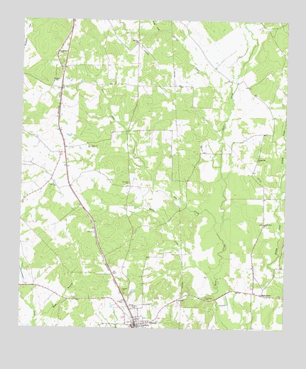
Lovelady North, TX USGS Topographic Map
Click on map above to begin viewing in our Map Viewer.

This topographic map contains these locations and features:
Feature Name Type Latitude Longitude GNIS ID View Map
Anderson Chapel United Methodist ChurchChurchN31.2257°W95.4855°1351101View Map
Box CreekStreamN31.1643°W95.4066°1352767View Map
Cal Wooten CemeteryCemeteryN31.1377°W95.4119°1353525View Map
Center GrovePopulated PlaceN31.1674°W95.3844°2034897View Map
Center Grove Nutrition CenterBuildingN31.1382°W95.3824°1377302View Map
Center Grove SchoolSchoolN31.1674°W95.3849°1354192View Map
Center Hill CemeteryCemeteryN31.1832°W95.4502°1354194View Map
City of LoveladyCivilN31.1279°W95.4456°2410885View Map
Clay Fulcher DamDamN31.1985°W95.4219°1860681View Map
Clay Fulcher LakeReservoirN31.1985°W95.4219°1860682View Map
CutPopulated PlaceN31.2218°W95.4819°1355497View Map
Evergreen CemeteryCemeteryN31.1355°W95.4502°1357119View Map
Hartts CreekStreamN31.1427°W95.4080°1358883View Map
Lone PinePopulated PlaceN31.1818°W95.4836°2034794View Map
Lone Pine ChurchChurchN31.1821°W95.4838°1361655View Map
LoveladyPopulated PlaceN31.1268°W95.4455°1361884View Map
Lovelady City HallBuildingN31.1273°W95.4453°2754030View Map
Lovelady Elementary SchoolSchoolN31.1356°W95.4473°2006297View Map
Lovelady High SchoolSchoolN31.1350°W95.4475°2006298View Map
Lovelady High School Football StadiumParkN31.1332°W95.4480°2027782View Map
Lovelady Post OfficePost OfficeN31.1252°W95.4449°2731250View Map
Lovelady Volunteer Fire DepartmentBuildingN31.1264°W95.4446°2655169View Map
Mount Olive Baptist ChurchChurchN31.2418°W95.4458°1363285View Map
Pleasant Hill Methodist ChurchChurchN31.1941°W95.3883°1365430View Map
Rockland CemeteryCemeteryN31.1985°W95.4674°1366734View Map
Smith GrovePopulated PlaceN31.1391°W95.3855°1380558View Map
Smith Grove Church of ChristChurchN31.1393°W95.3861°1377301View Map
Sookie CreekStreamN31.2460°W95.4355°1368608View Map
South Hillside ChurchChurchN31.2363°W95.4819°1368698View Map
Spring CreekStreamN31.2146°W95.4019°1368974View Map

Note: Coordinates in the location and feature list above are referenced to NAD83 datum.


Copyright (C) 2008-2025 Ryan Niemi / Sunset Dynamics ... All Rights Reserved