TopoQuest Logo
Do you find TopoQuest useful?
Help keep TopoQuest running and adding new maps/features by donating!
Bitcoin:  19c7KJd3qBynnjoSw5npx9KScwjBe4ifkT
Litecoin:  LXs6TkuXGGXo1vDsWCkWVdjQX94eUKd6ui
Home View Maps Find Maps Find Places Resources & Links


Lovelady South, Texas Topographic Map

USGS Map Title: Lovelady South, TX
USGS Map MRC: 31095A4
DRG (GeoTIFF) Download: o31095a4.tif


Neighboring USGS Topographic Map Quads:


  Pearsons Chapel, TX  
31095B5
 

  Lovelady North, TX  
31095B4
 

  Fodice, TX  
31095B3
 

  Weldon, TX  
31095A5
 

  Lovelady South, TX  
31095A4
 

  Glendale, TX  
31095A3
 

  Wyser Bottom, TX  
30095H5
 

  Trinity West, TX  
30095H4
 

  Trinity East, TX  
30095H3


Map MRC Location:

N32°
W96°
N32°
W95°
H8 H7 H6 H5 H4 H3 H2 H1
G8 G7 G6 G5 G4 G3 G2 G1
F8 F7 F6 F5 F4 F3 F2 F1
E8 E7 E6 E5 E4 E3 E2 E1
D8 D7 D6 D5 D4 D3 D2 D1
C8 C7 C6 C5 C4 C3 C2 C1
B8 B7 B6 B5 B4 B3 B2 B1
A8 A7 A6 A5 A4 A3 A2 A1
N31°
W96°
N31°
W95°

Lovelady South, TX USGS 1:24K Topographic Map Preview:
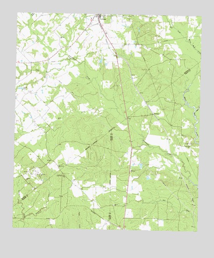
Lovelady South, TX USGS Topographic Map
Click on map above to begin viewing in our Map Viewer.

This topographic map contains these locations and features:
Feature Name Type Latitude Longitude GNIS ID View Map
Calvert LakeLakeN31.0811°W95.4969°1353589View Map
Cedar CreekStreamN31.0702°W95.3780°1381607View Map
Cedar CreekStreamN31.0991°W95.4627°1354072View Map
Clapp CemeteryCemeteryN31.0285°W95.4602°1354545View Map
Elm CreekStreamN31.0705°W95.4311°1356966View Map
Gail CreekStreamN31.1099°W95.3838°1357820View Map
Huffman CemeteryCemeteryN31.0288°W95.4919°1359792View Map
Landman CreekStreamN31.0063°W95.4924°1360917View Map
Mount Olive ChurchChurchN31.1110°W95.4702°1363284View Map
New Zion CemeteryCemeteryN31.0146°W95.4319°1363831View Map
Old Iron BridgeBridgeN31.0907°W95.4794°1377282View Map
Piney Woods Lookout TowerTowerN31.0307°W95.4666°1384644View Map
Pleasant Grove ChurchChurchN31.0366°W95.4702°1365411View Map
Prairie Point CemeteryCemeteryN31.0788°W95.4894°1365737View Map
Prairie Point School (historical)SchoolN31.0782°W95.4897°1377284View Map
Red BranchPopulated PlaceN31.0682°W95.4061°1380419View Map
Reed Sunshine Cemetery (historical)CemeteryN31.0780°W95.4894°1377283View Map
Sand BranchStreamN31.1238°W95.4908°1367568View Map
Trinity Oil FieldOilfieldN31.0319°W95.4852°1370131View Map
White Rock CemeteryCemeteryN31.0511°W95.3803°1371407View Map
White Rock ChurchChurchN31.0491°W95.3813°1371409View Map

Note: Coordinates in the location and feature list above are referenced to NAD83 datum.


Copyright (C) 2008-2025 Ryan Niemi / Sunset Dynamics ... All Rights Reserved