TopoQuest Logo
Do you find TopoQuest useful?
Help keep TopoQuest running and adding new maps/features by donating!
Bitcoin:  19c7KJd3qBynnjoSw5npx9KScwjBe4ifkT
Litecoin:  LXs6TkuXGGXo1vDsWCkWVdjQX94eUKd6ui
Home View Maps Find Maps Find Places Resources & Links


Weldon, Texas Topographic Map

USGS Map Title: Weldon, TX
USGS Map MRC: 31095A5
DRG (GeoTIFF) Download: o31095a5.tif


Neighboring USGS Topographic Map Quads:


  Austonio, TX  
31095B6
 

  Pearsons Chapel, TX  
31095B5
 

  Lovelady North, TX  
31095B4
 

  Sand Ridge, TX  
31095A6
 

  Weldon, TX  
31095A5
 

  Lovelady South, TX  
31095A4
 

  Baker Lake, TX  
30095H6
 

  Wyser Bottom, TX  
30095H5
 

  Trinity West, TX  
30095H4


Map MRC Location:

N32°
W96°
N32°
W95°
H8 H7 H6 H5 H4 H3 H2 H1
G8 G7 G6 G5 G4 G3 G2 G1
F8 F7 F6 F5 F4 F3 F2 F1
E8 E7 E6 E5 E4 E3 E2 E1
D8 D7 D6 D5 D4 D3 D2 D1
C8 C7 C6 C5 C4 C3 C2 C1
B8 B7 B6 B5 B4 B3 B2 B1
A8 A7 A6 A5 A4 A3 A2 A1
N31°
W96°
N31°
W95°

Weldon, TX USGS 1:24K Topographic Map Preview:
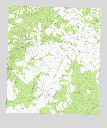
Weldon, TX USGS Topographic Map
Click on map above to begin viewing in our Map Viewer.

This topographic map contains these locations and features:
Feature Name Type Latitude Longitude GNIS ID View Map
Adams - Little Memorial CemeteryCemeteryN31.0812°W95.5885°1377300View Map
Antioch (historical)Populated PlaceN31.0974°W95.5041°1377294View Map
Antioch ChurchChurchN31.0982°W95.5049°1351198View Map
Antioch Post Office (historical)Post OfficeN31.0980°W95.5052°1385457View Map
Cedar CreekStreamN31.0869°W95.5980°1354055View Map
Cemetery BranchStreamN31.0066°W95.5491°1354181View Map
Center School (historical)SchoolN31.0880°W95.5333°1377286View Map
Gardner CreekStreamN31.0196°W95.6111°1357886View Map
Hazel ChapelLocaleN31.0513°W95.5824°1358962View Map
Hazel Chapel Pentecostal Church (historical)ChurchN31.0502°W95.5819°1377298View Map
Iron BridgeBridgeN31.0471°W95.5799°1377299View Map
Lovelady DivisionCivilN31.1027°W95.5215°1938943View Map
Nash SpringSpringN31.0975°W95.6040°1363597View Map
Original Eastham Prison (historical)BuildingN31.0013°W95.6063°1377292View Map
Primitive Baptist Church (historical)ChurchN31.0805°W95.5391°1377289View Map
Rough Edge School (historical)SchoolN31.0532°W95.5555°1377288View Map
Salem CemeteryCemeteryN31.0832°W95.5388°1367351View Map
Sand BranchStreamN31.0088°W95.5422°1367557View Map
SorghumvillePopulated PlaceN31.0569°W95.5086°1380573View Map
Sorghumville School (historical)SchoolN31.0571°W95.5086°1377287View Map
Volga (historical)AreaN31.0657°W95.5822°1377293View Map
WeldonPopulated PlaceN31.0216°W95.5713°1371008View Map
Weldon CemeteryCemeteryN31.0216°W95.5591°1377290View Map
Weldon Methodist Church (historical)ChurchN31.0216°W95.5711°1377278View Map
Weldon Post Office (historical)Post OfficeN31.0235°W95.5702°1385456View Map
Weldon SchoolSchoolN31.0246°W95.5669°1377291View Map
Weldon Volunteer Fire DepartmentBuildingN31.0214°W95.5720°2655410View Map

Note: Coordinates in the location and feature list above are referenced to NAD83 datum.


Copyright (C) 2008-2025 Ryan Niemi / Sunset Dynamics ... All Rights Reserved