TopoQuest Logo
Do you find TopoQuest useful?
Help keep TopoQuest running and adding new maps/features by donating!
Bitcoin:  19c7KJd3qBynnjoSw5npx9KScwjBe4ifkT
Litecoin:  LXs6TkuXGGXo1vDsWCkWVdjQX94eUKd6ui
Home View Maps Find Maps Find Places Resources & Links


Lowell, Iowa Topographic Map

USGS Map Title: Lowell, IA
USGS Map MRC: 40091G4
DRG (GeoTIFF) Download: o40091g4.tif


Neighboring USGS Topographic Map Quads:


  Mount Pleasant, IA  
40091H5
 

  New London, IA  
40091H4
 

  Pleasant Grove, IA  
40091H3
 

  Salem, IA  
40091G5
 

  Lowell, IA  
40091G4
 

  Danville, IA  
40091G3
 

  Donnellson, IA  
40091F5
 

  West Point, IA  
40091F4
 

  Fort Madison, IA  
40091F3


Map MRC Location:

N41°
W92°
N41°
W91°
H8 H7 H6 H5 H4 H3 H2 H1
G8 G7 G6 G5 G4 G3 G2 G1
F8 F7 F6 F5 F4 F3 F2 F1
E8 E7 E6 E5 E4 E3 E2 E1
D8 D7 D6 D5 D4 D3 D2 D1
C8 C7 C6 C5 C4 C3 C2 C1
B8 B7 B6 B5 B4 B3 B2 B1
A8 A7 A6 A5 A4 A3 A2 A1
N40°
W92°
N40°
W91°

Lowell, IA USGS 1:24K Topographic Map Preview:
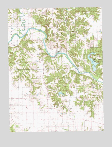
Lowell, IA USGS Topographic Map
Click on map above to begin viewing in our Map Viewer.

This topographic map contains these locations and features:
Feature Name Type Latitude Longitude GNIS ID View Map
Abbe CemeteryCemeteryN40.8639°W91.4779°1981554View Map
Abram Clark Historical MarkerParkN40.7778°W91.4396°1981314View Map
Baltimore (historical)Populated PlaceN40.8578°W91.4599°465343View Map
Beery Post Office (historical)Post OfficeN40.8709°W91.4696°1981409View Map
Bentler Farm CemeteryCemeteryN40.7917°W91.4168°1981326View Map
Bethany CemeteryCemeteryN40.8278°W91.4565°1823529View Map
Big CreekStreamN40.8542°W91.4793°454606View Map
Boyleston CemeteryCemeteryN40.8334°W91.4974°1981536View Map
Cedar CreekStreamN40.8048°W91.3785°455233View Map
Clark CemeteryCemeteryN40.7780°W91.4398°1823522View Map
Emerson PlotCemeteryN40.8056°W91.4585°1981340View Map
Enslow CemeteryCemeteryN40.7550°W91.4013°1823525View Map
First Flour Mill in Iowa Historical MarkerParkN40.8292°W91.4363°1981585View Map
Friends CemeteryCemeteryN40.7778°W91.4963°1823521View Map
Geode LakeReservoirN40.8197°W91.3881°1823527View Map
Geode State ParkParkN40.8325°W91.3852°456872View Map
Hell HollowStreamN40.7984°W91.3768°1823526View Map
Hicks CemeteryCemeteryN40.8195°W91.4974°1981537View Map
Lake WildernessLakeN40.7884°W91.4314°1823523View Map
LowellPopulated PlaceN40.8334°W91.4365°458654View Map
Lowell CemeteryCemeteryN40.8345°W91.4424°1823530View Map
Lowell City ParkParkN40.8292°W91.4363°1981586View Map
Lowell First Baptist ChurchChurchN40.8306°W91.4371°1981511View Map
Lowell Post Office (historical)Post OfficeN40.8334°W91.4365°1981410View Map
Mud CreekStreamN40.8284°W91.4224°459380View Map
Mud Creek County Recreation AreaParkN40.8514°W91.4174°1823531View Map
Old Geode Park CemeteryCemeteryN40.8056°W91.3757°1995137View Map
Pickle CemeteryCemeteryN40.8228°W91.4546°1981564View Map
Pickle ChurchChurchN40.8225°W91.4546°1823528View Map
Pleasant Ridge Post Office (historical)Post OfficeN40.7992°W91.4302°1981083View Map
Prairie CreekStreamN40.8425°W91.4960°460391View Map
Stephenson ParkParkN40.8267°W91.4404°1981393View Map
Township of BaltimoreCivilN40.8565°W91.4296°467410View Map
Township of Pleasant RidgeCivilN40.7682°W91.4314°468542View Map
Williamson CemeteryCemeteryN40.7728°W91.4207°1823524View Map

Note: Coordinates in the location and feature list above are referenced to NAD83 datum.


Copyright (C) 2008-2024 Ryan Niemi / Sunset Dynamics ... All Rights Reserved