TopoQuest Logo
Do you find TopoQuest useful?
Help keep TopoQuest running and adding new maps/features by donating!
Bitcoin:  19c7KJd3qBynnjoSw5npx9KScwjBe4ifkT
Litecoin:  LXs6TkuXGGXo1vDsWCkWVdjQX94eUKd6ui
Home View Maps Find Maps Find Places Resources & Links


West Point, Iowa Topographic Map

USGS Map Title: West Point, IA
USGS Map MRC: 40091F4
DRG (GeoTIFF) Download: o40091f4.tif


Neighboring USGS Topographic Map Quads:


  Salem, IA  
40091G5
 

  Lowell, IA  
40091G4
 

  Danville, IA  
40091G3
 

  Donnellson, IA  
40091F5
 

  West Point, IA  
40091F4
 

  Fort Madison, IA  
40091F3
 

  Argyle, IA  
40091E5
 

  Nauvoo, IL  
40091E4
 

  Niota, IL  
40091E3


Map MRC Location:

N41°
W92°
N41°
W91°
H8 H7 H6 H5 H4 H3 H2 H1
G8 G7 G6 G5 G4 G3 G2 G1
F8 F7 F6 F5 F4 F3 F2 F1
E8 E7 E6 E5 E4 E3 E2 E1
D8 D7 D6 D5 D4 D3 D2 D1
C8 C7 C6 C5 C4 C3 C2 C1
B8 B7 B6 B5 B4 B3 B2 B1
A8 A7 A6 A5 A4 A3 A2 A1
N40°
W92°
N40°
W91°

West Point, IA USGS 1:24K Topographic Map Preview:
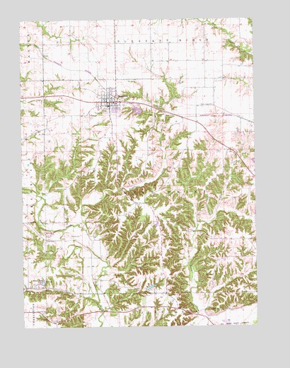
West Point, IA USGS Topographic Map
Click on map above to begin viewing in our Map Viewer.

This topographic map contains these locations and features:
Feature Name Type Latitude Longitude GNIS ID View Map
Air Evac Lifeteam 59 Air Ambulance ServiceBuildingN40.6267°W91.3851°2599897View Map
Calvary CemeteryCemeteryN40.7128°W91.4563°455063View Map
City of West PointCivilN40.7150°W91.4523°2397274View Map
Creel CemeteryCemeteryN40.7473°W91.4752°1981324View Map
Diamond B RacewayLocaleN40.7167°W91.4502°1981259View Map
Everhardt CemeteryCemeteryN40.6312°W91.4894°456445View Map
Fort Madison Community HospitalHospitalN40.6257°W91.3849°1981136View Map
Goldsmith CemeteryCemeteryN40.7334°W91.4974°1981323View Map
Graner CemeteryCemeteryN40.6603°W91.4832°457043View Map
Holy Trinity Elementary SchoolSchoolN40.7149°W91.4530°1981270View Map
Lee CountyCivilN40.6420°W91.4793°465244View Map
Pitman CemeteryCemeteryN40.7109°W91.4182°460194View Map
Pitman Chapel CemeteryCemeteryN40.7150°W91.3971°460195View Map
Pitman CreekStreamN40.6656°W91.4679°460196View Map
Pollimer Park LakeReservoirN40.7119°W91.4382°463545View Map
Pollimer Park Lake DamDamN40.7125°W91.4354°463544View Map
Pollmiller Park TrailTrailN40.7139°W91.4349°1981315View Map
Saint Mary's Roman Catholic ChurchChurchN40.7150°W91.4543°1981269View Map
Saint Peters CemeteryCemeteryN40.6675°W91.4976°461317View Map
Township of West PointCivilN40.6822°W91.4302°468986View Map
Van Hyning CemeteryCemeteryN40.7028°W91.4196°1981322View Map
West PointPopulated PlaceN40.7167°W91.4502°462900View Map
West Point (historical)LocaleN40.7189°W91.4502°1981271View Map
West Point Care CenterHospitalN40.7167°W91.4502°1981264View Map
West Point CemeteryCemeteryN40.7189°W91.4479°1981325View Map
West Point City HallBuildingN40.7167°W91.4502°1981261View Map
West Point ClinicHospitalN40.7159°W91.4493°1981267View Map
West Point Feed and Grain Incorporated ElevatorLocaleN40.7167°W91.4502°1981263View Map
West Point Optical CenterHospitalN40.7167°W91.4529°1981268View Map
West Point Police DepartmentBuildingN40.7167°W91.4502°1981260View Map
West Point Post OfficePost OfficeN40.7167°W91.4502°1981262View Map
West Point Public LibraryBuildingN40.7164°W91.4543°1981265View Map
West Point Volunteer Fire DepartmentBuildingN40.7198°W91.4500°1981266View Map
Whorton CemeteryCemeteryN40.6623°W91.4746°463020View Map
Wilson CemeteryCemeteryN40.6316°W91.3949°463099View Map
Wilson LakeLakeN40.6434°W91.4896°463112View Map
Wilson Lake ParkParkN40.6431°W91.4918°1981060View Map

Note: Coordinates in the location and feature list above are referenced to NAD83 datum.


Copyright (C) 2008-2025 Ryan Niemi / Sunset Dynamics ... All Rights Reserved