TopoQuest Logo
Do you find TopoQuest useful?
Help keep TopoQuest running and adding new maps/features by donating!
Bitcoin:  19c7KJd3qBynnjoSw5npx9KScwjBe4ifkT
Litecoin:  LXs6TkuXGGXo1vDsWCkWVdjQX94eUKd6ui
Home View Maps Find Maps Find Places Resources & Links


Fleming, Ohio Topographic Map

USGS Map Title: Fleming, OH
USGS Map MRC: 39081D5
DRG (GeoTIFF) Download: o39081d5.tif


Neighboring USGS Topographic Map Quads:


  Beverly, OH  
39081E6
 

  Lowell, OH  
39081E5
 

  Lower Salem, OH  
39081E4
 

  Watertown, OH  
39081D6
 

  Fleming, OH  
39081D5
 

  Marietta, OH  
39081D4
 

  Little Hocking, OH  
39081C6
 

  Parkersburg, WV  
39081C5
 

  Valley Mills, WV  
39081C4


Map MRC Location:

N40°
W82°
N40°
W81°
H8 H7 H6 H5 H4 H3 H2 H1
G8 G7 G6 G5 G4 G3 G2 G1
F8 F7 F6 F5 F4 F3 F2 F1
E8 E7 E6 E5 E4 E3 E2 E1
D8 D7 D6 D5 D4 D3 D2 D1
C8 C7 C6 C5 C4 C3 C2 C1
B8 B7 B6 B5 B4 B3 B2 B1
A8 A7 A6 A5 A4 A3 A2 A1
N39°
W82°
N39°
W81°

Fleming, OH USGS 1:24K Topographic Map Preview:
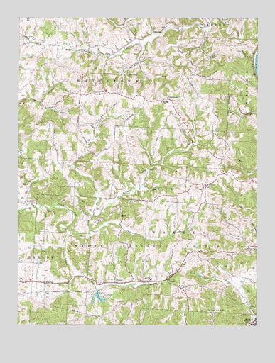
Fleming, OH USGS Topographic Map
Click on map above to begin viewing in our Map Viewer.

This topographic map contains these locations and features:
Feature Name Type Latitude Longitude GNIS ID View Map
AldenPopulated PlaceN39.4834°W81.5021°1057288View Map
Bethel CemeteryCemeteryN39.4317°W81.5260°1963884View Map
Bethel ChurchChurchN39.4323°W81.5257°1037927View Map
Brabham CemeteryCemeteryN39.4345°W81.5015°1037628View Map
Browns RunStreamN39.4120°W81.5968°1060899View Map
Chainey RunStreamN39.4315°W81.5612°1038975View Map
Christopher CemeteryCemeteryN39.3837°W81.5715°1039097View Map
ChurchtownPopulated PlaceN39.4673°W81.5479°1039117View Map
Churchtown CemeteryCemeteryN39.4662°W81.5446°1963890View Map
Coffmans FarmsLocaleN39.4078°W81.5436°2629000View Map
Deming CemeteryCemeteryN39.4884°W81.5816°1039667View Map
Evangelical CemeteryCemeteryN39.4690°W81.5835°1963895View Map
Evangelical ChurchChurchN39.4698°W81.5832°1040249View Map
FlemingPopulated PlaceN39.3917°W81.6107°1062767View Map
Goodfellows ParkLocaleN39.3867°W81.5798°1040949View Map
Goodfellows Park LakeReservoirN39.3864°W81.5827°1077763View Map
Goodfellows Park Lake DamDamN39.3889°W81.5830°1077762View Map
Halfway RunStreamN39.4195°W81.5851°1071142View Map
Henry CemeteryCemeteryN39.4906°W81.6131°1041493View Map
Horse RunStreamN39.4137°W81.5868°1041801View Map
Kern GreenhouseBuildingN39.4533°W81.5353°2652228View Map
Langs Buckeye Dairy FarmLocaleN39.4458°W81.5139°2628999View Map
Locust ForkPopulated PlaceN39.4370°W81.5168°1062857View Map
McAvanPopulated PlaceN39.3923°W81.5740°1062883View Map
Pleasant Grove CemeteryCemeteryN39.4913°W81.6200°1963930View Map
Pleasant Grove ChurchChurchN39.4912°W81.6199°1044531View Map
Russet RunStreamN39.4837°W81.5010°1045297View Map
Saint John CemeteryCemeteryN39.4965°W81.5667°1048369View Map
Township of WarrenCivilN39.4029°W81.5429°1087144View Map
Township of WatertownCivilN39.4791°W81.6100°1087146View Map
TunnelLocaleN39.3937°W81.5468°1061712View Map
Tunnel CemeteryCemeteryN39.3962°W81.5437°1963941View Map
Tunnel United Methodist ChurchChurchN39.3948°W81.5465°1050665View Map
Turkeyhen RunStreamN39.4126°W81.5868°1067028View Map
Union Carbide Waste Retention DamDamN39.3784°W81.5215°1079526View Map
Union Carbide Waste Retention PondReservoirN39.3825°W81.5212°1079527View Map
Warren Chapel CemeteryCemeteryN39.4203°W81.5712°1963943View Map
Warren Chapel Methodist ChurchChurchN39.4195°W81.5712°1070981View Map
Warren Elementary School (historical)SchoolN39.3940°W81.5551°1071784View Map
Warren Township Volunteer Fire Department Station 1BuildingN39.3946°W81.5460°2549800View Map
Warren Township Volunteer Fire Department Station 2BuildingN39.4439°W81.5218°2549095View Map

Note: Coordinates in the location and feature list above are referenced to NAD83 datum.


Copyright (C) 2008-2025 Ryan Niemi / Sunset Dynamics ... All Rights Reserved