TopoQuest Logo
Do you find TopoQuest useful?
Help keep TopoQuest running and adding new maps/features by donating!
Bitcoin:  19c7KJd3qBynnjoSw5npx9KScwjBe4ifkT
Litecoin:  LXs6TkuXGGXo1vDsWCkWVdjQX94eUKd6ui
Home View Maps Find Maps Find Places Resources & Links


Lowry City, Missouri Topographic Map

USGS Map Title: Lowry City, MO
USGS Map MRC: 38093B6
DRG (GeoTIFF) Download: o38093b6.tif


Neighboring USGS Topographic Map Quads:


  Clinton South, MO  
38093C7
 

  Gaines, MO  
38093C6
 

  Leesville, MO  
38093C5
 

  Ohio, MO  
38093B7
 

  Lowry City, MO  
38093B6
 

  Ninnescah Park, MO  
38093B5
 

  Monegaw Springs, MO  
38093A7
 

  Osceola, MO  
38093A6
 

  Iconium, MO  
38093A5


Map MRC Location:

N39°
W94°
N39°
W93°
H8 H7 H6 H5 H4 H3 H2 H1
G8 G7 G6 G5 G4 G3 G2 G1
F8 F7 F6 F5 F4 F3 F2 F1
E8 E7 E6 E5 E4 E3 E2 E1
D8 D7 D6 D5 D4 D3 D2 D1
C8 C7 C6 C5 C4 C3 C2 C1
B8 B7 B6 B5 B4 B3 B2 B1
A8 A7 A6 A5 A4 A3 A2 A1
N38°
W94°
N38°
W93°

Lowry City, MO USGS 1:24K Topographic Map Preview:
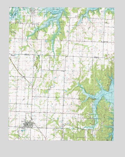
Lowry City, MO USGS Topographic Map
Click on map above to begin viewing in our Map Viewer.

This topographic map contains these locations and features:
Feature Name Type Latitude Longitude GNIS ID View Map
Ackley LakeReservoirN38.2183°W93.7057°763170View Map
Ackley Lake DamDamN38.2184°W93.7052°763169View Map
Big Otter CreekStreamN38.2316°W93.7074°755769View Map
BrowningtonPopulated PlaceN38.2459°W93.7230°714798View Map
Brownington CemeteryCemeteryN38.2341°W93.7241°714799View Map
Brownington Community CenterBuildingN38.2472°W93.7244°748322View Map
Brownington Presbyterian Church (historical)ChurchN38.2489°W93.7245°745043View Map
Brownington School (historical)SchoolN38.2486°W93.7258°745488View Map
Brownington State Wildlife AreaParkN38.2425°W93.7405°748321View Map
ChloePopulated PlaceN38.1842°W93.7333°755884View Map
City of Lowry CityCivilN38.1401°W93.7274°2395779View Map
Clary Lake DamDamN38.1700°W93.6819°763445View Map
Columbia Community CenterBuildingN38.2359°W93.6369°509544View Map
Columbia Hall School (historical)SchoolN38.2359°W93.6369°748486View Map
Consville (historical)Populated PlaceN38.2469°W93.7247°739099View Map
County Line School (historical)SchoolN38.2039°W93.6524°716385View Map
Denny School (historical)SchoolN38.1509°W93.6949°755983View Map
Diamond Point School (historical)SchoolN38.2192°W93.7160°716877View Map
Dunlap (historical)LocaleN38.2320°W93.7316°740266View Map
Haverland Lake DamDamN38.1717°W93.7052°763446View Map
Hay Creek School (historical)SchoolN38.2401°W93.6701°719249View Map
Kelly School (historical)SchoolN38.1625°W93.6510°756241View Map
Lakeland Elementary SchoolSchoolN38.2052°W93.7464°2743750View Map
Lakeland High SchoolSchoolN38.2049°W93.7471°758207View Map
Landecker ChurchChurchN38.1375°W93.6674°756278View Map
Landecker School (historical)SchoolN38.1317°W93.6719°756279View Map
Little Muddy CreekStreamN38.1642°W93.6435°756312View Map
Little Otter CreekStreamN38.2400°W93.6955°756313View Map
Lowry CityPopulated PlaceN38.1400°W93.7269°756332View Map
Lowry City CemeteryCemeteryN38.1342°W93.7396°758205View Map
Lowry City Municipal BuildingBuildingN38.1403°W93.7294°758206View Map
Lowry City Police DepartmentBuildingN38.1400°W93.7316°2752427View Map
Lowry City Post OfficePost OfficeN38.1410°W93.7280°2779510View Map
Lowry City School (historical)SchoolN38.1400°W93.7313°757194View Map
Lowry City Volunteer Fire DepartmentBuildingN38.1402°W93.7282°2620962View Map
Maplewood CemeteryCemeteryN38.2337°W93.7257°721848View Map
Mount ZionPopulated PlaceN38.2175°W93.6380°722924View Map
Mount Zion Baptist ChurchChurchN38.2172°W93.6397°748323View Map
Mount Zion CemeteryCemeteryN38.2179°W93.6391°748325View Map
Mount Zion United Methodist ChurchChurchN38.2181°W93.6385°748324View Map
Park Grove CemeteryCemeteryN38.1756°W93.7008°756501View Map
Park Grove ChurchChurchN38.1900°W93.6852°756502View Map
Park Grove School (historical)SchoolN38.1909°W93.6947°756503View Map
Pleasant View School (historical)SchoolN38.1525°W93.7499°756542View Map
Town of BrowningtonCivilN38.2453°W93.7227°2396610View Map
Township of ButlerCivilN38.1472°W93.6876°767309View Map
Township of OsageCivilN38.2339°W93.6325°766745View Map
Turkey HollowValleyN38.1311°W93.6272°756808View Map
Valley Center School (historical)SchoolN38.1850°W93.7485°756838View Map

Note: Coordinates in the location and feature list above are referenced to NAD83 datum.


Copyright (C) 2008-2025 Ryan Niemi / Sunset Dynamics ... All Rights Reserved