TopoQuest Logo
Do you find TopoQuest useful?
Help keep TopoQuest running and adding new maps/features by donating!
Bitcoin:  19c7KJd3qBynnjoSw5npx9KScwjBe4ifkT
Litecoin:  LXs6TkuXGGXo1vDsWCkWVdjQX94eUKd6ui
Home View Maps Find Maps Find Places Resources & Links


Lumberton, Mississippi Topographic Map

USGS Map Title: Lumberton, MS
USGS Map MRC: 31089A4
DRG (GeoTIFF) Download: o31089a4.tif


Neighboring USGS Topographic Map Quads:


  Baxterville NE, MS  
31089B5
 

  Purvis, MS  
31089B4
 

  Dixie, MS  
31089B3
 

  Baxterville, MS  
31089A5
 

  Lumberton, MS  
31089A4
 

  Rock Hill, MS  
31089A3
 

  Orvisburg, MS  
30089H5
 

  Hillsdale, MS  
30089H4
 

  Carnes, MS  
30089H3


Map MRC Location:

N32°
W90°
N32°
W89°
H8 H7 H6 H5 H4 H3 H2 H1
G8 G7 G6 G5 G4 G3 G2 G1
F8 F7 F6 F5 F4 F3 F2 F1
E8 E7 E6 E5 E4 E3 E2 E1
D8 D7 D6 D5 D4 D3 D2 D1
C8 C7 C6 C5 C4 C3 C2 C1
B8 B7 B6 B5 B4 B3 B2 B1
A8 A7 A6 A5 A4 A3 A2 A1
N31°
W90°
N31°
W89°

Lumberton, MS USGS 1:24K Topographic Map Preview:
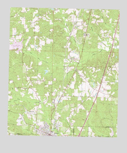
Lumberton, MS USGS Topographic Map
Click on map above to begin viewing in our Map Viewer.

This topographic map contains these locations and features:
Feature Name Type Latitude Longitude GNIS ID View Map
Bass Memorial AcademySchoolN31.0999°W89.4156°692467View Map
Bass Pecan Plant Pond DamDamN31.0418°W89.4034°695341View Map
Bass Pecan Plant Pond DamDamN31.0452°W89.3834°695342View Map
Bass Pecan Plant Pond DamDamN31.0468°W89.3834°695343View Map
Bass Pecan Plant Pond DamDamN31.0468°W89.3901°695344View Map
Bass Pecan Plant Pond DamDamN31.0535°W89.4017°695345View Map
Bass Pecan Plant Pond DamDamN31.0818°W89.3784°695350View Map
Beaverdam BranchStreamN31.0877°W89.3851°692517View Map
Boggy HollowValleyN31.0822°W89.4102°692661View Map
Buster Crider Pond DamDamN31.0652°W89.4551°695347View Map
Christ Gospel ChurchChurchN31.0010°W89.4264°2596318View Map
City of LumbertonCivilN31.0065°W89.4613°2404973View Map
Corinth Baptist ChurchChurchN31.1182°W89.4678°692974View Map
Corinth CemeteryCemeteryN31.1185°W89.4670°707455View Map
Corinth School (historical)SchoolN31.1155°W89.4959°705129View Map
Freedom StripAirportN31.1012°W89.4182°695263View Map
Gateway Baptist ChurchChurchN31.0096°W89.4688°2596627View Map
HanfordPopulated PlaceN31.1127°W89.4278°705131View Map
HarmonPopulated PlaceN31.0932°W89.4148°705132View Map
Hoyle D ByrdDamN31.0302°W89.4334°695340View Map
I H Bass Jr Memorial AirportAirportN31.0179°W89.4832°695261View Map
Interchange 41CrossingN31.0007°W89.4187°691478View Map
Lamar County Fire DepartmentBuildingN31.0666°W89.4236°2332808View Map
Little Black Creek CemeteryCemeteryN31.0321°W89.4639°707458View Map
Little Black Creek ChurchChurchN31.0324°W89.4648°693746View Map
Little Black Creek Water ParkParkN31.0849°W89.4859°705133View Map
Little CreekStreamN31.0863°W89.4915°693757View Map
LumbertonPopulated PlaceN31.0013°W89.4523°693845View Map
Lumberton Citizens Hospital (historical)HospitalN31.0003°W89.4586°707459View Map
Lumberton Family Life CenterChurchN31.0087°W89.4687°2596740View Map
Lumberton Fire DepartmentBuildingN31.0064°W89.4584°2332759View Map
Lumberton Fire DepartmentBuildingN31.0000°W89.4496°2332760View Map
Lumberton Police Department Chief of PoliceBuildingN31.0001°W89.4495°2332920View Map
Lumberton Post OfficePost OfficeN31.0006°W89.4530°2596180View Map
Morning Star Baptist ChurchChurchN31.0086°W89.4549°2596862View Map
Mrs Florine Ulmer Pond DamDamN31.1218°W89.4151°695355View Map
Myers Bay CreekStreamN31.0930°W89.3751°694139View Map
Our Lady of Perpetual Help ChurchChurchN31.0387°W89.4423°2596863View Map
Pat Harrison Waterway Lake DamDamN31.0885°W89.4867°695351View Map
Paul H Barrett Lake DamDamN31.0019°W89.3801°695337View Map
Rehoboth Word of Life Fellowship ChurchChurchN31.0065°W89.4650°2596320View Map
Samuel Slade CemeteryCemeteryN31.0177°W89.4409°707477View Map
Sawed Horn SpringSpringN31.1030°W89.3892°705135View Map
SenecaPopulated PlaceN31.0393°W89.4395°694743View Map
Seneca CemeteryCemeteryN31.0399°W89.4406°707479View Map
Slade CemeteryCemeteryN31.0188°W89.4428°694809View Map
South Branch Red CreekStreamN31.0346°W89.4892°694841View Map
Sunny Hill ChurchChurchN31.0657°W89.3840°694909View Map
Supervisor District 2CivilN31.0827°W89.4337°711934View Map
Sweet Beulah Missionary Baptist ChurchChurchN31.0076°W89.4439°2596864View Map
Tabernacle Baptist ChurchChurchN31.0088°W89.4571°2596446View Map
TalowahPopulated PlaceN31.0760°W89.4303°694935View Map
Talowah CemeteryCemeteryN31.0824°W89.4314°694936View Map
Trinity Christian Fellowship ChurchChurchN31.0010°W89.4517°2596447View Map
Union Grove CemeteryCemeteryN31.0691°W89.3834°695050View Map
Wells TownPopulated PlaceN31.0230°W89.4748°695118View Map
West Boggy Hollow CreekStreamN31.0857°W89.3945°705137View Map
Yawn School (historical)SchoolN31.0471°W89.4023°705138View Map
Zion Hill Baptist ChurchChurchN31.0211°W89.4738°2596322View Map

Note: Coordinates in the location and feature list above are referenced to NAD83 datum.


Copyright (C) 2008-2024 Ryan Niemi / Sunset Dynamics ... All Rights Reserved