TopoQuest Logo
Do you find TopoQuest useful?
Help keep TopoQuest running and adding new maps/features by donating!
Bitcoin:  19c7KJd3qBynnjoSw5npx9KScwjBe4ifkT
Litecoin:  LXs6TkuXGGXo1vDsWCkWVdjQX94eUKd6ui
Home View Maps Find Maps Find Places Resources & Links


Lykens, Pennsylvania Topographic Map

USGS Map Title: Lykens, PA
USGS Map MRC: 40076E6
DRG (GeoTIFF) Download: o40076e6.tif


Neighboring USGS Topographic Map Quads:


  Pillow, PA  
40076F7
 

  Klingerstown, PA  
40076F6
 

  Valley View, PA  
40076F5
 

  Elizabethville, PA  
40076E7
 

  Lykens, PA  
40076E6
 

  Tower City, PA  
40076E5
 

  Enders, PA  
40076D7
 

  Grantville, PA  
40076D6
 

  Indiantown Gap, PA  
40076D5


Map MRC Location:

N41°
W77°
N41°
W76°
H8 H7 H6 H5 H4 H3 H2 H1
G8 G7 G6 G5 G4 G3 G2 G1
F8 F7 F6 F5 F4 F3 F2 F1
E8 E7 E6 E5 E4 E3 E2 E1
D8 D7 D6 D5 D4 D3 D2 D1
C8 C7 C6 C5 C4 C3 C2 C1
B8 B7 B6 B5 B4 B3 B2 B1
A8 A7 A6 A5 A4 A3 A2 A1
N40°
W77°
N40°
W76°

Lykens, PA USGS 1:24K Topographic Map Preview:
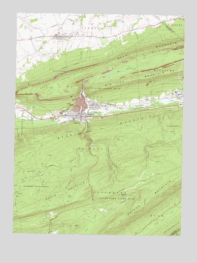
Lykens, PA USGS Topographic Map
Click on map above to begin viewing in our Map Viewer.

This topographic map contains these locations and features:
Feature Name Type Latitude Longitude GNIS ID View Map
Bear CreekStreamN40.5695°W76.6986°1168854View Map
Bear PuddlesLakeN40.5203°W76.7089°1168906View Map
Bear SwampSwampN40.5932°W76.6700°1168940View Map
Big RunPopulated PlaceN40.5706°W76.7439°1203090View Map
Big RunStreamN40.5640°W76.7372°1169564View Map
Borough of GratzCivilN40.6073°W76.7157°1215160View Map
Borough of LykensCivilN40.5641°W76.6984°2086583View Map
Calvary CemeteryCemeteryN40.5717°W76.6835°1170914View Map
DaytonPopulated PlaceN40.5768°W76.6486°1173005View Map
Doc Smith RunStreamN40.5409°W76.7080°1173325View Map
Dry RunStreamN40.5373°W76.7233°1173530View Map
East Branch Rattling CreekStreamN40.5506°W76.6900°1198692View Map
Fairview CemeteryCemeteryN40.5788°W76.6355°1174484View Map
GratzPopulated PlaceN40.6118°W76.7186°1175994View Map
Gratz Area Fire Company Station 27BuildingN40.6104°W76.7188°2652983View Map
Gratz Post OfficePost OfficeN40.6109°W76.7189°2773151View Map
Greenland TrailTrailN40.5423°W76.6511°1176156View Map
Hawks Nest RunStreamN40.5340°W76.7289°1176674View Map
Hostler TrailTrailN40.5287°W76.6325°1177494View Map
Liberty Hose Company Station 22BuildingN40.5659°W76.7013°2653053View Map
Lukes TrailTrailN40.5170°W76.7122°1180072View Map
LykensPopulated PlaceN40.5668°W76.7005°1180100View Map
Lykens Police DepartmentBuildingN40.5662°W76.7015°2754587View Map
Lykens Post OfficePost OfficeN40.5663°W76.6981°2772807View Map
Matter TrailTrailN40.5481°W76.7302°1180555View Map
Minnich Hit Picnic AreaLocaleN40.5226°W76.7472°1181345View Map
Mud RunStreamN40.5306°W76.7352°1182034View Map
Nine O'Clock RunStreamN40.5518°W76.6505°1182460View Map
Rattling CreekStreamN40.5662°W76.7155°1184686View Map
Round TopSummitN40.5048°W76.7052°1193223View Map
Shale RunStreamN40.5331°W76.7252°1187335View Map
Sheepshead Airport (historical)AirportN40.5652°W76.7457°2442847View Map
Sheepshead HeliportAirportN40.5648°W76.7466°1213784View Map
Short MountainSummitN40.5826°W76.7255°1187598View Map
Smoke Hole RunStreamN40.5070°W76.6900°1199553View Map
Spechty KopfPopulated PlaceN40.5229°W76.6700°1204699View Map
State Game Lands Number 210ParkN40.5181°W76.6755°1188487View Map
State Game Lands Number 264ParkN40.5812°W76.6833°1188509View Map
State Game Lands Number 264ParkN40.5834°W76.6747°1208069View Map
Stone Cabin RunStreamN40.5531°W76.6827°1188704View Map
Township of JeffersonCivilN40.5121°W76.7029°1216358View Map
Township of LykensCivilN40.6210°W76.7301°1216362View Map
Township of RushCivilN40.5039°W76.6567°1216366View Map
Township of WiconiscoCivilN40.5786°W76.6997°1216374View Map
Township of WilliamsCivilN40.5908°W76.6302°1216375View Map
West Branch Rattling CreekStreamN40.5506°W76.6930°1190926View Map
WiconiscoPopulated PlaceN40.5734°W76.6914°1199792View Map
Wiconisco Fire Engine Company Station 23BuildingN40.5708°W76.6948°2653052View Map
Wiconisco Post OfficePost OfficeN40.5738°W76.6886°2773036View Map
Wiconisco Township Police DepartmentBuildingN40.5735°W76.6925°2754557View Map
Wiconsico Census Designated PlaceCensusN40.5742°W76.6773°2630049View Map
Williams Valley SchoolSchoolN40.5801°W76.6308°1191478View Map
Wolf RunStreamN40.5309°W76.7352°1209353View Map
WQIN-AM (Lykens)TowerN40.5651°W76.7408°1200429View Map

Note: Coordinates in the location and feature list above are referenced to NAD83 datum.


Copyright (C) 2008-2024 Ryan Niemi / Sunset Dynamics ... All Rights Reserved