TopoQuest Logo
Do you find TopoQuest useful?
Help keep TopoQuest running and adding new maps/features by donating!
Bitcoin:  19c7KJd3qBynnjoSw5npx9KScwjBe4ifkT
Litecoin:  LXs6TkuXGGXo1vDsWCkWVdjQX94eUKd6ui
Home View Maps Find Maps Find Places Resources & Links


Lykens, Ohio Topographic Map

USGS Map Title: Lykens, OH
USGS Map MRC: 40083H1
DRG (GeoTIFF) Download: o40083h1.tif


Neighboring USGS Topographic Map Quads:


  Tiffin South, OH  
41083A2
 

  Bloomville, OH  
41083A1
 

  Attica, OH  
41082A8
 

  Sycamore, OH  
40083H2
 

  Lykens, OH  
40083H1
 

  Chatfield, OH  
40082H8
 

  Nevada, OH  
40083G2
 

  Oceola, OH  
40083G1
 

  Bucyrus, OH  
40082G8


Map MRC Location:

N41°
W84°
N41°
W83°
H8 H7 H6 H5 H4 H3 H2 H1
G8 G7 G6 G5 G4 G3 G2 G1
F8 F7 F6 F5 F4 F3 F2 F1
E8 E7 E6 E5 E4 E3 E2 E1
D8 D7 D6 D5 D4 D3 D2 D1
C8 C7 C6 C5 C4 C3 C2 C1
B8 B7 B6 B5 B4 B3 B2 B1
A8 A7 A6 A5 A4 A3 A2 A1
N40°
W84°
N40°
W83°

Lykens, OH USGS 1:24K Topographic Map Preview:
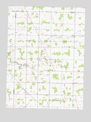
Lykens, OH USGS Topographic Map
Click on map above to begin viewing in our Map Viewer.

This topographic map contains these locations and features:
Feature Name Type Latitude Longitude GNIS ID View Map
Baseline CemeteryCemeteryN40.9934°W83.0596°1963169View Map
BentonPopulated PlaceN40.9270°W83.0938°1060863View Map
Brandywine CreekStreamN40.8889°W83.0241°1038266View Map
Broken SwordPopulated PlaceN40.9067°W83.0169°1060893View Map
Brokensword CemeteryCemeteryN40.9062°W83.0080°1963171View Map
Brokensword Post Office (historical)Post OfficeN40.9070°W83.0166°1966945View Map
Brundedge CemeteryCemeteryN40.9937°W83.1130°1038398View Map
East Baseline Baptist CemeteryCemeteryN40.9939°W83.0115°1730842View Map
Eden CemeteryCemeteryN40.9721°W83.0796°1040070View Map
Freewill CemeteryCemeteryN40.9639°W83.0548°1040671View Map
Lee CemeteryCemeteryN40.9286°W83.0509°1042474View Map
LemertPopulated PlaceN40.8942°W83.0935°1064985View Map
Lemert Post Office (historical)Post OfficeN40.8945°W83.0596°1966937View Map
LykensPopulated PlaceN40.9651°W83.0169°1084016View Map
Lykens Post Office (historical)Post OfficeN40.9653°W83.0166°1966931View Map
Lykens Township Fire DepartmentBuildingN40.9653°W83.0157°2550085View Map
North Branch Spring BranchStreamN40.8939°W83.1235°1060692View Map
Olive Branch ChurchChurchN40.9359°W83.0574°1044158View Map
Pipetown CemeteryCemeteryN40.9679°W83.1132°1044499View Map
PlanktonPopulated PlaceN40.9578°W83.0938°1063423View Map
Pleasant Home ChurchChurchN40.8920°W83.0563°1044568View Map
Saint Johns ChurchChurchN40.9942°W83.0624°1065271View Map
Seery CemeteryCemeteryN40.9348°W83.0605°1046085View Map
South Branch Spring BranchStreamN40.8937°W83.1205°1060696View Map
Texas Township CemeteryCemeteryN40.9270°W83.0985°1963198View Map
Township of LykensCivilN40.9502°W83.0261°1085942View Map
Township of TexasCivilN40.9501°W83.0933°1085945View Map

Note: Coordinates in the location and feature list above are referenced to NAD83 datum.


Copyright (C) 2008-2025 Ryan Niemi / Sunset Dynamics ... All Rights Reserved