TopoQuest Logo
Do you find TopoQuest useful?
Help keep TopoQuest running and adding new maps/features by donating!
Bitcoin:  19c7KJd3qBynnjoSw5npx9KScwjBe4ifkT
Litecoin:  LXs6TkuXGGXo1vDsWCkWVdjQX94eUKd6ui
Home View Maps Find Maps Find Places Resources & Links


Bloomville, Ohio Topographic Map

USGS Map Title: Bloomville, OH
USGS Map MRC: 41083A1
DRG (GeoTIFF) Download: o41083a1.tif


Neighboring USGS Topographic Map Quads:


  Tiffin North, OH  
41083B2
 

  Watson, OH  
41083B1
 

  Fireside, OH  
41082B8
 

  Tiffin South, OH  
41083A2
 

  Bloomville, OH  
41083A1
 

  Attica, OH  
41082A8
 

  Sycamore, OH  
40083H2
 

  Lykens, OH  
40083H1
 

  Chatfield, OH  
40082H8


Map MRC Location:

N42°
W84°
N42°
W83°
H8 H7 H6 H5 H4 H3 H2 H1
G8 G7 G6 G5 G4 G3 G2 G1
F8 F7 F6 F5 F4 F3 F2 F1
E8 E7 E6 E5 E4 E3 E2 E1
D8 D7 D6 D5 D4 D3 D2 D1
C8 C7 C6 C5 C4 C3 C2 C1
B8 B7 B6 B5 B4 B3 B2 B1
A8 A7 A6 A5 A4 A3 A2 A1
N41°
W84°
N41°
W83°

Bloomville, OH USGS 1:24K Topographic Map Preview:
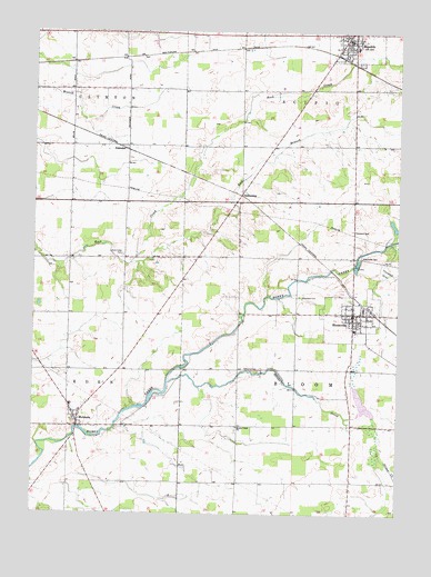
Bloomville, OH USGS Topographic Map
Click on map above to begin viewing in our Map Viewer.

This topographic map contains these locations and features:
Feature Name Type Latitude Longitude GNIS ID View Map
Bliss Memorial Public LibraryBuildingN41.0514°W83.0157°1055677View Map
Bloom Township CemeteryCemeteryN41.0375°W83.0478°1730838View Map
Bloom Township Elementary SchoolSchoolN41.0478°W83.0149°1055678View Map
Bloom Township Fire and Emergency Medical Services DepartmentBuildingN41.0464°W83.0147°2550538View Map
BloomvillePopulated PlaceN41.0520°W83.0149°1064457View Map
Bloomville CemeteryCemeteryN41.0670°W83.0125°1038128View Map
Bloomville Post OfficePost OfficeN41.0514°W83.0152°2045555View Map
Bloomville United Methodist ChurchChurchN41.0523°W83.0130°1055679View Map
Dunkard CemeteryCemeteryN41.0736°W83.0149°1039877View Map
East Branch Rock CreekStreamN41.0648°W83.0919°1065992View Map
Elizabethtown (historical)Populated PlaceN41.0667°W83.0685°1060676View Map
Farewell Retreat CemeteryCemeteryN41.1173°W83.0132°1730844View Map
Honey Creek ChurchChurchN41.0228°W83.0544°1041736View Map
MelmorePopulated PlaceN41.0239°W83.1094°1048967View Map
Melmore Census Designated PlaceCensusN41.0262°W83.1050°2628931View Map
Melmore Elementary SchoolSchoolN41.0281°W83.1119°1055696View Map
Melmore Post OfficePost OfficeN41.0237°W83.1096°2045565View Map
Melmore United Methodist ChurchChurchN41.0256°W83.1085°1073220View Map
Pleasant View CemeteryCemeteryN41.0217°W83.0552°1730853View Map
Reformed CemeteryCemeteryN41.0556°W83.0157°1730854View Map
RepublicPopulated PlaceN41.1220°W83.0157°1061596View Map
Republic Elementary SchoolSchoolN41.1209°W83.0149°1055702View Map
Republic Police DepartmentBuildingN41.1226°W83.0168°2732444View Map
Republic Post OfficePost OfficeN41.1223°W83.0152°2045564View Map
Rock Creek CemeteryCemeteryN41.0670°W83.0946°1045108View Map
RockawayPopulated PlaceN41.0831°W83.0541°1061622View Map
Rockaway Post Office (historical)Post OfficeN41.0834°W83.0546°2045545View Map
Scipio - Republic Fire DepartmentBuildingN41.1220°W83.0144°2550541View Map
Scipio Township CemeteryCemeteryN41.0956°W83.0055°1730861View Map
Silver CreekStreamN41.0339°W83.0785°1046274View Map
Slee DitchCanalN41.0262°W83.0635°1060687View Map
SwanderPopulated PlaceN41.0953°W83.0932°1061665View Map
Township of BloomCivilN41.0374°W83.0159°1086942View Map
Village of BloomvilleCivilN41.0514°W83.0137°2398141View Map
Woodlawn CemeteryCemeteryN41.0564°W83.0335°1048094View Map

Note: Coordinates in the location and feature list above are referenced to NAD83 datum.


Copyright (C) 2008-2025 Ryan Niemi / Sunset Dynamics ... All Rights Reserved