TopoQuest Logo
Do you find TopoQuest useful?
Help keep TopoQuest running and adding new maps/features by donating!
Bitcoin:  19c7KJd3qBynnjoSw5npx9KScwjBe4ifkT
Litecoin:  LXs6TkuXGGXo1vDsWCkWVdjQX94eUKd6ui
Home View Maps Find Maps Find Places Resources & Links


Macon, Mississippi Topographic Map

USGS Map Title: Macon, MS
USGS Map MRC: 33088A5
DRG (GeoTIFF) Download: o33088a5.tif


Neighboring USGS Topographic Map Quads:


  Lynn Creek, MS  
33088B6
 

  Brooksville, MS  
33088B5
 

  Cliftonville, MS  
33088B4
 

  Mashulaville, MS  
33088A6
 

  Macon, MS  
33088A5
 

  McLeod, MS  
33088A4
 

  Gholson, MS  
32088H6
 

  Shuqualak, MS  
32088H5
 

  Paulette, MS  
32088H4


Map MRC Location:

N34°
W89°
N34°
W88°
H8 H7 H6 H5 H4 H3 H2 H1
G8 G7 G6 G5 G4 G3 G2 G1
F8 F7 F6 F5 F4 F3 F2 F1
E8 E7 E6 E5 E4 E3 E2 E1
D8 D7 D6 D5 D4 D3 D2 D1
C8 C7 C6 C5 C4 C3 C2 C1
B8 B7 B6 B5 B4 B3 B2 B1
A8 A7 A6 A5 A4 A3 A2 A1
N33°
W89°
N33°
W88°

Macon, MS USGS 1:24K Topographic Map Preview:
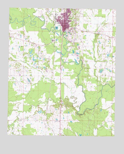
Macon, MS USGS Topographic Map
Click on map above to begin viewing in our Map Viewer.

This topographic map contains these locations and features:
Feature Name Type Latitude Longitude GNIS ID View Map
Bells (historical)Populated PlaceN33.0626°W88.5737°689568View Map
Calvary Baptist ChurchChurchN33.1235°W88.5584°689580View Map
Cedar CreekStreamN33.1029°W88.5584°668184View Map
Cedar Grove ChurchChurchN33.0668°W88.5337°668201View Map
Central AcademySchoolN33.1154°W88.5634°668272View Map
Church of ChristChurchN33.1190°W88.5603°689585View Map
City of MaconCivilN33.1216°W88.5564°2404987View Map
Cockrell Lake DamDamN33.0518°W88.6017°681814View Map
Coleman Lake DamDamN33.0635°W88.5150°681821View Map
Concord ChurchChurchN33.0801°W88.6056°668740View Map
Conners Mill (historical)LocaleN33.0473°W88.5375°689590View Map
DeJarnate CemeteryCemeteryN33.0237°W88.5048°669158View Map
Dry CreekStreamN33.0387°W88.5492°669441View Map
Elon (historical)Populated PlaceN33.0612°W88.5117°710484View Map
Elon ChurchChurchN33.0607°W88.5117°669756View Map
Episcopal Church of the NativityChurchN33.1137°W88.5595°1985647View Map
Evans Lake DamDamN33.0218°W88.5867°681789View Map
First Baptist ChurchChurchN33.1090°W88.5620°689607View Map
First United Methodist ChurchChurchN33.1137°W88.5598°689608View Map
Hall Lake DamDamN33.0785°W88.5450°681834View Map
Horse Hunters CreekStreamN33.1065°W88.5739°671468View Map
Howard LakeLakeN33.1158°W88.5867°671533View Map
Ivy Grove ChurchChurchN33.0104°W88.5148°671751View Map
Joes CreekStreamN33.1168°W88.5931°671894View Map
Lindley Lake DamDamN33.0735°W88.5917°681829View Map
Lindley Lake DamDamN33.0801°W88.6000°681836View Map
Lindley Lake DamDamN33.0701°W88.6017°681826View Map
Loveladys Mill (historical)LocaleN33.0373°W88.5628°689618View Map
Macedonia CreekStreamN33.0260°W88.5409°673036View Map
MaconPopulated PlaceN33.1054°W88.5609°673046View Map
Macon City HallBuildingN33.1076°W88.5614°689620View Map
Macon Fire DepartmentBuildingN33.1171°W88.5692°2665627View Map
Macon Independant Methodist ChurchChurchN33.1132°W88.5584°689621View Map
Macon Lagoon DamDamN33.1035°W88.5684°681856View Map
Macon Police DepartmentBuildingN33.1079°W88.5616°2754060View Map
Macon Post OfficePost OfficeN33.1085°W88.5604°2768607View Map
Macon Presbyterian ChurchChurchN33.1098°W88.5584°689622View Map
Mount Sinai ChurchChurchN33.0676°W88.5809°674274View Map
New Zion ChurchChurchN33.0729°W88.5906°674884View Map
Noxubee CountyCivilN33.1101°W88.5698°695774View Map
Noxubee County CourthouseBuildingN33.1057°W88.5606°689628View Map
Noxubee County Elementary SchoolSchoolN33.0532°W88.5534°710495View Map
Noxubee County High SchoolSchoolN33.0623°W88.5570°710496View Map
Noxubee County Junior High SchoolSchoolN33.1046°W88.5520°710497View Map
Noxubee County Sheriff's OfficeBuildingN33.1057°W88.5606°2754250View Map
Noxubee County Vocational CenterSchoolN33.1087°W88.5434°710498View Map
Noxubee General HospitalHospitalN33.1221°W88.5586°710499View Map
Oak Grove ChurchChurchN33.0873°W88.6106°675047View Map
Odd Fellows CemeteryCemeteryN33.1032°W88.5503°1985652View Map
Parkeville (historical)Populated PlaceN33.0210°W88.6098°710500View Map
Plum CreekStreamN33.0498°W88.5142°691599View Map
Poplar CreekStreamN33.1140°W88.6220°676222View Map
Reed Attendance CenterSchoolN33.0001°W88.5639°676557View Map
Running Water CreekStreamN33.0229°W88.6106°691607View Map
Running Water Creek ChurchChurchN33.0148°W88.6100°676956View Map
Saint John ChurchChurchN33.1007°W88.5212°677059View Map
Saint Paul Missionary Baptist ChurchChurchN33.1057°W88.5595°689636View Map
Saint Paul United Methodist ChurchChurchN33.1068°W88.5553°689637View Map
Salem CemeteryCemeteryN33.0965°W88.6245°710503View Map
Salem ChurchChurchN33.0962°W88.6239°689638View Map
Sand CreekStreamN33.0110°W88.6181°677331View Map
Supervisor District 3CivilN33.1179°W88.5991°712009View Map
Vandevender Lake DamDamN33.1018°W88.5417°681850View Map
West Sdie Baptist ChurchChurchN33.1137°W88.5675°689645View Map
William Lake DamDamN33.0768°W88.5117°681833View Map
Zion Hill ChurchChurchN33.0735°W88.5114°680027View Map

Note: Coordinates in the location and feature list above are referenced to NAD83 datum.


Copyright (C) 2008-2025 Ryan Niemi / Sunset Dynamics ... All Rights Reserved