TopoQuest Logo
Do you find TopoQuest useful?
Help keep TopoQuest running and adding new maps/features by donating!
Bitcoin:  19c7KJd3qBynnjoSw5npx9KScwjBe4ifkT
Litecoin:  LXs6TkuXGGXo1vDsWCkWVdjQX94eUKd6ui
Home View Maps Find Maps Find Places Resources & Links


Gholson, Mississippi Topographic Map

USGS Map Title: Gholson, MS
USGS Map MRC: 32088H6
DRG (GeoTIFF) Download: o32088h6.tif


Neighboring USGS Topographic Map Quads:


  Fearns Springs, MS  
33088A7
 

  Mashulaville, MS  
33088A6
 

  Macon, MS  
33088A5
 

  Preston, MS  
32088H7
 

  Gholson, MS  
32088H6
 

  Shuqualak, MS  
32088H5
 

  Lynville, MS  
32088G7
 

  De Kalb, MS  
32088G6
 

  Townsend, MS  
32088G5


Map MRC Location:

N33°
W89°
N33°
W88°
H8 H7 H6 H5 H4 H3 H2 H1
G8 G7 G6 G5 G4 G3 G2 G1
F8 F7 F6 F5 F4 F3 F2 F1
E8 E7 E6 E5 E4 E3 E2 E1
D8 D7 D6 D5 D4 D3 D2 D1
C8 C7 C6 C5 C4 C3 C2 C1
B8 B7 B6 B5 B4 B3 B2 B1
A8 A7 A6 A5 A4 A3 A2 A1
N32°
W89°
N32°
W88°

Gholson, MS USGS 1:24K Topographic Map Preview:
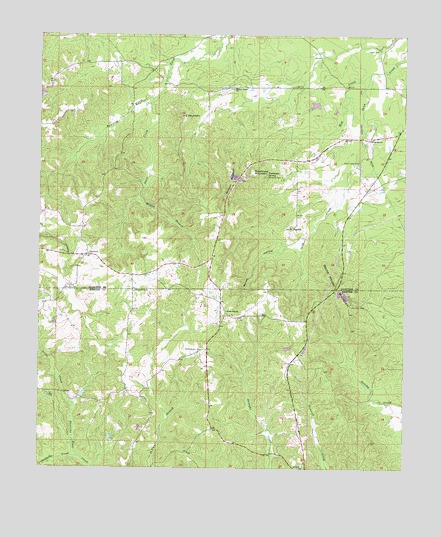
Gholson, MS USGS Topographic Map
Click on map above to begin viewing in our Map Viewer.

This topographic map contains these locations and features:
Feature Name Type Latitude Longitude GNIS ID View Map
Calhoun CemeteryCemeteryN32.9882°W88.6853°710477View Map
Calvary ChurchChurchN32.9699°W88.6370°667936View Map
Chamberlin CreekStreamN32.8782°W88.7364°668302View Map
ClearmanPopulated PlaceN32.9649°W88.6570°710479View Map
Clermont Church (historical)ChurchN32.9699°W88.6437°689588View Map
Cotton CemeteryCemeteryN32.9960°W88.6345°668848View Map
FairhillPopulated PlaceN32.9443°W88.6650°691855View Map
Friendship ChurchChurchN32.9262°W88.7175°670228View Map
GholsonPopulated PlaceN32.9365°W88.7339°670367View Map
Gholson CemeteryCemeteryN32.9398°W88.7314°710487View Map
Gholson MountainSummitN32.9587°W88.6850°670368View Map
Hit MountainSummitN32.9768°W88.7034°671246View Map
Little CreekStreamN32.8929°W88.7387°672585View Map
Marsh HollowValleyN32.9385°W88.6661°673157View Map
Mud CreekStreamN32.9890°W88.6375°674430View Map
Nails CreekStreamN32.9815°W88.7128°674501View Map
Pine Turkey CemeteryCemeteryN32.9635°W88.6412°675879View Map
Poorhouse CemeteryCemeteryN32.9593°W88.6742°676208View Map
Poorhouse MountainSummitN32.9604°W88.6787°676210View Map
Poorhouse SpringSpringN32.9599°W88.6725°676211View Map
Potters RidgeRidgeN32.9710°W88.7195°689632View Map
Summerville (historical)Populated PlaceN32.9440°W88.7353°689659View Map
Thomas Mill Pond DamDamN32.8985°W88.7384°681732View Map
Union Hill ChurchChurchN32.9204°W88.6867°679097View Map
Van Devender CemeteryCemeteryN32.9087°W88.6942°679182View Map
White House MountainSummitN32.9265°W88.6473°679588View Map
Wilder BranchStreamN32.9524°W88.7181°679676View Map
Willow Grove ChurchChurchN32.9849°W88.6856°679738View Map

Note: Coordinates in the location and feature list above are referenced to NAD83 datum.


Copyright (C) 2008-2025 Ryan Niemi / Sunset Dynamics ... All Rights Reserved