TopoQuest Logo
Do you find TopoQuest useful?
Help keep TopoQuest running and adding new maps/features by donating!
Bitcoin:  19c7KJd3qBynnjoSw5npx9KScwjBe4ifkT
Litecoin:  LXs6TkuXGGXo1vDsWCkWVdjQX94eUKd6ui
Home View Maps Find Maps Find Places Resources & Links


Shuqualak, Mississippi Topographic Map

USGS Map Title: Shuqualak, MS
USGS Map MRC: 32088H5
DRG (GeoTIFF) Download: o32088h5.tif


Neighboring USGS Topographic Map Quads:


  Mashulaville, MS  
33088A6
 

  Macon, MS  
33088A5
 

  McLeod, MS  
33088A4
 

  Gholson, MS  
32088H6
 

  Shuqualak, MS  
32088H5
 

  Paulette, MS  
32088H4
 

  De Kalb, MS  
32088G6
 

  Townsend, MS  
32088G5
 

  Scooba, MS  
32088G4


Map MRC Location:

N33°
W89°
N33°
W88°
H8 H7 H6 H5 H4 H3 H2 H1
G8 G7 G6 G5 G4 G3 G2 G1
F8 F7 F6 F5 F4 F3 F2 F1
E8 E7 E6 E5 E4 E3 E2 E1
D8 D7 D6 D5 D4 D3 D2 D1
C8 C7 C6 C5 C4 C3 C2 C1
B8 B7 B6 B5 B4 B3 B2 B1
A8 A7 A6 A5 A4 A3 A2 A1
N32°
W89°
N32°
W88°

Shuqualak, MS USGS 1:24K Topographic Map Preview:
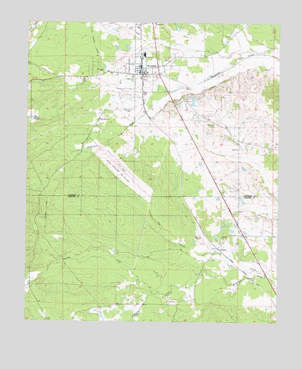
Shuqualak, MS USGS Topographic Map
Click on map above to begin viewing in our Map Viewer.

This topographic map contains these locations and features:
Feature Name Type Latitude Longitude GNIS ID View Map
Anderson Lake DamDamN32.9968°W88.5367°681780View Map
Bell CemeteryCemeteryN32.9573°W88.5331°666775View Map
Columbus Air Force Base Auxiliary Field, (Gunshy)AirportN32.9424°W88.5799°680360View Map
Goolsby CreekStreamN32.8871°W88.5620°670515View Map
Martin CemeteryCemeteryN32.9979°W88.5742°673176View Map
New Chapel ChurchChurchN32.9599°W88.5900°674606View Map
Shiloh ChurchChurchN32.9476°W88.5206°677688View Map
ShuqualakPopulated PlaceN32.9785°W88.5700°677762View Map
Shuqualak CemeteryCemeteryN32.9790°W88.5895°677763View Map
Shuqualak Police DepartmentBuildingN32.9793°W88.5695°2754203View Map
Shuqualak Post OfficePost OfficeN32.9794°W88.5698°2768819View Map
Shuqualak Volunteer Fire DepartmentBuildingN32.9799°W88.5693°2665760View Map
Sid CreekStreamN32.8954°W88.5059°677769View Map
Skipper Lake DamDamN32.9585°W88.6167°681760View Map
Slaughter CemeteryCemeteryN32.9637°W88.5745°677876View Map
Town of ShuqualakCivilN32.9793°W88.5693°2407331View Map
Twin CemeteriesCemeteryN32.8840°W88.5534°678999View Map
WahalakPopulated PlaceN32.9057°W88.5298°692299View Map
Wahalak CemeteryCemeteryN32.9018°W88.5323°1805827View Map
Wahalak First Baptist ChurchChurchN32.9104°W88.5278°679243View Map
Windhams CreekStreamN32.9851°W88.5181°689646View Map

Note: Coordinates in the location and feature list above are referenced to NAD83 datum.


Copyright (C) 2008-2024 Ryan Niemi / Sunset Dynamics ... All Rights Reserved