TopoQuest Logo
Do you find TopoQuest useful?
Help keep TopoQuest running and adding new maps/features by donating!
Bitcoin:  19c7KJd3qBynnjoSw5npx9KScwjBe4ifkT
Litecoin:  LXs6TkuXGGXo1vDsWCkWVdjQX94eUKd6ui
Home View Maps Find Maps Find Places Resources & Links


Madisonville, Virginia Topographic Map

USGS Map Title: Madisonville, VA
USGS Map MRC: 37078B6
DRG (GeoTIFF) Download: o37078b6.tif


Neighboring USGS Topographic Map Quads:


  Appomattox, VA  
37078C7
 

  Pamplin, VA  
37078C6
 

  Prospect, VA  
37078C5
 

  Red House, VA  
37078B7
 

  Madisonville, VA  
37078B6
 

  Abilene, VA  
37078B5
 

  Aspen, VA  
37078A7
 

  Charlotte Court House, VA  
37078A6
 

  Eureka, VA  
37078A5


Map MRC Location:

N38°
W79°
N38°
W78°
H8 H7 H6 H5 H4 H3 H2 H1
G8 G7 G6 G5 G4 G3 G2 G1
F8 F7 F6 F5 F4 F3 F2 F1
E8 E7 E6 E5 E4 E3 E2 E1
D8 D7 D6 D5 D4 D3 D2 D1
C8 C7 C6 C5 C4 C3 C2 C1
B8 B7 B6 B5 B4 B3 B2 B1
A8 A7 A6 A5 A4 A3 A2 A1
N37°
W79°
N37°
W78°

Madisonville, VA USGS 1:24K Topographic Map Preview:
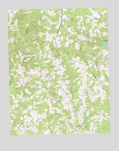
Madisonville, VA USGS Topographic Map
Click on map above to begin viewing in our Map Viewer.

This topographic map contains these locations and features:
Feature Name Type Latitude Longitude GNIS ID View Map
Alabama ChurchChurchN37.2254°W78.6408°1462383View Map
Baker MountainSummitN37.2040°W78.6492°1495220View Map
Baker Mountain MineMineN37.2022°W78.6478°2633285View Map
Big Cub CreekStreamN37.2032°W78.7336°1463343View Map
Cetenary ChurchChurchN37.1818°W78.7033°1464706View Map
Crocked BranchStreamN37.2085°W78.6336°1465442View Map
Horsepen CreekStreamN37.2143°W78.7281°1468296View Map
Industrial Waste DamDamN37.2135°W78.6297°1490670View Map
Industrial Waste PondReservoirN37.2116°W78.6307°1490671View Map
Jenkins CreekStreamN37.1371°W78.6678°1468671View Map
Little Cub CreekStreamN37.2029°W78.7336°1469525View Map
Lyle MountainSummitN37.2021°W78.6917°1495881View Map
Madison DistrictCivilN37.1456°W78.6864°1927384View Map
MadisonvillePopulated PlaceN37.1882°W78.6900°1477512View Map
Madisonville ChurchChurchN37.1946°W78.6839°1470008View Map
Maloney SidingLocaleN37.1738°W78.6367°1470034View Map
Moores BranchStreamN37.2157°W78.7250°1470716View Map
Mount Lyle CemeteryCemeteryN37.2101°W78.6922°1470930View Map
Mount Lyle ChurchChurchN37.2029°W78.6919°1470931View Map
Mountain BranchStreamN37.2174°W78.6578°1471161View Map
North Branch Spring CreekStreamN37.2174°W78.6483°1471585View Map
Oak View ChurchChurchN37.1346°W78.6914°1471771View Map
Oaks CemeteryCemeteryN37.2407°W78.6417°1492321View Map
Rattlesnake BranchStreamN37.1968°W78.7345°1473014View Map
Roanoke Creek Number 4a DamDamN37.1601°W78.6914°1489423View Map
Roanoke Creek Number 5b DamDamN37.1451°W78.6664°1489413View Map
Roanoke Creek Number 6a DamDamN37.1335°W78.6564°1489415View Map
Roanoke Creek Site 4a LakeReservoirN37.1608°W78.6921°1489424View Map
Roanoke Creek Site 5b LakeReservoirN37.1482°W78.6662°1489414View Map
Roanoke Creek Site 6a LakeReservoirN37.1335°W78.6564°1489416View Map
Saint Andrews ChurchChurchN37.1443°W78.6361°1473698View Map
Salem CemeteryCemeteryN37.1607°W78.7311°1492428View Map
Salem ChurchChurchN37.1613°W78.7306°1473942View Map
South Branch Spring CreekStreamN37.2174°W78.6483°1474841View Map
Spring Creek CemeteryCemeteryN37.1926°W78.6256°1474991View Map
TaroPopulated PlaceN37.1363°W78.6406°1477807View Map
Vincent CornerPopulated PlaceN37.1421°W78.7033°1477845View Map
Wards Fork MillLocaleN37.1321°W78.6597°1476316View Map
Wells DamDamN37.2385°W78.6614°1490693View Map
West Branch Wards Fork CreekStreamN37.1282°W78.6556°1476474View Map
White Oak Grove ChurchChurchN37.1568°W78.7403°1476612View Map

Note: Coordinates in the location and feature list above are referenced to NAD83 datum.


Copyright (C) 2008-2024 Ryan Niemi / Sunset Dynamics ... All Rights Reserved