TopoQuest Logo
Do you find TopoQuest useful?
Help keep TopoQuest running and adding new maps/features by donating!
Bitcoin:  19c7KJd3qBynnjoSw5npx9KScwjBe4ifkT
Litecoin:  LXs6TkuXGGXo1vDsWCkWVdjQX94eUKd6ui
Home View Maps Find Maps Find Places Resources & Links


Red House, Virginia Topographic Map

USGS Map Title: Red House, VA
USGS Map MRC: 37078B7
DRG (GeoTIFF) Download: o37078b7.tif


Neighboring USGS Topographic Map Quads:


  Concord, VA  
37078C8
 

  Appomattox, VA  
37078C7
 

  Pamplin, VA  
37078C6
 

  Mike, VA  
37078B8
 

  Red House, VA  
37078B7
 

  Madisonville, VA  
37078B6
 

  Brookneal, VA  
37078A8
 

  Aspen, VA  
37078A7
 

  Charlotte Court House, VA  
37078A6


Map MRC Location:

N38°
W79°
N38°
W78°
H8 H7 H6 H5 H4 H3 H2 H1
G8 G7 G6 G5 G4 G3 G2 G1
F8 F7 F6 F5 F4 F3 F2 F1
E8 E7 E6 E5 E4 E3 E2 E1
D8 D7 D6 D5 D4 D3 D2 D1
C8 C7 C6 C5 C4 C3 C2 C1
B8 B7 B6 B5 B4 B3 B2 B1
A8 A7 A6 A5 A4 A3 A2 A1
N37°
W79°
N37°
W78°

Red House, VA USGS 1:24K Topographic Map Preview:
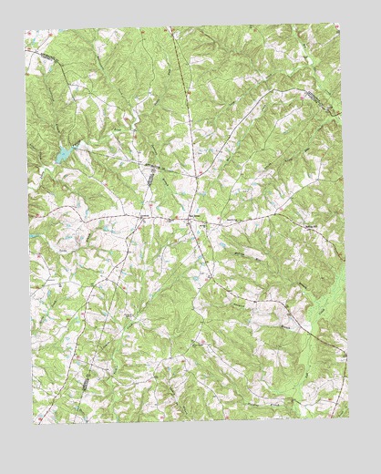
Red House, VA USGS Topographic Map
Click on map above to begin viewing in our Map Viewer.

This topographic map contains these locations and features:
Feature Name Type Latitude Longitude GNIS ID View Map
Bear CreekStreamN37.2179°W78.7511°1462881View Map
Beautiful Zion ChurchChurchN37.1879°W78.7922°1462921View Map
Beaverpond BranchStreamN37.2132°W78.8614°1462978View Map
Butterwood CreekStreamN37.1688°W78.7520°1464188View Map
Concord ChurchChurchN37.2221°W78.7561°1465160View Map
Dividing BranchStreamN37.1271°W78.7706°1465830View Map
Jonnican BranchStreamN37.2182°W78.8331°1468870View Map
Lions CreekStreamN37.2004°W78.8747°1469451View Map
Little Bear CreekStreamN37.2188°W78.7570°1469463View Map
Long CreekStreamN37.2371°W78.7617°1469803View Map
Madison Mill BranchStreamN37.1588°W78.7606°1470002View Map
Marrowbone CreekStreamN37.2185°W78.8331°1470105View Map
Mount Zion Baptist ChurchChurchN37.1874°W78.8056°1471129View Map
Providence ChurchChurchN37.1893°W78.8306°1472823View Map
Red HouseLocaleN37.1890°W78.8122°1473054View Map
Red House Post OfficePost OfficeN37.1888°W78.8121°1492423View Map
Red House Volunteer Fire DepartmentBuildingN37.1881°W78.8053°2086300View Map
Redhouse AirfieldAirportN37.1892°W78.8321°1498780View Map
Rolling HillLocaleN37.1849°W78.7636°1473516View Map
Steele ForkStreamN37.2213°W78.8317°1475108View Map
Tanyard BranchStreamN37.1543°W78.7645°1475464View Map
Trinity ChurchChurchN37.1885°W78.8203°1475864View Map
Whites Chapel CemeteryCemeteryN37.1496°W78.8106°1476664View Map

Note: Coordinates in the location and feature list above are referenced to NAD83 datum.


Copyright (C) 2008-2024 Ryan Niemi / Sunset Dynamics ... All Rights Reserved