TopoQuest Logo
Do you find TopoQuest useful?
Help keep TopoQuest running and adding new maps/features by donating!
Bitcoin:  19c7KJd3qBynnjoSw5npx9KScwjBe4ifkT
Litecoin:  LXs6TkuXGGXo1vDsWCkWVdjQX94eUKd6ui
Home View Maps Find Maps Find Places Resources & Links


Charlotte Court House, Virginia Topographic Map

USGS Map Title: Charlotte Court House, VA
USGS Map MRC: 37078A6
DRG (GeoTIFF) Download: o37078a6.tif


Neighboring USGS Topographic Map Quads:


  Red House, VA  
37078B7
 

  Madisonville, VA  
37078B6
 

  Abilene, VA  
37078B5
 

  Aspen, VA  
37078A7
 

  Charlotte Court House, VA  
37078A6
 

  Eureka, VA  
37078A5
 

  Conner Lake, VA  
36078H7
 

  Saxe, VA  
36078H6
 

  Drakes Branch, VA  
36078H5


Map MRC Location:

N38°
W79°
N38°
W78°
H8 H7 H6 H5 H4 H3 H2 H1
G8 G7 G6 G5 G4 G3 G2 G1
F8 F7 F6 F5 F4 F3 F2 F1
E8 E7 E6 E5 E4 E3 E2 E1
D8 D7 D6 D5 D4 D3 D2 D1
C8 C7 C6 C5 C4 C3 C2 C1
B8 B7 B6 B5 B4 B3 B2 B1
A8 A7 A6 A5 A4 A3 A2 A1
N37°
W79°
N37°
W78°

Charlotte Court House, VA USGS 1:24K Topographic Map Preview:
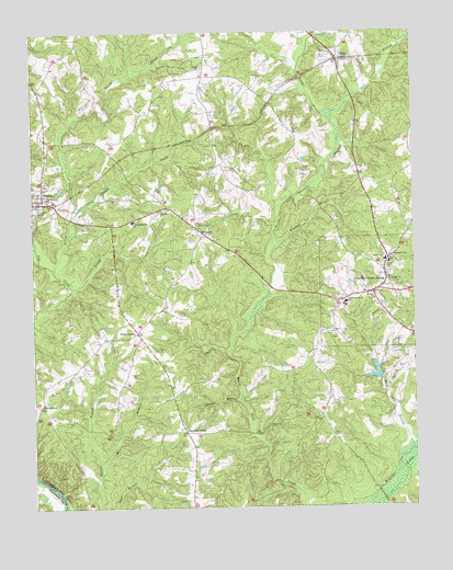
Charlotte Court House, VA USGS Topographic Map
Click on map above to begin viewing in our Map Viewer.

This topographic map contains these locations and features:
Feature Name Type Latitude Longitude GNIS ID View Map
Austin CreekStreamN37.0760°W78.7372°1462623View Map
Bush Ford BranchStreamN37.0151°W78.6258°1464158View Map
Central Middle SchoolSchoolN37.0527°W78.6461°1464691View Map
Chandlers BranchStreamN37.0285°W78.6822°1464731View Map
Chandlers ForksPopulated PlaceN37.0199°W78.7000°1477196View Map
Charlotte CountyCivilN37.0116°W78.6616°1492442View Map
Charlotte County CourthouseBuildingN37.0563°W78.6378°1492372View Map
Charlotte County Sheriff's OfficeBuildingN37.0520°W78.6382°2766945View Map
Charlotte Court HousePopulated PlaceN37.0565°W78.6383°1498462View Map
Charlotte Court House Post OfficePost OfficeN37.0567°W78.6382°1492373View Map
Charlotte Court House United Methodist ChurchChurchN37.0563°W78.6397°1492374View Map
Charlotte Court House Volunteer Fire DepartmentBuildingN37.0567°W78.6344°2086332View Map
Concord ChurchChurchN37.1157°W78.6936°1465159View Map
CullenPopulated PlaceN37.1176°W78.6492°1465516View Map
Cullen Post OfficePost OfficeN37.1179°W78.6491°2766353View Map
Cullen Volunteer Fire DepartmentBuildingN37.1197°W78.6490°2086333View Map
East Branch Wards Fork CreekStreamN37.1013°W78.6508°1466093View Map
Evergreen CemeteryCemeteryN37.0460°W78.6528°1466359View Map
Fears CornerPopulated PlaceN37.0460°W78.7161°1477319View Map
Gillispie CemeteryCemeteryN37.1085°W78.7072°1492390View Map
HarrisburgPopulated PlaceN37.0265°W78.7478°1477398View Map
J Murray Jeffress Elementary SchoolSchoolN37.0755°W78.7167°1468663View Map
Layne Farm AirstripAirportN37.1213°W78.6436°1498647View Map
Martin BranchStreamN37.0110°W78.7281°1470122View Map
Martin CemeteryCemeteryN37.0485°W78.6942°1492406View Map
Middle Branch Wards Fork CreekStreamN37.1013°W78.6508°1470393View Map
Morrison Grove ChurchChurchN37.0657°W78.6317°1470766View Map
Mount Horan ChurchChurchN37.0824°W78.7450°1470906View Map
Mount Tirzah ChurchChurchN37.0593°W78.6336°1471084View Map
PhenixPopulated PlaceN37.0799°W78.7478°1472249View Map
Phenix Elementary SchoolSchoolN37.0850°W78.7454°1492417View Map
Phenix Lookout TowerTowerN37.0749°W78.6964°1491215View Map
Phenix Post OfficePost OfficeN37.0806°W78.7471°1492418View Map
Phenix United Methodist ChurchChurchN37.0799°W78.7483°1492419View Map
Phenix Volunteer Fire DepartmentBuildingN37.0790°W78.7475°2086299View Map
Plain ChurchChurchN37.0640°W78.6331°1472456View Map
Randolph Henry High SchoolSchoolN37.0538°W78.6471°1472967View Map
Roaches BranchStreamN37.0682°W78.6708°1473282View Map
Roanoke Creek Number 31b DamDamN37.1201°W78.6314°1489427View Map
Roanoke Creek Number 35a DamDamN37.0335°W78.6364°1489409View Map
Roanoke Creek Site 31b LakeReservoirN37.1201°W78.6314°1489428View Map
Roanoke Creek Site 35-A LakeReservoirN37.0344°W78.6383°1489410View Map
Roanoke DistrictCivilN37.0074°W78.7462°1927467View Map
Saint Louis ChurchChurchN37.0785°W78.7069°1473795View Map
Sandy CreekStreamN37.0582°W78.7369°1474012View Map
Terrys CreekStreamN37.0618°W78.7425°1475547View Map
Thomas Jefferson Academy Alternative EducationSchoolN37.0648°W78.6343°2499219View Map
Town of Charlotte Court HouseCivilN37.0564°W78.6378°2390778View Map
Town of PhenixCivilN37.0811°W78.7485°2391359View Map
Union CemeteryCemeteryN37.0735°W78.6258°1476028View Map
Village ChurchChurchN37.0546°W78.6378°1476189View Map
WomacksPopulated PlaceN37.0735°W78.6961°1477894View Map

Note: Coordinates in the location and feature list above are referenced to NAD83 datum.


Copyright (C) 2008-2025 Ryan Niemi / Sunset Dynamics ... All Rights Reserved