TopoQuest Logo
Do you find TopoQuest useful?
Help keep TopoQuest running and adding new maps/features by donating!
Bitcoin:  19c7KJd3qBynnjoSw5npx9KScwjBe4ifkT
Litecoin:  LXs6TkuXGGXo1vDsWCkWVdjQX94eUKd6ui
Home View Maps Find Maps Find Places Resources & Links


Magnolia, Kentucky Topographic Map

USGS Map Title: Magnolia, KY
USGS Map MRC: 37085D6
DRG (GeoTIFF) Download: o37085d6.tif


Neighboring USGS Topographic Map Quads:


  Tonieville, KY  
37085E7
 

  Hodgenville, KY  
37085E6
 

  Howardstown, KY  
37085E5
 

  Hammonville, KY  
37085D7
 

  Magnolia, KY  
37085D6
 

  Hibernia, KY  
37085D5
 

  Canmer, KY  
37085C7
 

  Hudgins, KY  
37085C6
 

  Summersville, KY  
37085C5


Map MRC Location:

N38°
W86°
N38°
W85°
H8 H7 H6 H5 H4 H3 H2 H1
G8 G7 G6 G5 G4 G3 G2 G1
F8 F7 F6 F5 F4 F3 F2 F1
E8 E7 E6 E5 E4 E3 E2 E1
D8 D7 D6 D5 D4 D3 D2 D1
C8 C7 C6 C5 C4 C3 C2 C1
B8 B7 B6 B5 B4 B3 B2 B1
A8 A7 A6 A5 A4 A3 A2 A1
N37°
W86°
N37°
W85°

Magnolia, KY USGS 1:24K Topographic Map Preview:
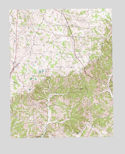
Magnolia, KY USGS Topographic Map
Click on map above to begin viewing in our Map Viewer.

This topographic map contains these locations and features:
Feature Name Type Latitude Longitude GNIS ID View Map
Aetna FurnaceLocaleN37.3764°W85.7197°485786View Map
Bayne CreekStreamN37.4742°W85.7389°486488View Map
Benningfield ChapelChurchN37.4434°W85.6883°486869View Map
Brownfield CreekStreamN37.4870°W85.6800°488019View Map
Brushy ForkStreamN37.3856°W85.7069°488116View Map
Davis Memorial ChapelChurchN37.4239°W85.6291°490672View Map
Dezarn CemeteryCemeteryN37.4248°W85.6272°490855View Map
Dye BranchStreamN37.4868°W85.7468°491382View Map
Foote Post Office (historical)Post OfficeN37.4911°W85.6804°2569442View Map
Gatton Post Office (historical)Post OfficeN37.4882°W85.6553°2569443View Map
Laurel BranchStreamN37.3934°W85.7275°496019View Map
Lindy CreekStreamN37.3903°W85.7037°496578View Map
Locust BranchStreamN37.3976°W85.7489°496937View Map
MagnoliaPopulated PlaceN37.4439°W85.7436°497453View Map
Magnolia Census Designated PlaceCensusN37.4502°W85.7400°2629645View Map
Magnolia Fire DepartmentBuildingN37.4442°W85.7451°2636806View Map
Magnolia Gas Storage FieldOilfieldN37.4189°W85.6833°497454View Map
Magnolia High School (historical)SchoolN37.4443°W85.7440°2569456View Map
Mount Moriah Baptist ChurchChurchN37.4427°W85.6748°498780View Map
Mount ShermanPopulated PlaceN37.4526°W85.6683°498863View Map
Mount Sherman ChurchChurchN37.4487°W85.6533°498864View Map
Mount Sherman Post OfficePost OfficeN37.4526°W85.6681°2555023View Map
Mount Tabor Baptist ChurchChurchN37.4891°W85.6592°498868View Map
Mount Tabor Church CemeteryCemeteryN37.4886°W85.6592°2569462View Map
Mount Zion Separate Baptist ChurchChurchN37.4074°W85.7198°498934View Map
Pottinger CreekStreamN37.4142°W85.7025°501207View Map
Rose Hill Church (historical)ChurchN37.4507°W85.6659°2569475View Map
Russell CemeteryCemeteryN37.3751°W85.7211°502513View Map
School Number Twenty-Nine (historical)SchoolN37.4463°W85.7146°2569480View Map
School Number Twenty-Six (historical)SchoolN37.4880°W85.6557°2569481View Map
Shiboley ChurchChurchN37.4148°W85.6666°503364View Map
Spring Town School (historical)SchoolN37.4434°W85.6786°2569482View Map
Terrell SchoolSchoolN37.4298°W85.6283°505086View Map
Tom Bill BranchStreamN37.4239°W85.6311°505332View Map
Union ChurchChurchN37.3752°W85.7174°505781View Map
Walters School (historical)SchoolN37.4784°W85.7149°2569485View Map
Wathen CreekStreamN37.4590°W85.6605°2569486View Map

Note: Coordinates in the location and feature list above are referenced to NAD83 datum.


Copyright (C) 2008-2025 Ryan Niemi / Sunset Dynamics ... All Rights Reserved