TopoQuest Logo
Do you find TopoQuest useful?
Help keep TopoQuest running and adding new maps/features by donating!
Bitcoin:  19c7KJd3qBynnjoSw5npx9KScwjBe4ifkT
Litecoin:  LXs6TkuXGGXo1vDsWCkWVdjQX94eUKd6ui
Home View Maps Find Maps Find Places Resources & Links


Magnolia Beach, South Carolina Topographic Map

USGS Map Title: Magnolia Beach, SC
USGS Map MRC: 33079D1
DRG (GeoTIFF) Download: o33079d1.tif


Neighboring USGS Topographic Map Quads:


  Plantersville, SC  
33079E2
 

  Brookgreen, SC  
33079E1
 

  Surfside Beach, SC  
33078E8
 

  Waverly Mills, SC  
33079D2
 

  Magnolia Beach, SC  
33079D1


  North Island, SC  
33079C2


Map MRC Location:

N34°
W80°
N34°
W79°
H8 H7 H6 H5 H4 H3 H2 H1
G8 G7 G6 G5 G4 G3 G2 G1
F8 F7 F6 F5 F4 F3 F2 F1
E8 E7 E6 E5 E4 E3 E2 E1
D8 D7 D6 D5 D4 D3 D2 D1
C8 C7 C6 C5 C4 C3 C2 C1
B8 B7 B6 B5 B4 B3 B2 B1
A8 A7 A6 A5 A4 A3 A2 A1
N33°
W80°
N33°
W79°

Magnolia Beach, SC USGS 1:24K Topographic Map Preview:
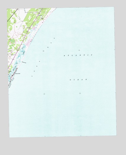
Magnolia Beach, SC USGS Topographic Map
Click on map above to begin viewing in our Map Viewer.

This topographic map contains these locations and features:
Feature Name Type Latitude Longitude GNIS ID View Map
AnnievillePopulated PlaceN33.4807°W79.1020°1231005View Map
Camp BaskervilleLocaleN33.4613°W79.1150°1232278View Map
Clubhouse CreekGutN33.4588°W79.1048°1221650View Map
Flagg PondLakeN33.4883°W79.0875°1222425View Map
GeorgievillePopulated PlaceN33.4932°W79.0889°1222680View Map
Holy Cross Faith Memorial SchoolSchoolN33.4627°W79.1136°1232354View Map
Inlet PointCapeN33.4604°W79.1109°1232367View Map
Litchfield BeachPopulated PlaceN33.4668°W79.0998°1232382View Map
Litchfield BeachBeachN33.4566°W79.1039°1228035View Map
Litchfield Books Post OfficePost OfficeN33.4884°W79.0942°2489852View Map
Litchfield by the SeaPopulated PlaceN33.4757°W79.0956°1232383View Map
Litchfield Golf and Country ClubLocaleN33.4774°W79.1164°1232384View Map
Litchfield RetreatPopulated PlaceN33.4852°W79.0859°1232386View Map
Litchfield SpitBarN33.4538°W79.1056°1232387View Map
Magnolia BeachBeachN33.4824°W79.0859°1246517View Map
Midway Fire Department Station 81BuildingN33.4863°W79.0987°2368399View Map
Midway InletBayN33.4488°W79.1089°1246646View Map
North Litchfield BeachPopulated PlaceN33.4891°W79.0825°1232417View Map
ParkersvillePopulated PlaceN33.4541°W79.1231°1231633View Map
Pawleys IslandPopulated PlaceN33.4332°W79.1214°1231638View Map
Pawleys IslandIslandN33.4296°W79.1217°1253481View Map
Pawleys Island CreekGutN33.4432°W79.1156°1225326View Map
Pawleys Island Historic DistrictParkN33.4377°W79.1175°1232419View Map
Pawleys Island Police DepartmentBuildingN33.4336°W79.1212°2334985View Map
Pawleys Island Post OfficePost OfficeN33.4453°W79.1240°2489870View Map
Pawleys Island Post Office (historical)Post OfficeN33.4332°W79.1214°2027139View Map
Pawleys PierLocaleN33.4324°W79.1181°1232420View Map
Saint Pauls Waccamau United Methodist ChurchChurchN33.4858°W79.0963°2490226View Map
Saint Peter Lutheran ChurchChurchN33.4750°W79.1036°2490227View Map
Salt Marsh CovePopulated PlaceN33.4682°W79.1050°1232465View Map
The Lakes at LitchfieldBuildingN33.4747°W79.1061°2489926View Map
Town of Pawleys IslandCivilN33.4258°W79.1249°2407082View Map
Waccamaw Intermediate SchoolSchoolN33.4932°W79.0958°2486566View Map
Waccamaw Middle SchoolSchoolN33.4926°W79.0958°2486525View Map

Note: Coordinates in the location and feature list above are referenced to NAD83 datum.


Copyright (C) 2008-2025 Ryan Niemi / Sunset Dynamics ... All Rights Reserved