TopoQuest Logo
Do you find TopoQuest useful?
Help keep TopoQuest running and adding new maps/features by donating!
Bitcoin:  19c7KJd3qBynnjoSw5npx9KScwjBe4ifkT
Litecoin:  LXs6TkuXGGXo1vDsWCkWVdjQX94eUKd6ui
Home View Maps Find Maps Find Places Resources & Links


Mahoney Hill, Montana Topographic Map

USGS Map Title: Mahoney Hill, MT
USGS Map MRC: 47111C1
DRG (GeoTIFF) Download: o47111c1.tif


Neighboring USGS Topographic Map Quads:


  Southeast Great Falls, MT  
47111D2
 

  Fife, MT  
47111D1
 

  Belt, MT  
47110D8
 

  Stockett, MT  
47111C2
 

  Mahoney Hill, MT  
47111C1
 

  Armington, MT  
47110C8
 

  Calvert, MT  
47111B2
 

  Evans, MT  
47111B1
 

  Riceville, MT  
47110B8


Map MRC Location:

N48°
W112°
N48°
W111°
H8 H7 H6 H5 H4 H3 H2 H1
G8 G7 G6 G5 G4 G3 G2 G1
F8 F7 F6 F5 F4 F3 F2 F1
E8 E7 E6 E5 E4 E3 E2 E1
D8 D7 D6 D5 D4 D3 D2 D1
C8 C7 C6 C5 C4 C3 C2 C1
B8 B7 B6 B5 B4 B3 B2 B1
A8 A7 A6 A5 A4 A3 A2 A1
N47°
W112°
N47°
W111°

Mahoney Hill, MT USGS 1:24K Topographic Map Preview:
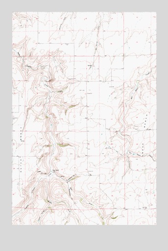
Mahoney Hill, MT USGS Topographic Map
Click on map above to begin viewing in our Map Viewer.

This topographic map contains these locations and features:
Feature Name Type Latitude Longitude GNIS ID View Map
18N05E01____01 WellWellN47.3416°W111.0388°822319View Map
18N05E12____01 WellWellN47.3269°W111.0388°822233View Map
18N05E12____02 WellWellN47.3269°W111.0388°822234View Map
18N05E14____01 WellWellN47.3122°W111.0600°822129View Map
18N05E14____02 WellWellN47.3122°W111.0600°822130View Map
18N05E14C___01 WellWellN47.3083°W111.0652°822102View Map
18N05E21____01 WellWellN47.2972°W111.1022°822042View Map
18N05E24____01 WellWellN47.2972°W111.0388°822041View Map
18N05E26A___01 WellWellN47.2864°W111.0547°821958View Map
Bayes CouleeValleyN47.2636°W111.0919°779457View Map
Big Dumb Bunny DamDamN47.3666°W111.0475°798461View Map
Blankenbaker HillSummitN47.2644°W111.0733°769023View Map
East Fork Sand Coulee CreekStreamN47.2816°W111.0919°782902View Map
Forest HillSummitN47.2822°W111.0972°771491View Map
Mahoney HillSummitN47.2797°W111.0708°773818View Map
Middle Fork Sand Coulee CreekStreamN47.2811°W111.0911°787305View Map
New Century School (historical)SchoolN47.3130°W111.0605°1761881View Map
Pleasant Valley ColonyPopulated PlaceN47.3569°W111.0841°1762473View Map
Three ForksPopulated PlaceN47.2816°W111.0902°777602View Map
Tiger Butte CemeteryCemeteryN47.2597°W111.0116°777641View Map

Note: Coordinates in the location and feature list above are referenced to NAD83 datum.


Copyright (C) 2008-2025 Ryan Niemi / Sunset Dynamics ... All Rights Reserved