TopoQuest Logo
Do you find TopoQuest useful?
Help keep TopoQuest running and adding new maps/features by donating!
Bitcoin:  19c7KJd3qBynnjoSw5npx9KScwjBe4ifkT
Litecoin:  LXs6TkuXGGXo1vDsWCkWVdjQX94eUKd6ui
Home View Maps Find Maps Find Places Resources & Links


Riceville, Montana Topographic Map

USGS Map Title: Riceville, MT
USGS Map MRC: 47110B8
DRG (GeoTIFF) Download: o47110b8.tif


Neighboring USGS Topographic Map Quads:


  Mahoney Hill, MT  
47111C1
 

  Armington, MT  
47110C8
 

  Blythe, MT  
47110C7
 

  Evans, MT  
47111B1
 

  Riceville, MT  
47110B8
 

  Monarch NE, MT  
47110B7
 

  Blankenbaker Flats, MT  
47111A1
 

  Thunder Mountain, MT  
47110A8
 

  Monarch, MT  
47110A7


Map MRC Location:

N48°
W111°
N48°
W110°
H8 H7 H6 H5 H4 H3 H2 H1
G8 G7 G6 G5 G4 G3 G2 G1
F8 F7 F6 F5 F4 F3 F2 F1
E8 E7 E6 E5 E4 E3 E2 E1
D8 D7 D6 D5 D4 D3 D2 D1
C8 C7 C6 C5 C4 C3 C2 C1
B8 B7 B6 B5 B4 B3 B2 B1
A8 A7 A6 A5 A4 A3 A2 A1
N47°
W111°
N47°
W110°

Riceville, MT USGS 1:24K Topographic Map Preview:
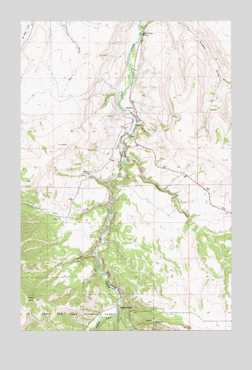
Riceville, MT USGS Topographic Map
Click on map above to begin viewing in our Map Viewer.

This topographic map contains these locations and features:
Feature Name Type Latitude Longitude GNIS ID View Map
A C M Company Spur (historical)LocaleN47.1761°W110.9452°1762294View Map
Albright (historical)Populated PlaceN47.1477°W110.9502°1762291View Map
Albright (historical)LocaleN47.1477°W110.9502°1762293View Map
Albright Post Office (historical)Post OfficeN47.1477°W110.9502°1762292View Map
Camp Don BoscoLocaleN47.2036°W110.9374°780854View Map
Campsite Post Office (historical)Post OfficeN47.1341°W110.9424°1762443View Map
Crown ButteSummitN47.1372°W110.9919°781938View Map
Dicks GulchValleyN47.1552°W110.9572°782378View Map
Isaac Walton SpringSpringN47.2445°W110.9284°785348View Map
Limestone Spar (historical)LocaleN47.1861°W110.9405°1762354View Map
Logging CreekLocaleN47.1344°W110.9422°786452View Map
Logging CreekStreamN47.1311°W110.9436°786455View Map
Logging Creek Post Office (historical)Post OfficeN47.1344°W110.9422°1762450View Map
Nasen CouleeValleyN47.1930°W110.9386°787915View Map
RicevillePopulated PlaceN47.2147°W110.9336°789562View Map
Riceville (historical)LocaleN47.2147°W110.9336°1762468View Map
Riceville Post Office (historical)Post OfficeN47.2147°W110.9336°1762456View Map
Sluice BoxesBasinN47.1922°W110.9413°790695View Map
Tiger CreekStreamN47.1764°W110.9461°792169View Map

Note: Coordinates in the location and feature list above are referenced to NAD83 datum.


Copyright (C) 2008-2024 Ryan Niemi / Sunset Dynamics ... All Rights Reserved