TopoQuest Logo
Do you find TopoQuest useful?
Help keep TopoQuest running and adding new maps/features by donating!
Bitcoin:  19c7KJd3qBynnjoSw5npx9KScwjBe4ifkT
Litecoin:  LXs6TkuXGGXo1vDsWCkWVdjQX94eUKd6ui
Home View Maps Find Maps Find Places Resources & Links


Apalachin, New York Topographic Map

USGS Map Title: Apalachin, NY
USGS Map MRC: 42076A2
DRG (GeoTIFF) Download: o42076a2.tif


Neighboring USGS Topographic Map Quads:


  Candor, NY  
42076B3
 

  Newark Valley, NY  
42076B2
 

  Maine, NY  
42076B1
 

  Owego, NY  
42076A3
 

  Apalachin, NY  
42076A2
 

  Endicott, NY  
42076A1
 

  Windham, PA  
41076H3
 

  Little Meadows, PA  
41076H2
 

  Friendsville, PA  
41076H1


Map MRC Location:

N43°
W77°
N43°
W76°
H8 H7 H6 H5 H4 H3 H2 H1
G8 G7 G6 G5 G4 G3 G2 G1
F8 F7 F6 F5 F4 F3 F2 F1
E8 E7 E6 E5 E4 E3 E2 E1
D8 D7 D6 D5 D4 D3 D2 D1
C8 C7 C6 C5 C4 C3 C2 C1
B8 B7 B6 B5 B4 B3 B2 B1
A8 A7 A6 A5 A4 A3 A2 A1
N42°
W77°
N42°
W76°

Apalachin, NY USGS 1:24K Topographic Map Preview:
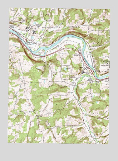
Apalachin, NY USGS Topographic Map
Click on map above to begin viewing in our Map Viewer.

This topographic map contains these locations and features:
Feature Name Type Latitude Longitude GNIS ID View Map
Abide in the Vine FellowshipChurchN42.1066°W76.2251°2667495View Map
ApalachinPopulated PlaceN42.0695°W76.1547°942517View Map
Apalachin Census Designated PlaceCensusN42.0706°W76.1626°2389140View Map
Apalachin CreekStreamN42.0637°W76.1424°969320View Map
Apalachin Elementary SchoolSchoolN42.0658°W76.1564°2507537View Map
Apalachin Fire DepartmentBuildingN42.0688°W76.1561°2701211View Map
Apalachin Golf CourseLocaleN42.0100°W76.1725°2507664View Map
Apalachin Marsh Bird SanctuaryParkN42.0900°W76.1756°2507676View Map
Apalachin Post OfficePost OfficeN42.0797°W76.1594°2617796View Map
Apalachin United Methodist ChurchChurchN42.0675°W76.1564°2507627View Map
Barnes CreekStreamN42.0937°W76.2274°943044View Map
Boland ParkParkN42.1100°W76.2494°2507674View Map
Broadway CemeteryCemeteryN42.1073°W76.1891°944791View Map
Cafferty HillSummitN42.1101°W76.1277°945430View Map
CampvillePopulated PlaceN42.0876°W76.1488°945713View Map
Campville CemeteryCemeteryN42.0698°W76.1421°2507608View Map
Campville CommonsParkN42.0886°W76.1458°2507659View Map
Campville Fire Department Station 1BuildingN42.0883°W76.1485°2718397View Map
Community Baptist ChurchChurchN42.0579°W76.1405°947234View Map
Deerlick CreekStreamN42.0537°W76.1658°948245View Map
Faith Christian Academy ChurchChurchN42.0533°W76.1681°2507628View Map
Gladden SchoolSchoolN42.1065°W76.2285°951150View Map
Hiawatha CemeteryCemeteryN42.0908°W76.2074°952670View Map
Hiawatha IslandIslandN42.0842°W76.2094°952671View Map
Hiawatha Island Wildlife RefugeParkN42.0839°W76.2103°2507657View Map
Holy Counselor ChurchChurchN42.0812°W76.1691°953036View Map
IBM Owego HeliportAirportN42.1029°W76.2208°978213View Map
Kenny FlatsFlatN42.0815°W76.1513°954516View Map
Klett FarmLocaleN42.0606°W76.2300°2517008View Map
Lakeview ChapelChurchN42.0964°W76.2181°2504864View Map
Lillie HillSummitN42.0354°W76.1288°955303View Map
Little Nanticoke CreekStreamN42.0920°W76.2288°955606View Map
Living Water Baptist ChurchChurchN42.1064°W76.2250°2504872View Map
Main Street BridgeBridgeN42.0624°W76.1489°2614946View Map
MDC Site 1 HeliportAirportN42.1112°W76.1769°975788View Map
Muth ParkParkN42.0600°W76.1669°2507660View Map
Mutton Hill PondLakeN42.0690°W76.1792°958220View Map
Owego Family Practice Health CenterHospitalN42.1058°W76.2494°2507672View Map
Owego ReservoirReservoirN42.1110°W76.2444°959673View Map
Owego Water Pollution Control Point Number 2LocaleN42.0616°W76.1452°2617743View Map
Park Terrace United Methodist ChurchChurchN42.0576°W76.1260°959892View Map
Price HomePopulated PlaceN42.1095°W76.2133°972972View Map
Riverside CemeteryCemeteryN42.0858°W76.1598°962576View Map
Riverview Manor Nursing HomeBuildingN42.1052°W76.2480°2614761View Map
Rural Owego CemeteryCemeteryN42.0210°W76.2122°2504884View Map
Saint Margaret Mary's ChurchChurchN42.0590°W76.1688°963832View Map
South ApalachinPopulated PlaceN42.0192°W76.1552°965661View Map
South Apalachin Baptist ChurchChurchN42.0178°W76.1556°2507629View Map
South OwegoPopulated PlaceN42.0245°W76.2141°965834View Map
South Owego Bible ChurchChurchN42.0242°W76.2142°2504874View Map
South Owego CemeteryCemeteryN42.0201°W76.2015°2504886View Map
Southern Tier NurseriesLocaleN42.0864°W76.2178°2517002View Map
Susquehanna HeliportAirportN42.0973°W76.2241°978212View Map
The Hickories ParkParkN42.0926°W76.2238°967262View Map
The Links At Hiawatha LandingLocaleN42.0925°W76.1714°2507658View Map
The Links at Hiawatha LandingLocaleN42.0928°W76.1713°2615074View Map
Thomas J Watson Sr Elementary SchoolSchoolN42.0744°W76.1272°968929View Map
Tioga GardensLocaleN42.0922°W76.2139°2517005View Map
Tioga Hills Elementary SchoolSchoolN42.0556°W76.1266°967552View Map
Tioga Hills Elementary SchoolSchoolN42.0553°W76.1264°2668921View Map
Town of OwegoCivilN42.0881°W76.1906°979334View Map
Tracy CemeteryCemeteryN42.0955°W76.1781°2507607View Map
Tree of Life Christian FellowshipChurchN42.1067°W76.1983°2504878View Map

Note: Coordinates in the location and feature list above are referenced to NAD83 datum.


Copyright (C) 2008-2024 Ryan Niemi / Sunset Dynamics ... All Rights Reserved