TopoQuest Logo
Do you find TopoQuest useful?
Help keep TopoQuest running and adding new maps/features by donating!
Bitcoin:  19c7KJd3qBynnjoSw5npx9KScwjBe4ifkT
Litecoin:  LXs6TkuXGGXo1vDsWCkWVdjQX94eUKd6ui
Home View Maps Find Maps Find Places Resources & Links


Malheureux Point, Louisiana Topographic Map

USGS Map Title: Malheureux Point, LA
USGS Map MRC: 30089A4
DRG (GeoTIFF) Download: o30089a4.tif


Neighboring USGS Topographic Map Quads:


  English Lookout, LA  
30089B5
 

  Saint Joe Pass, MS  
30089B4


  False Mouth Bayou, LA  
30089A5
 

  Malheureux Point, LA  
30089A4
 

  Three Mile Bay, LA  
30089A3
 

  Pointe aux Marchettes, LA  
29089H5
 

  Lake Eugenie, LA  
29089H4
 

  Oak Mound Bayou, LA  
29089H3


Map MRC Location:

N31°
W90°
N31°
W89°
H8 H7 H6 H5 H4 H3 H2 H1
G8 G7 G6 G5 G4 G3 G2 G1
F8 F7 F6 F5 F4 F3 F2 F1
E8 E7 E6 E5 E4 E3 E2 E1
D8 D7 D6 D5 D4 D3 D2 D1
C8 C7 C6 C5 C4 C3 C2 C1
B8 B7 B6 B5 B4 B3 B2 B1
A8 A7 A6 A5 A4 A3 A2 A1
N30°
W90°
N30°
W89°

Malheureux Point, LA USGS 1:24K Topographic Map Preview:
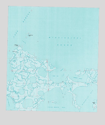
Malheureux Point, LA USGS Topographic Map
Click on map above to begin viewing in our Map Viewer.

This topographic map contains these locations and features:
Feature Name Type Latitude Longitude GNIS ID View Map
Bayou La FeeBayN30.0518°W89.4673°559994View Map
Biloxi State Wildlife Management AreaParkN30.0263°W89.4959°560201View Map
Blind BayBayN30.0421°W89.4317°560216View Map
Blind PassChannelN30.0513°W89.4231°560222View Map
False Mouth BayBayN30.0077°W89.4284°560725View Map
Kennedys LagoonLakeN30.0419°W89.4014°1628557View Map
Le Petit PassChannelN30.0827°W89.4781°1627461View Map
Le Petit Pass IslandIslandN30.0902°W89.4720°1627462View Map
Malheureux PointCapeN30.0796°W89.4839°1627600View Map
Mosquito InletBayN30.0337°W89.4878°1627704View Map
Ninemile BayBayN30.0216°W89.3887°1627777View Map
Ninemile BayouGutN30.0285°W89.4159°1627778View Map
Ninemile Bayou LightLocaleN30.0483°W89.4195°1627779View Map
South BayouGutN30.0410°W89.3998°1628253View Map
Trappers BayouBayN30.0116°W89.4796°1628555View Map
Whiskey BayouBayN30.0094°W89.4689°1628552View Map

Note: Coordinates in the location and feature list above are referenced to NAD83 datum.


Copyright (C) 2008-2025 Ryan Niemi / Sunset Dynamics ... All Rights Reserved