TopoQuest Logo
Do you find TopoQuest useful?
Help keep TopoQuest running and adding new maps/features by donating!
Bitcoin:  19c7KJd3qBynnjoSw5npx9KScwjBe4ifkT
Litecoin:  LXs6TkuXGGXo1vDsWCkWVdjQX94eUKd6ui
Home View Maps Find Maps Find Places Resources & Links


Maltbys Mound, Montana Topographic Map

USGS Map Title: Maltbys Mound, MT
USGS Map MRC: 45111E7
DRG (GeoTIFF) Download: o45111e7.tif


Neighboring USGS Topographic Map Quads:


  Pony, MT  
45111F8
 

  Harrison, MT  
45111F7
 

  Willow Creek Reservoir, MT  
45111F6
 

  Potosi Peak, MT  
45111E8
 

  Maltbys Mound, MT  
45111E7
 

  Norris, MT  
45111E6
 

  Ramshorn Mountain, MT  
45111D8
 

  Leonard Creek, MT  
45111D7
 

  Ennis Lake, MT  
45111D6


Map MRC Location:

N46°
W112°
N46°
W111°
H8 H7 H6 H5 H4 H3 H2 H1
G8 G7 G6 G5 G4 G3 G2 G1
F8 F7 F6 F5 F4 F3 F2 F1
E8 E7 E6 E5 E4 E3 E2 E1
D8 D7 D6 D5 D4 D3 D2 D1
C8 C7 C6 C5 C4 C3 C2 C1
B8 B7 B6 B5 B4 B3 B2 B1
A8 A7 A6 A5 A4 A3 A2 A1
N45°
W112°
N45°
W111°

Maltbys Mound, MT USGS 1:24K Topographic Map Preview:
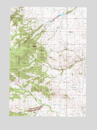
Maltbys Mound, MT USGS Topographic Map
Click on map above to begin viewing in our Map Viewer.

This topographic map contains these locations and features:
Feature Name Type Latitude Longitude GNIS ID View Map
04S02W01CACC01 WellWellN45.5141°W111.7972°809889View Map
Arctic/Monitor MineMineN45.5310°W111.7703°804142View Map
Arkansas MineMineN45.5333°W111.7828°804364View Map
Aurora CreekStreamN45.5024°W111.8330°779193View Map
Belle of Tennessee MineMineN45.5374°W111.7697°804359View Map
Billy MineMineN45.5705°W111.7553°779921View Map
Brooklyn/Black Prince MineMineN45.5416°W111.7730°804366View Map
Camp CreekStreamN45.6238°W111.8600°780846View Map
Canadian CreekStreamN45.6160°W111.7908°780877View Map
Columbus MineMineN45.5305°W111.7639°804357View Map
Cousin Jeny/Lomonica MineMineN45.5110°W111.8341°804485View Map
Emperor MineMineN45.5310°W111.7772°804143View Map
Galena MineMineN45.5627°W111.7686°783802View Map
Galena MineMineN45.5638°W111.7703°804363View Map
Galena Minor MineMineN45.5666°W111.7689°804361View Map
Idaho MineMineN45.5369°W111.7800°804205View Map
Lehigh Group MineMineN45.5016°W111.8344°804507View Map
Lexington MineMineN45.5360°W111.7675°804358View Map
Maltbys MoundSummitN45.5960°W111.7761°786805View Map
Mary A MineMineN45.5366°W111.7703°804354View Map
Midasburg (historical)LocaleN45.5658°W111.7591°1797480View Map
Middle Fork Hot Springs CreekStreamN45.5552°W111.8075°787280View Map
NE NW Section 9 MineMineN45.5083°W111.8591°804510View Map
NE SE Section 31 MineMineN45.5305°W111.7647°804353View Map
NE SW Section 12 MineMineN45.5888°W111.7925°804351View Map
New York Belle MineMineN45.5305°W111.7772°804360View Map
North Fork Hot Springs CreekStreamN45.5552°W111.8075°788186View Map
North Meadow Creek DamDamN45.5283°W111.8575°798405View Map
Norwegian MineMineN45.6010°W111.8000°788323View Map
Norwegian MineMineN45.6055°W111.8147°804125View Map
Norwegin Creek DamDamN45.6166°W111.7975°796402View Map
NW SW Section 25 MineMineN45.5463°W111.8016°804608View Map
NW SW Section 6 MineMineN45.6021°W111.7814°804352View Map
Pauline MineMineN45.6021°W111.7953°804350View Map
Pearl MineMineN45.5416°W111.7828°804147View Map
Polaris MineMineN45.5402°W111.7869°804149View Map
Pony GulchValleyN45.5666°W111.7614°789080View Map
Pony Gulch MineMineN45.5771°W111.7861°804602View Map
Preacher CreekStreamN45.6066°W111.8125°789179View Map
Rattlesnake CreekStreamN45.6066°W111.8147°789403View Map
Revenue (historical)LocaleN45.5333°W111.7675°1797636View Map
Revenue MineMineN45.5344°W111.7708°789542View Map
Revenue Post Office (historical)Post OfficeN45.5333°W111.7675°1797637View Map
Revenue School (historical)SchoolN45.5333°W111.7675°1797638View Map
Saw Log CreekStreamN45.5119°W111.8222°790037View Map
SE NW Section 20 MineMineN45.5624°W111.7591°804362View Map
SE NW Section 29 MineMineN45.5480°W111.7508°804610View Map
South Fork Hot Springs CreekStreamN45.5541°W111.7891°790984View Map
SterlingPopulated PlaceN45.5652°W111.7594°777200View Map
Sterling Post Office (historical)Post OfficeN45.5652°W111.7594°1797598View Map
Sterling School (historical)SchoolN45.5652°W111.7594°1797599View Map
Sugar Loaf MountainSummitN45.5796°W111.8380°791625View Map
SW SE Section 25 MineMineN45.5388°W111.7828°804365View Map
Wallace PeakSummitN45.5755°W111.8225°792781View Map
Washington Bar Placer MineMineN45.5035°W111.8289°792850View Map
Washington CreekStreamN45.5133°W111.8205°792851View Map
Washington Creek Group Placer MineMineN45.5021°W111.8564°792852View Map

Note: Coordinates in the location and feature list above are referenced to NAD83 datum.


Copyright (C) 2008-2024 Ryan Niemi / Sunset Dynamics ... All Rights Reserved