TopoQuest Logo
Do you find TopoQuest useful?
Help keep TopoQuest running and adding new maps/features by donating!
Bitcoin:  19c7KJd3qBynnjoSw5npx9KScwjBe4ifkT
Litecoin:  LXs6TkuXGGXo1vDsWCkWVdjQX94eUKd6ui
Home View Maps Find Maps Find Places Resources & Links


Norris, Montana Topographic Map

USGS Map Title: Norris, MT
USGS Map MRC: 45111E6
DRG (GeoTIFF) Download: o45111e6.tif


Neighboring USGS Topographic Map Quads:


  Harrison, MT  
45111F7
 

  Willow Creek Reservoir, MT  
45111F6
 

  Norris NE, MT  
45111F5
 

  Maltbys Mound, MT  
45111E7
 

  Norris, MT  
45111E6
 

  Bear Trap Creek, MT  
45111E5
 

  Leonard Creek, MT  
45111D7
 

  Ennis Lake, MT  
45111D6
 

  Cherry Lake, MT  
45111D5


Map MRC Location:

N46°
W112°
N46°
W111°
H8 H7 H6 H5 H4 H3 H2 H1
G8 G7 G6 G5 G4 G3 G2 G1
F8 F7 F6 F5 F4 F3 F2 F1
E8 E7 E6 E5 E4 E3 E2 E1
D8 D7 D6 D5 D4 D3 D2 D1
C8 C7 C6 C5 C4 C3 C2 C1
B8 B7 B6 B5 B4 B3 B2 B1
A8 A7 A6 A5 A4 A3 A2 A1
N45°
W112°
N45°
W111°

Norris, MT USGS 1:24K Topographic Map Preview:
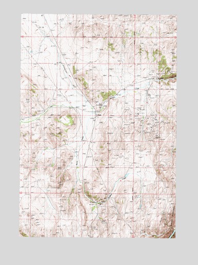
Norris, MT USGS Topographic Map
Click on map above to begin viewing in our Map Viewer.

This topographic map contains these locations and features:
Feature Name Type Latitude Longitude GNIS ID View Map
03S01W14DAB_01 WellWellN45.5724°W111.6864°810211View Map
03S01W14DAB_02 WellWellN45.5719°W111.6855°810210View Map
03S01W14DABA01 SpringSpringN45.5749°W111.6841°810226View Map
03S01W23ABAB01 SpringSpringN45.5674°W111.6872°810167View Map
03S01W23ABBB01 WellWellN45.5677°W111.6891°810170View Map
Audrey MineMineN45.5555°W111.6647°804522View Map
Barter RanchLocaleN45.5352°W111.6514°768532View Map
Baush MineMineN45.5938°W111.6775°804521View Map
Bear Trap Hot SpringsSpringN45.5744°W111.6847°774670View Map
Beartrap Hot Springs CampgroundLocaleN45.5738°W111.6841°1797667View Map
Billy MineMineN45.5799°W111.7466°804605View Map
Black Rock Extension MineMineN45.5655°W111.6625°804539View Map
Boaz MineMineN45.5597°W111.6561°769058View Map
Bozeman Trail Historical MarkerParkN45.5005°W111.6950°1813140View Map
Bradley CreekStreamN45.5335°W111.7041°769182View Map
Burnt CreekStreamN45.5694°W111.6939°769421View Map
Easter ShaftMineN45.5180°W111.7169°804530View Map
Golconda MineMineN45.5597°W111.6430°804135View Map
Grubstake MineMineN45.5563°W111.6425°804518View Map
Grubstake MineMineN45.5558°W111.6422°772020View Map
Headlight MineMineN45.5449°W111.6675°804533View Map
Helene MineMineN45.5655°W111.6539°772321View Map
Helene-Birdia MineMineN45.5638°W111.6550°804130View Map
Jackson DamDamN45.5499°W111.6675°796405View Map
Jackson Ranch MineMineN45.5402°W111.7133°804523View Map
Mary Lee MineMineN45.5619°W111.6430°804140View Map
Michels Ranch MineMineN45.5027°W111.6775°804535View Map
Montana Boy MineMineN45.5202°W111.6878°804534View Map
Moore Ranch Number 4 MineMineN45.6235°W111.6425°804562View Map
MSU Adit MineMineN45.5905°W111.6341°804433View Map
NE SE Section 7 MineMineN45.5888°W111.6425°804529View Map
NorrisPopulated PlaceN45.5680°W111.6908°774669View Map
Norris (historical)LocaleN45.5680°W111.6908°1797471View Map
Norris Post OfficePost OfficeN45.5708°W111.6900°1797473View Map
Norris School (historical)SchoolN45.5680°W111.6908°1797474View Map
Peanut MineMineN45.5602°W111.6564°804524View Map
Red BluffPopulated PlaceN45.5885°W111.6480°775616View Map
Red Bluff North MineMineN45.5938°W111.6341°804553View Map
Red Bluff Post Office (historical)Post OfficeN45.5885°W111.6480°1797459View Map
Red Bluff School (historical)SchoolN45.5885°W111.6480°1797460View Map
Red Chief MineMineN45.5630°W111.6439°804139View Map
Rice Ranch MineMineN45.6222°W111.6411°804543View Map
Rosebud MineMineN45.5633°W111.6377°804525View Map
SE NE Section 12 MineMineN45.5027°W111.6625°804531View Map
SE NE Section 24 MineMineN45.5597°W111.6594°804526View Map
SE SE S13/NE NE S24 MineMineN45.5685°W111.6647°804542View Map
Sleepy Jim MineMineN45.5860°W111.6972°804519View Map
SW NW Section 25 MineMineN45.5485°W111.6775°804532View Map
The Mound (historical)LocaleN45.6174°W111.7369°1797590View Map
Tobacco Root MineMineN45.5597°W111.6703°804150View Map
Water/Mohegan MineMineN45.5691°W111.6425°804141View Map
Waterlode MineMineN45.5669°W111.6439°778137View Map
Woods CreekStreamN45.5569°W111.7000°1797624View Map

Note: Coordinates in the location and feature list above are referenced to NAD83 datum.


Copyright (C) 2008-2024 Ryan Niemi / Sunset Dynamics ... All Rights Reserved