TopoQuest Logo
Do you find TopoQuest useful?
Help keep TopoQuest running and adding new maps/features by donating!
Bitcoin:  19c7KJd3qBynnjoSw5npx9KScwjBe4ifkT
Litecoin:  LXs6TkuXGGXo1vDsWCkWVdjQX94eUKd6ui
Home View Maps Find Maps Find Places Resources & Links


Malvern, Alabama Topographic Map

USGS Map Title: Malvern, AL
USGS Map MRC: 31085B5
DRG (GeoTIFF) Download: o31085b5.tif


Neighboring USGS Topographic Map Quads:


  Daleville, AL  
31085C6
 

  Pinckard, AL  
31085C5
 

  Midland City, AL  
31085C4
 

  Clayhatchee, AL  
31085B6
 

  Malvern, AL  
31085B5
 

  Dothan West, AL  
31085B4
 

  Hartford, AL  
31085A6
 

  Slocomb, AL  
31085A5
 

  Madrid, AL  
31085A4


Map MRC Location:

N32°
W86°
N32°
W85°
H8 H7 H6 H5 H4 H3 H2 H1
G8 G7 G6 G5 G4 G3 G2 G1
F8 F7 F6 F5 F4 F3 F2 F1
E8 E7 E6 E5 E4 E3 E2 E1
D8 D7 D6 D5 D4 D3 D2 D1
C8 C7 C6 C5 C4 C3 C2 C1
B8 B7 B6 B5 B4 B3 B2 B1
A8 A7 A6 A5 A4 A3 A2 A1
N31°
W86°
N31°
W85°

Malvern, AL USGS 1:24K Topographic Map Preview:
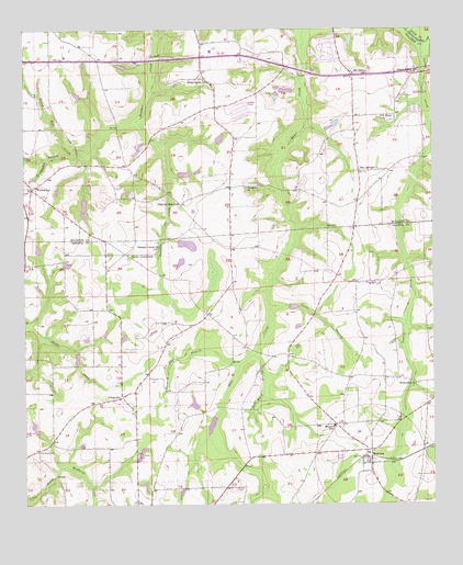
Malvern, AL USGS Topographic Map
Click on map above to begin viewing in our Map Viewer.

This topographic map contains these locations and features:
Feature Name Type Latitude Longitude GNIS ID View Map
Bailey CrossroadsPopulated PlaceN31.1910°W85.5938°156012View Map
Bay Springs Baptist ChurchChurchN31.2130°W85.5222°113593View Map
Bay Springs CemeteryCemeteryN31.2129°W85.5227°1729900View Map
Bay Springs Volunteer Fire DepartmentBuildingN31.2159°W85.5234°2331023View Map
Bethlehem ChurchChurchN31.1568°W85.5047°114117View Map
Buzzard Bay BranchStreamN31.1616°W85.5594°115327View Map
Camelite Church (historical)ChurchN31.1393°W85.6208°132103View Map
Community ChurchChurchN31.1385°W85.5410°158328View Map
Emmett Sellers DamDamN31.2018°W85.6066°129703View Map
Emmett Sellers LakeReservoirN31.2006°W85.6064°129702View Map
Gilley Mill CreekStreamN31.2263°W85.5902°118957View Map
Goodwater BranchStreamN31.2180°W85.6124°119149View Map
Green Valley ChurchChurchN31.2385°W85.5049°119351View Map
Halls Mill (historical)LocaleN31.1863°W85.5069°132133View Map
Hatband CreekStreamN31.1355°W85.6127°119835View Map
Hosea Mathis DamDamN31.1985°W85.5799°129698View Map
Hosea Mathis LakeReservoirN31.1985°W85.5799°129699View Map
Jack Ward BranchStreamN31.1646°W85.5549°120750View Map
MalvernPopulated PlaceN31.1393°W85.5191°152214View Map
Malvern Community Volunteer Fire DepartmentBuildingN31.1363°W85.5199°2331071View Map
Malvern New Life ChurchChurchN31.1542°W85.5237°2580331View Map
Malvern Post OfficePost OfficeN31.1360°W85.5191°167385View Map
Malvern SchoolSchoolN31.1460°W85.5305°122239View Map
Mount Olive ChurchChurchN31.2385°W85.5202°123284View Map
New Holy Temple Church of GodChurchN31.2057°W85.6176°2580334View Map
Newton CreekStreamN31.2463°W85.5041°123932View Map
Oak Grove CemeteryCemeteryN31.1391°W85.6210°124063View Map
Panther Creek ChurchChurchN31.1924°W85.5847°152841View Map
Panther Creek Church (historical)ChurchN31.1730°W85.5744°132165View Map
Pasco Davis DamDamN31.1518°W85.5716°129668View Map
Pilgrim Home Baptist ChurchChurchN31.2426°W85.6143°124737View Map
Pilgrim Home ChurchChurchN31.1641°W85.5441°132167View Map
Pilgrim Rest Baptist ChurchChurchN31.2088°W85.5622°2580321View Map
Pilgrims Home ChurchChurchN31.2418°W85.6122°132369View Map
Pilgrims Rest ChurchChurchN31.2043°W85.5777°152904View Map
Piney Grove Assembly of God ChurchChurchN31.2371°W85.5702°124872View Map
Providence CemeteryCemeteryN31.1379°W85.5908°125317View Map
Purvis CemeteryCemeteryN31.1296°W85.5605°125370View Map
Saint Peter ChurchChurchN31.2271°W85.5152°126193View Map
Sardis Baptist ChurchChurchN31.2044°W85.5777°2580244View Map
Sardis Church (historical)ChurchN31.2080°W85.5433°132394View Map
Sasser BranchStreamN31.1774°W85.5499°126422View Map
Sasser School (historical)SchoolN31.1755°W85.5344°132183View Map
Sawdust ChurchChurchN31.2085°W85.5569°126438View Map
Town of MalvernCivilN31.1428°W85.5210°2406084View Map
Union Baptist ChurchChurchN31.1535°W85.5960°128282View Map
Union CemeteryCemeteryN31.1538°W85.5960°1730178View Map
Wadford School (historical)SchoolN31.1368°W85.5563°132200View Map
WicksburgPopulated PlaceN31.2082°W85.6224°153984View Map
Wicksburg ChurchChurchN31.2099°W85.6202°132431View Map
Wicksburg Volunteer Fire DepartmentBuildingN31.2088°W85.6222°2691269View Map
Winslette Chapel ChurchChurchN31.2396°W85.5710°163660View Map

Note: Coordinates in the location and feature list above are referenced to NAD83 datum.


Copyright (C) 2008-2025 Ryan Niemi / Sunset Dynamics ... All Rights Reserved