TopoQuest Logo
Do you find TopoQuest useful?
Help keep TopoQuest running and adding new maps/features by donating!
Bitcoin:  19c7KJd3qBynnjoSw5npx9KScwjBe4ifkT
Litecoin:  LXs6TkuXGGXo1vDsWCkWVdjQX94eUKd6ui
Home View Maps Find Maps Find Places Resources & Links


Slocomb, Alabama Topographic Map

USGS Map Title: Slocomb, AL
USGS Map MRC: 31085A5
DRG (GeoTIFF) Download: o31085a5.tif


Neighboring USGS Topographic Map Quads:


  Clayhatchee, AL  
31085B6
 

  Malvern, AL  
31085B5
 

  Dothan West, AL  
31085B4
 

  Hartford, AL  
31085A6
 

  Slocomb, AL  
31085A5
 

  Madrid, AL  
31085A4
 

  Esto, FL  
30085H6
 

  Graceville, FL  
30085H5
 

  Campbellton, FL  
30085H4


Map MRC Location:

N32°
W86°
N32°
W85°
H8 H7 H6 H5 H4 H3 H2 H1
G8 G7 G6 G5 G4 G3 G2 G1
F8 F7 F6 F5 F4 F3 F2 F1
E8 E7 E6 E5 E4 E3 E2 E1
D8 D7 D6 D5 D4 D3 D2 D1
C8 C7 C6 C5 C4 C3 C2 C1
B8 B7 B6 B5 B4 B3 B2 B1
A8 A7 A6 A5 A4 A3 A2 A1
N31°
W86°
N31°
W85°

Slocomb, AL USGS 1:24K Topographic Map Preview:
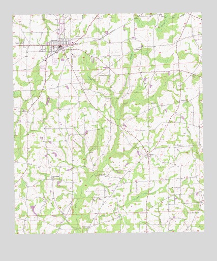
Slocomb, AL USGS Topographic Map
Click on map above to begin viewing in our Map Viewer.

This topographic map contains these locations and features:
Feature Name Type Latitude Longitude GNIS ID View Map
Adoniram Baptist ChurchChurchN31.0738°W85.5150°2580333View Map
Antioch ChurchChurchN31.0116°W85.5377°113114View Map
Bell School (historical)SchoolN31.0713°W85.6191°132093View Map
Bethesda ChurchChurchN31.0738°W85.5347°114101View Map
Bullock School (historical)SchoolN31.0966°W85.5166°132098View Map
Burns ChurchChurchN31.1046°W85.5455°115254View Map
Burns School (historical)SchoolN31.1082°W85.5180°132102View Map
Canal Swamp (historical)StreamN31.0821°W85.5433°132105View Map
Carver Junior High SchoolSchoolN31.0218°W85.5133°132175View Map
Christian Home Baptist ChurchChurchN31.0905°W85.5619°116096View Map
Christian Home CemeteryCemeteryN31.0893°W85.5605°1730142View Map
City of SlocombCivilN31.1103°W85.5954°2405471View Map
City of Slocomb Wastewater Sewage LagoonLocaleN31.0990°W85.5920°2579645View Map
Corinth ChurchChurchN31.0749°W85.5105°116632View Map
Countyline Missionary Baptist ChurchChurchN31.1013°W85.5863°116718View Map
Davis Mill CreekStreamN31.0624°W85.5569°117136View Map
Eato Highway ChurchChurchN31.0830°W85.6063°132119View Map
FadettePopulated PlaceN31.0446°W85.5374°118102View Map
Fadette ChurchChurchN31.0474°W85.5383°158331View Map
Fadette SchoolSchoolN31.0485°W85.5235°132124View Map
Fadette Volunteer Fire DepartmentBuildingN31.0454°W85.5368°2331070View Map
First Baptist Church of SlocombChurchN31.1101°W85.5941°2580332View Map
Freedom FieldAirportN31.1152°W85.6192°2676346View Map
Geneva County Training School (historical)SchoolN31.1018°W85.5855°151650View Map
Grant BranchStreamN31.0305°W85.5758°119236View Map
Gully BranchStreamN31.0030°W85.5838°119469View Map
Hinsons Store (historical)LocaleN31.0313°W85.5152°132141View Map
Holiness Chapel (historical)ChurchN31.1018°W85.5488°132142View Map
Immanuel Baptist ChurchChurchN31.0899°W85.5063°151848View Map
Mack Snell DamDamN31.0118°W85.6083°129596View Map
Marrith School (historical)SchoolN31.0657°W85.5616°132152View Map
Martin CemeteryCemeteryN31.0838°W85.5488°122321View Map
Mount Calvary ChurchChurchN31.0257°W85.5155°152399View Map
New Hinson ChurchChurchN31.0491°W85.5144°152627View Map
New Teamon ChurchChurchN31.0316°W85.5999°152682View Map
Pilgrims Rest ChurchChurchN31.0116°W85.5047°124741View Map
Pine Lilly School (historical)SchoolN31.0741°W85.5819°132168View Map
Pleasant Hill Baptist ChurchChurchN31.1099°W85.6180°124980View Map
Robins School (historical)SchoolN31.0216°W85.5605°132178View Map
Saint Johns Church (historical)ChurchN31.0685°W85.5797°132180View Map
SlocombPopulated PlaceN31.1082°W85.5944°126977View Map
Slocomb DivisionCivilN31.1062°W85.5721°165787View Map
Slocomb High SchoolSchoolN31.1066°W85.5985°151649View Map
Slocomb Police DepartmentBuildingN31.1080°W85.5907°2751716View Map
Slocomb Post OfficePost OfficeN31.1072°W85.6073°2578959View Map
Slocomb Public LibraryBuildingN31.1081°W85.5915°2579910View Map
Slocomb Volunteer Fire DepartmentBuildingN31.1080°W85.5910°2331050View Map
Tindil BranchStreamN31.0716°W85.5583°127990View Map
Union Hill ChurchChurchN31.0707°W85.6183°128334View Map
Whitaker (historical)Populated PlaceN31.0035°W85.5755°167352View Map
Whitaker ChurchChurchN31.0038°W85.5760°128853View Map
Wright ChurchChurchN31.0332°W85.5699°129244View Map

Note: Coordinates in the location and feature list above are referenced to NAD83 datum.


Copyright (C) 2008-2025 Ryan Niemi / Sunset Dynamics ... All Rights Reserved