TopoQuest Logo
Do you find TopoQuest useful?
Help keep TopoQuest running and adding new maps/features by donating!
Bitcoin:  19c7KJd3qBynnjoSw5npx9KScwjBe4ifkT
Litecoin:  LXs6TkuXGGXo1vDsWCkWVdjQX94eUKd6ui
Home View Maps Find Maps Find Places Resources & Links


Mammoth, West Virginia Topographic Map

USGS Map Title: Mammoth, WV
USGS Map MRC: 38081C3
DRG (GeoTIFF) Download: o38081c3.tif


Neighboring USGS Topographic Map Quads:


  Blue Creek, WV  
38081D4
 

  Clendenin, WV  
38081D3
 

  Elkhurst, WV  
38081D2
 

  Quick, WV  
38081C4
 

  Mammoth, WV  
38081C3
 

  Bentree, WV  
38081C2
 

  Cedar Grove, WV  
38081B4
 

  Montgomery, WV  
38081B3
 

  Gauley Bridge, WV  
38081B2


Map MRC Location:

N39°
W82°
N39°
W81°
H8 H7 H6 H5 H4 H3 H2 H1
G8 G7 G6 G5 G4 G3 G2 G1
F8 F7 F6 F5 F4 F3 F2 F1
E8 E7 E6 E5 E4 E3 E2 E1
D8 D7 D6 D5 D4 D3 D2 D1
C8 C7 C6 C5 C4 C3 C2 C1
B8 B7 B6 B5 B4 B3 B2 B1
A8 A7 A6 A5 A4 A3 A2 A1
N38°
W82°
N38°
W81°

Mammoth, WV USGS 1:24K Topographic Map Preview:
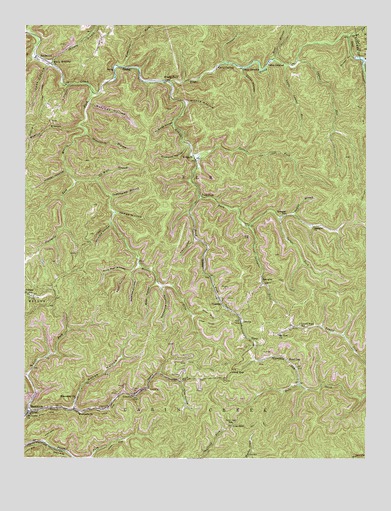
Mammoth, WV USGS Topographic Map
Click on map above to begin viewing in our Map Viewer.

This topographic map contains these locations and features:
Feature Name Type Latitude Longitude GNIS ID View Map
AcupPopulated PlaceN38.3620°W81.3421°1553690View Map
AmeliaPopulated PlaceN38.2893°W81.2959°1549564View Map
Bear BranchStreamN38.3654°W81.2846°1535348View Map
Bear HollowValleyN38.3001°W81.3271°1535372View Map
Belcher HollowValleyN38.3520°W81.3509°1535591View Map
BlakeleyPopulated PlaceN38.2962°W81.3037°1553923View Map
Blakley CemeteryCemeteryN38.2923°W81.3051°2586297View Map
Blue Star HollowValleyN38.3051°W81.3340°1536134View Map
Boardtree BranchStreamN38.3654°W81.3721°1742036View Map
Camp CamelotLocaleN38.3629°W81.2965°1536904View Map
Camp CarlisleLocaleN38.3629°W81.3048°1536905View Map
Camp GalahadLocaleN38.3648°W81.2857°1536928View Map
Campbell ForkStreamN38.2709°W81.2737°1536972View Map
Coral HollowValleyN38.3620°W81.2959°1537678View Map
Danny Beasley SpringSpringN38.2645°W81.3440°1678150View Map
Deadening HollowValleyN38.2993°W81.3251°1538086View Map
Durham HollowValleyN38.3662°W81.2562°1538456View Map
Egypt HollowValleyN38.3032°W81.3371°1538573View Map
Fivemile ForkStreamN38.3301°W81.3568°1539026View Map
Goodman HollowValleyN38.3398°W81.3162°1539510View Map
Goose HollowValleyN38.2645°W81.3568°1539522View Map
Gravelick BranchStreamN38.3437°W81.3529°1539648View Map
Hidden HollowValleyN38.3326°W81.3598°1540234View Map
Hillfield HollowValleyN38.3170°W81.3443°1540302View Map
HitopPopulated PlaceN38.2843°W81.2937°1554722View Map
Horsehead LakeReservoirN38.3534°W81.2515°1557420View Map
Hurricane ForkStreamN38.2637°W81.3568°1540629View Map
James HollowValleyN38.3207°W81.3415°1540813View Map
Jim HollowValleyN38.2501°W81.2507°1540896View Map
Joes HollowValleyN38.3629°W81.3673°1540934View Map
KendaliaPopulated PlaceN38.3365°W81.3132°1549770View Map
Laurel Fork School (historical)SchoolN38.2879°W81.2743°1541470View Map
Laurel RunStreamN38.3645°W81.2757°1541494View Map
Left Fork Kellys CreekStreamN38.2618°W81.3748°1541670View Map
Little Laurel RunStreamN38.3637°W81.2796°1542149View Map
Low GapGapN38.2595°W81.2990°1542494View Map
Low Gap School (historical)SchoolN38.2601°W81.2990°1542512View Map
MammothPopulated PlaceN38.2634°W81.3721°1555033View Map
Mammoth ChurchChurchN38.2629°W81.3548°1542705View Map
Mammoth Post OfficePost OfficeN38.2647°W81.3668°1742203View Map
McBride HollowValleyN38.3465°W81.3218°1542921View Map
Middle ForkPopulated PlaceN38.3584°W81.3226°1549820View Map
Middle Fork Blue CreekStreamN38.3590°W81.3223°1543173View Map
Missionary ChurchChurchN38.2670°W81.3562°1543456View Map
Moore HollowValleyN38.3526°W81.3154°1543516View Map
Morris (historical)Populated PlaceN38.3634°W81.3651°1742232View Map
Morris ForkStreamN38.3557°W81.3504°1543573View Map
Morris Memorial ChurchChurchN38.3640°W81.3654°1543578View Map
Mount Lewis ChurchChurchN38.2618°W81.3743°1543670View Map
Mount Zion ChurchChurchN38.2854°W81.2821°1543818View Map
Mudlick BranchStreamN38.3459°W81.3551°1543943View Map
Mudlick HollowValleyN38.3029°W81.3359°1543953View Map
Nans BranchStreamN38.3651°W81.2507°1544041View Map
Nathan BranchStreamN38.3201°W81.2768°1544052View Map
Oil Well BranchStreamN38.3301°W81.3493°1544340View Map
Panther HollowValleyN38.3645°W81.3021°1544551View Map
Pond ForkPopulated PlaceN38.3259°W81.3107°1555387View Map
Pond ForkStreamN38.3254°W81.3112°1545126View Map
Pond GapGapN38.2751°W81.2990°1545128View Map
Pond GapPopulated PlaceN38.2782°W81.2787°1545129View Map
Pond Gap Post OfficePost OfficeN38.2790°W81.2856°1742207View Map
PutneyPopulated PlaceN38.2965°W81.3729°1549887View Map
Rich HollowValleyN38.2715°W81.3179°1545550View Map
Rockcamp ForkStreamN38.3626°W81.3393°1545941View Map
SandersonPopulated PlaceN38.3645°W81.3682°1555565View Map
Sandlick BranchStreamN38.3726°W81.3740°1546390View Map
Shirkey BranchStreamN38.3626°W81.3651°1546695View Map
Slabcamp HollowValleyN38.2737°W81.3743°1546894View Map
SpanglerPopulated PlaceN38.3007°W81.2882°1547098View Map
Spangler ChurchChurchN38.3168°W81.2701°1547099View Map
Spangler ForkStreamN38.3170°W81.2929°1547100View Map
Spangler School (historical)SchoolN38.3204°W81.2796°1547101View Map
Spruce ForkStreamN38.3195°W81.2821°1547233View Map
Spruce ForkStreamN38.3729°W81.2571°1547245View Map
Sugarcamp BranchStreamN38.3254°W81.3437°1547671View Map
Turner ForkStreamN38.3373°W81.3121°1548381View Map
Union Carbide Lake Number Three DamDamN38.3534°W81.2515°1557419View Map

Note: Coordinates in the location and feature list above are referenced to NAD83 datum.


Copyright (C) 2008-2024 Ryan Niemi / Sunset Dynamics ... All Rights Reserved