TopoQuest Logo
Do you find TopoQuest useful?
Help keep TopoQuest running and adding new maps/features by donating!
Bitcoin:  19c7KJd3qBynnjoSw5npx9KScwjBe4ifkT
Litecoin:  LXs6TkuXGGXo1vDsWCkWVdjQX94eUKd6ui
Home View Maps Find Maps Find Places Resources & Links


Elkhurst, West Virginia Topographic Map

USGS Map Title: Elkhurst, WV
USGS Map MRC: 38081D2
DRG (GeoTIFF) Download: o38081d2.tif


Neighboring USGS Topographic Map Quads:


  Clio, WV  
38081E3
 

  Newton, WV  
38081E2
 

  Ivydale, WV  
38081E1
 

  Clendenin, WV  
38081D3
 

  Elkhurst, WV  
38081D2
 

  Clay, WV  
38081D1
 

  Mammoth, WV  
38081C3
 

  Bentree, WV  
38081C2
 

  Lockwood, WV  
38081C1


Map MRC Location:

N39°
W82°
N39°
W81°
H8 H7 H6 H5 H4 H3 H2 H1
G8 G7 G6 G5 G4 G3 G2 G1
F8 F7 F6 F5 F4 F3 F2 F1
E8 E7 E6 E5 E4 E3 E2 E1
D8 D7 D6 D5 D4 D3 D2 D1
C8 C7 C6 C5 C4 C3 C2 C1
B8 B7 B6 B5 B4 B3 B2 B1
A8 A7 A6 A5 A4 A3 A2 A1
N38°
W82°
N38°
W81°

Elkhurst, WV USGS 1:24K Topographic Map Preview:
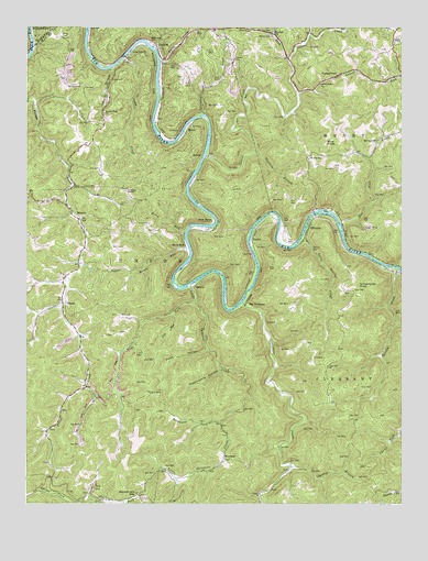
Elkhurst, WV USGS Topographic Map
Click on map above to begin viewing in our Map Viewer.

This topographic map contains these locations and features:
Feature Name Type Latitude Longitude GNIS ID View Map
Beechy CreekStreamN38.4368°W81.1259°1535570View Map
Bethel Community ChurchChurchN38.4190°W81.2318°1741265View Map
Big SycamoreLocaleN38.4270°W81.1779°1535978View Map
Birch RunLocaleN38.4420°W81.1982°1536028View Map
Birch RunStreamN38.4465°W81.1973°1553906View Map
Blessed Hope ChurchChurchN38.4773°W81.2243°1536099View Map
Blue KnobSummitN38.4695°W81.1504°1553932View Map
Blue Knob CemeteryCemeteryN38.4704°W81.1332°1741272View Map
Blue Knob CreekStreamN38.4490°W81.1459°1536128View Map
Blue Knob United Methodist ChurchChurchN38.4704°W81.1334°1536127View Map
BomontPopulated PlaceN38.4498°W81.2323°1549602View Map
Bomont Methodist ChurchChurchN38.4493°W81.2318°1741276View Map
Bomont Post OfficePost OfficeN38.4498°W81.2312°1741277View Map
Browncamp HollowValleyN38.4104°W81.1857°1536415View Map
Buckhorn ForkStreamN38.3959°W81.1854°1536601View Map
Burke Memorial United Methodist ChurchChurchN38.4934°W81.2159°1541789View Map
Camp CreekStreamN38.4918°W81.2187°1536912View Map
Camp Creek BridgeBridgeN38.4924°W81.2174°2635377View Map
Charley BranchStreamN38.3845°W81.1618°1537215View Map
Davis CemeteryCemeteryN38.4637°W81.1473°1741284View Map
District CCivilN38.3915°W81.2022°1928248View Map
DorfeePopulated PlaceN38.4437°W81.1748°1558357View Map
Dulls CreekStreamN38.4909°W81.2062°1538420View Map
Dulls Creek CemeteryCemeteryN38.4906°W81.2051°1741290View Map
Dulls Creek School (historical)SchoolN38.4962°W81.2090°1538421View Map
ElkhurstPopulated PlaceN38.4476°W81.1559°1558361View Map
Elkhurst BridgeBridgeN38.4512°W81.1539°2635380View Map
GlenPopulated PlaceN38.3943°W81.2426°1549706View Map
Glen Post OfficePost OfficeN38.3939°W81.2430°1741298View Map
H E White Elementary SchoolSchoolN38.4465°W81.2299°1741302View Map
Hart SpringSpringN38.4212°W81.2468°1677973View Map
Horner ForkStreamN38.4915°W81.1632°1540467View Map
Horners Fork Missionary Baptist ChurchChurchN38.4984°W81.1687°1540468View Map
Jack BendBendN38.4493°W81.1882°1540759View Map
Laurel CreekStreamN38.4662°W81.1904°1541423View Map
Laurel ForkStreamN38.4826°W81.1593°1541461View Map
Laurel Fork ChurchChurchN38.4851°W81.1523°1541467View Map
Left Fork Spruce ForkStreamN38.3754°W81.2323°1541730View Map
Liberty ChurchChurchN38.4918°W81.1812°1541818View Map
Lick RunStreamN38.4251°W81.2015°1541906View Map
Little Beechy CreekStreamN38.4454°W81.1579°1542024View Map
Little Sycamore CreekStreamN38.4326°W81.1954°1542236View Map
MarnePopulated PlaceN38.4729°W81.1973°1555052View Map
Mount Carmel ChurchChurchN38.4851°W81.2323°1543624View Map
Mount Zion School (historical)SchoolN38.4654°W81.1559°1543851View Map
Mullins CemeteryCemeteryN38.4907°W81.1353°2574006View Map
OdessaPopulated PlaceN38.4287°W81.2379°1549860View Map
Open HollowValleyN38.4157°W81.1904°1544418View Map
PaxtonPopulated PlaceN38.4982°W81.1679°1544647View Map
Pierson CemeteryCemeteryN38.4637°W81.1537°1741352View Map
ProciousPopulated PlaceN38.4957°W81.2076°1555416View Map
Procious Post OfficePost OfficeN38.4962°W81.2084°1741356View Map
Reed ForkStreamN38.4982°W81.1679°1545483View Map
Right Fork Spruce ForkStreamN38.3754°W81.2323°1545708View Map
RouzerPopulated PlaceN38.4662°W81.1921°1555533View Map
Samples CemeteryCemeteryN38.4865°W81.1979°2586223View Map
Schoonover KnobSummitN38.4320°W81.1396°1555583View Map
SheltonPopulated PlaceN38.4315°W81.1951°1555607View Map
Spruce Low GapGapN38.3773°W81.2129°1547262View Map
Summers ForkStreamN38.4976°W81.1559°1547736View Map
Sycamore CreekStreamN38.4276°W81.1782°1547829View Map
Tanner CemeteryCemeteryN38.3836°W81.1391°2586284View Map
Toms HollowValleyN38.4884°W81.2218°1548143View Map
Twistabout CreekStreamN38.4768°W81.1926°1548404View Map
Twomile BranchStreamN38.4673°W81.1746°1548428View Map
VarneytownPopulated PlaceN38.4873°W81.1468°1555880View Map
Wade ForkStreamN38.4282°W81.1940°1548698View Map
WarfieldPopulated PlaceN38.3868°W81.1837°1549978View Map
West Virginia State Police Troop 4 - Clay DetachmentBuildingN38.4927°W81.1261°2727899View Map
White CemeteryCemeteryN38.4979°W81.2387°1549019View Map

Note: Coordinates in the location and feature list above are referenced to NAD83 datum.


Copyright (C) 2008-2024 Ryan Niemi / Sunset Dynamics ... All Rights Reserved