TopoQuest Logo
Do you find TopoQuest useful?
Help keep TopoQuest running and adding new maps/features by donating!
Bitcoin:  19c7KJd3qBynnjoSw5npx9KScwjBe4ifkT
Litecoin:  LXs6TkuXGGXo1vDsWCkWVdjQX94eUKd6ui
Home View Maps Find Maps Find Places Resources & Links


Bentree, West Virginia Topographic Map

USGS Map Title: Bentree, WV
USGS Map MRC: 38081C2
DRG (GeoTIFF) Download: o38081c2.tif


Neighboring USGS Topographic Map Quads:


  Clendenin, WV  
38081D3
 

  Elkhurst, WV  
38081D2
 

  Clay, WV  
38081D1
 

  Mammoth, WV  
38081C3
 

  Bentree, WV  
38081C2
 

  Lockwood, WV  
38081C1
 

  Montgomery, WV  
38081B3
 

  Gauley Bridge, WV  
38081B2
 

  Ansted, WV  
38081B1


Map MRC Location:

N39°
W82°
N39°
W81°
H8 H7 H6 H5 H4 H3 H2 H1
G8 G7 G6 G5 G4 G3 G2 G1
F8 F7 F6 F5 F4 F3 F2 F1
E8 E7 E6 E5 E4 E3 E2 E1
D8 D7 D6 D5 D4 D3 D2 D1
C8 C7 C6 C5 C4 C3 C2 C1
B8 B7 B6 B5 B4 B3 B2 B1
A8 A7 A6 A5 A4 A3 A2 A1
N38°
W82°
N38°
W81°

Bentree, WV USGS 1:24K Topographic Map Preview:
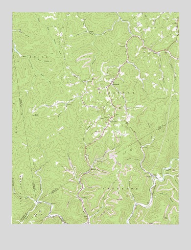
Bentree, WV USGS Topographic Map
Click on map above to begin viewing in our Map Viewer.

This topographic map contains these locations and features:
Feature Name Type Latitude Longitude GNIS ID View Map
AdonijahPopulated PlaceN38.3340°W81.1946°1741378View Map
Adonijah ForkStreamN38.3720°W81.1690°1534843View Map
Backus BranchStreamN38.2551°W81.2215°1534759View Map
Backus BranchStreamN38.2621°W81.1565°1535106View Map
Bearpen ForkStreamN38.3004°W81.1448°1535416View Map
Bells Creek ChurchChurchN38.2615°W81.2212°1535613View Map
BentreePopulated PlaceN38.2837°W81.1909°1535652View Map
Bentree Post OfficePost OfficeN38.2834°W81.1909°1741379View Map
Big HollowValleyN38.2659°W81.1443°1535856View Map
Big HollowValleyN38.2965°W81.1948°1535857View Map
Big HollowValleyN38.3504°W81.1398°1535858View Map
Bird KnobSummitN38.3140°W81.2334°1536037View Map
Brown School (historical)SchoolN38.3507°W81.1409°1536414View Map
Bull HollowValleyN38.3245°W81.1984°1536698View Map
CambriaPopulated PlaceN38.2654°W81.1996°1554052View Map
CrosbyPopulated PlaceN38.3209°W81.2093°1549649View Map
Crosby School (historical)SchoolN38.3343°W81.1948°1537864View Map
DeerpondReservoirN38.3651°W81.2415°1557426View Map
DixiePopulated PlaceN38.2509°W81.1932°1538212View Map
Dixie Census Designated PlaceCensusN38.2509°W81.1943°2586798View Map
Dixie Elementary SchoolSchoolN38.2545°W81.1920°2489147View Map
Dixie Post OfficePost OfficeN38.2516°W81.1927°1741073View Map
Eberbaugh Station (historical)LocaleN38.2534°W81.1929°1741077View Map
Grassy ForkStreamN38.3462°W81.1648°1539631View Map
GreendalePopulated PlaceN38.2957°W81.1534°1549716View Map
Henderson DamDamN38.3668°W81.1548°1557421View Map
Henderson LakeReservoirN38.3680°W81.1542°1557422View Map
Holcomb CemeteryCemeteryN38.3618°W81.1251°1741405View Map
Hubbard ForkStreamN38.3209°W81.2098°1540542View Map
Hughes ForkStreamN38.2623°W81.2307°1540570View Map
Ida CemeteryCemeteryN38.2909°W81.1951°1741406View Map
Ida Missionary Baptist ChurchChurchN38.2904°W81.1951°1540654View Map
IndependencePopulated PlaceN38.3126°W81.1765°1540660View Map
Independence MountainSummitN38.3134°W81.1809°1540662View Map
IndorePopulated PlaceN38.3529°W81.1468°1554768View Map
Indore Baptist ChurchChurchN38.3532°W81.1462°1741409View Map
Indore ChapelChurchN38.3515°W81.1340°1540704View Map
Indore Post OfficePost OfficeN38.3590°W81.1538°1741410View Map
Kuns BranchStreamN38.3487°W81.2387°1541296View Map
Laurel ForkStreamN38.3343°W81.1940°1541437View Map
Laurel ForkStreamN38.3487°W81.1304°1541438View Map
Laurel ForkStreamN38.2693°W81.2482°1541457View Map
Laurel Fork Missionary Baptist ChurchChurchN38.3345°W81.1943°1541466View Map
Lick BranchStreamN38.2534°W81.1934°1541858View Map
Lick BranchStreamN38.3615°W81.1876°1541860View Map
Lilly BranchStreamN38.2795°W81.1368°1541959View Map
Lilly Number 11 School (historical)SchoolN38.3684°W81.1268°1557857View Map
Lizemore Church of the NazareneChurchN38.3345°W81.1746°1741412View Map
Lizemore Elementary SchoolSchoolN38.3308°W81.1793°1741413View Map
LizemoresPopulated PlaceN38.3340°W81.1751°1549788View Map
Lizemores ChurchChurchN38.3551°W81.1648°1542276View Map
Lizemores Post OfficePost OfficeN38.3348°W81.1742°1741414View Map
Lizemores Volunteer Fire DepartmentBuildingN38.3438°W81.1669°2577801View Map
Open ForkStreamN38.2504°W81.1937°1544416View Map
Orchard LakeReservoirN38.3668°W81.2415°1557418View Map
Pack ForkStreamN38.3332°W81.1754°1544502View Map
Ramp HollowValleyN38.2834°W81.1898°1545397View Map
Right Fork Sycamore CreekStreamN38.3615°W81.1593°1545714View Map
Road ForkStreamN38.2957°W81.1529°1545806View Map
Road ForkStreamN38.3393°W81.2309°1545807View Map
Rockcamp ForkStreamN38.2634°W81.2318°1545939View Map
Rockcamp ForkStreamN38.2779°W81.1446°1545940View Map
Sangamore ForkStreamN38.2832°W81.1915°1546423View Map
Smith BranchStreamN38.2512°W81.2104°1546960View Map
Spring BranchStreamN38.2862°W81.1534°1547174View Map
Tent BranchStreamN38.3495°W81.2423°1547981View Map
Union Carbide H F Club Lake Number One DamDamN38.3668°W81.2415°1557417View Map
Union Carbide Lake Number Two DamDamN38.3651°W81.2415°1557425View Map
VaughanPopulated PlaceN38.2784°W81.1446°1548636View Map
Williams HollowValleyN38.2765°W81.2009°1549174View Map

Note: Coordinates in the location and feature list above are referenced to NAD83 datum.


Copyright (C) 2008-2024 Ryan Niemi / Sunset Dynamics ... All Rights Reserved