TopoQuest Logo
Do you find TopoQuest useful?
Help keep TopoQuest running and adding new maps/features by donating!
Bitcoin:  19c7KJd3qBynnjoSw5npx9KScwjBe4ifkT
Litecoin:  LXs6TkuXGGXo1vDsWCkWVdjQX94eUKd6ui
Home View Maps Find Maps Find Places Resources & Links


Gauley Bridge, West Virginia Topographic Map

USGS Map Title: Gauley Bridge, WV
USGS Map MRC: 38081B2
DRG (GeoTIFF) Download: o38081b2.tif


Neighboring USGS Topographic Map Quads:


  Mammoth, WV  
38081C3
 

  Bentree, WV  
38081C2
 

  Lockwood, WV  
38081C1
 

  Montgomery, WV  
38081B3
 

  Gauley Bridge, WV  
38081B2
 

  Ansted, WV  
38081B1
 

  Powellton, WV  
38081A3
 

  Beckwith, WV  
38081A2
 

  Fayetteville, WV  
38081A1


Map MRC Location:

N39°
W82°
N39°
W81°
H8 H7 H6 H5 H4 H3 H2 H1
G8 G7 G6 G5 G4 G3 G2 G1
F8 F7 F6 F5 F4 F3 F2 F1
E8 E7 E6 E5 E4 E3 E2 E1
D8 D7 D6 D5 D4 D3 D2 D1
C8 C7 C6 C5 C4 C3 C2 C1
B8 B7 B6 B5 B4 B3 B2 B1
A8 A7 A6 A5 A4 A3 A2 A1
N38°
W82°
N38°
W81°

Gauley Bridge, WV USGS 1:24K Topographic Map Preview:
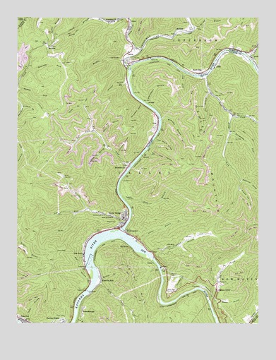
Gauley Bridge, WV USGS Topographic Map
Click on map above to begin viewing in our Map Viewer.

This topographic map contains these locations and features:
Feature Name Type Latitude Longitude GNIS ID View Map
Abbott-Huddleston CemeteryCemeteryN38.1302°W81.1898°2586371View Map
AgnewPopulated PlaceN38.2126°W81.1429°1556046View Map
AltaPopulated PlaceN38.2073°W81.1773°1553719View Map
Bailey Memorial ChurchChurchN38.1687°W81.2001°1535129View Map
Beech GlenPopulated PlaceN38.2273°W81.1554°1535534View Map
Bells CreekStreamN38.2373°W81.1859°1535612View Map
BelvaPopulated PlaceN38.2312°W81.1921°1535619View Map
Belva Census Designated PlaceCensusN38.2327°W81.1895°2586760View Map
Belva Post OfficePost OfficeN38.2323°W81.1893°1741138View Map
Bible Baptist ChurchChurchN38.2329°W81.1868°1741139View Map
Big CreekStreamN38.1882°W81.1923°1535817View Map
Big CreekStreamN38.1337°W81.1501°1535823View Map
Blue Hole Tunnel (historical)TunnelN38.1321°W81.1740°1556055View Map
BoonesboroughPopulated PlaceN38.1296°W81.2162°1553948View Map
Bridge ForkStreamN38.2101°W81.1384°1536337View Map
BrownsvillePopulated PlaceN38.1884°W81.1934°1553994View Map
BrycePopulated PlaceN38.2232°W81.1518°1556058View Map
Buck RunStreamN38.2273°W81.1637°1536564View Map
Buckles BranchStreamN38.2332°W81.1940°1536604View Map
C D Coleman BridgeBridgeN38.2264°W81.1538°2635395View Map
Cane BranchStreamN38.1534°W81.1809°1536985View Map
Cane Branch ChurchChurchN38.1568°W81.1682°1536987View Map
Cane Branch School (historical)SchoolN38.1568°W81.1676°1556061View Map
Charlton Heights Census Designated PlaceCensusN38.1254°W81.2332°2586780View Map
Chimney CornerPopulated PlaceN38.1390°W81.1470°1554132View Map
Copeland BranchStreamN38.1959°W81.2015°1537664View Map
Currycamp ForkStreamN38.2029°W81.1396°1537935View Map
Dickerson School (historical)SchoolN38.2007°W81.1804°1556073View Map
Dixie Baptist ChurchChurchN38.2418°W81.1929°1741157View Map
Dorsey BranchStreamN38.2454°W81.1590°1538276View Map
Falls CreekStreamN38.1421°W81.2087°1538876View Map
Falls ViewPopulated PlaceN38.1262°W81.2462°1554440View Map
Fivemile ForkStreamN38.2126°W81.2473°1539025View Map
GamocaPopulated PlaceN38.1934°W81.1851°1549695View Map
GauleyPopulated PlaceN38.1493°W81.1793°1554542View Map
Gauley BridgePopulated PlaceN38.1684°W81.1948°1554543View Map
Gauley BridgeBridgeN38.1628°W81.1959°2635387View Map
Gauley Bridge Elementary SchoolSchoolN38.1676°W81.1959°1556106View Map
Gauley Bridge High School (historical)SchoolN38.1685°W81.1945°1556107View Map
Gauley Bridge Middle School (historical)SchoolN38.1676°W81.1951°1556108View Map
Gauley Bridge Police DepartmentBuildingN38.1646°W81.1970°2727908View Map
Gauley Bridge Post OfficePost OfficeN38.1678°W81.1928°2774593View Map
Gauley Bridge Public LibraryBuildingN38.1653°W81.1950°2727201View Map
Gauley Bridge Volunteer Fire DepartmentBuildingN38.1653°W81.1948°2577718View Map
Gauley RiverStreamN38.1618°W81.1962°1551216View Map
Gauley River Volunteer Fire DepartmentBuildingN38.2289°W81.1487°2578061View Map
Glen FerrisPopulated PlaceN38.1532°W81.2148°1554564View Map
Glen Ferris Census Designated PlaceCensusN38.1518°W81.2185°2586812View Map
Glen Ferris Post OfficePost OfficeN38.1499°W81.2154°2774647View Map
Grassy Lot HollowValleyN38.1673°W81.1298°1539635View Map
Gum Springs ChurchChurchN38.1418°W81.1468°1539790View Map
Hawks Nest Country ClubLocaleN38.1379°W81.1726°1557847View Map
Hawks Nest State Park Golf CourseLocaleN38.1399°W81.1701°2634121View Map
Hill CemeteryCemeteryN38.2334°W81.1901°1540286View Map
Hitt HollowValleyN38.1946°W81.1823°1540321View Map
Honey BranchStreamN38.1337°W81.1498°1540418View Map
James Hudnall SpringSpringN38.1598°W81.1554°1960214View Map
Jan - Care Ambulance Service Gauley BridgeBuildingN38.1644°W81.1976°2581084View Map
JodiePopulated PlaceN38.2304°W81.1479°1554812View Map
Kanawha FallsFallsN38.1512°W81.2123°1556129View Map
Kanawha FallsPopulated PlaceN38.1426°W81.2065°1554842View Map
KM JunctionPopulated PlaceN38.1623°W81.1940°1541053View Map
Laurel BranchStreamN38.1587°W81.1865°1541385View Map
Lee BranchStreamN38.1271°W81.2193°1541601View Map
Left Fork Big CreekStreamN38.2037°W81.2104°1541632View Map
Left Fork Scrabble CreekStreamN38.1718°W81.2132°1541721View Map
Lick BranchStreamN38.2196°W81.1498°1541855View Map
Litchford HollowValleyN38.1946°W81.1979°1542012View Map
Little Elk CreekStreamN38.2343°W81.1307°1542094View Map
Log Chute HollowValleyN38.1998°W81.1784°1542307View Map
Meadow BranchStreamN38.1437°W81.2079°1543052View Map
Mount OlivePopulated PlaceN38.2379°W81.2334°1555174View Map
Mount Olive Correctional ComplexBuildingN38.2359°W81.2391°2634730View Map
Mount Olive School (historical)SchoolN38.2393°W81.2346°1556154View Map
Nancy BranchStreamN38.2134°W81.2154°1544036View Map
New RiverStreamN38.1618°W81.1965°1552301View Map
Old GauleyPopulated PlaceN38.1562°W81.1918°1555263View Map
Rich CreekStreamN38.2259°W81.1529°1545539View Map
Rich Creek CemeteryCemeteryN38.2096°W81.1365°1545540View Map
Rich Creek JunctionLocaleN38.2279°W81.1904°1556186View Map
Riggs BranchStreamN38.1418°W81.2112°1545597View Map
Robin HollowValleyN38.2021°W81.2059°1545855View Map
Rockcamp BranchStreamN38.2087°W81.1757°1545936View Map
Sand BranchStreamN38.1734°W81.1923°1546340View Map
Schoolhouse BranchStreamN38.2146°W81.1832°1546493View Map
Scrabble CreekStreamN38.1659°W81.1934°1546528View Map
Scrabble Creek ChurchChurchN38.1696°W81.2051°1546529View Map
Sevenmile ForkStreamN38.2290°W81.2446°1546584View Map
Simms CemeteryCemeteryN38.2346°W81.1282°2586321View Map
Sims Memorial United Methodist ChurchChurchN38.2351°W81.1290°1741224View Map
Softwood HollowValleyN38.1832°W81.1334°1547053View Map
SwissPopulated PlaceN38.2332°W81.1279°1555769View Map
Swiss Post OfficePost OfficeN38.2397°W81.1252°1741230View Map
Town of Gauley BridgeCivilN38.1681°W81.2039°2390202View Map
Twentymile CreekStreamN38.2287°W81.1923°1548395View Map
VanettaPopulated PlaceN38.1754°W81.1937°1555878View Map
Victor School (historical)SchoolN38.2448°W81.1626°1741234View Map
West Virginia State Police Troop 6 - Gauley Bridge DetachmentBuildingN38.1637°W81.2011°2727907View Map
Whiteface HollowValleyN38.2143°W81.1857°1549086View Map
Windsor HollowValleyN38.2232°W81.1946°1549242View Map
WyndalPopulated PlaceN38.2146°W81.1821°1556033View Map

Note: Coordinates in the location and feature list above are referenced to NAD83 datum.


Copyright (C) 2008-2024 Ryan Niemi / Sunset Dynamics ... All Rights Reserved