TopoQuest Logo
Do you find TopoQuest useful?
Help keep TopoQuest running and adding new maps/features by donating!
Bitcoin:  19c7KJd3qBynnjoSw5npx9KScwjBe4ifkT
Litecoin:  LXs6TkuXGGXo1vDsWCkWVdjQX94eUKd6ui
Home View Maps Find Maps Find Places Resources & Links


Manchester, Alabama Topographic Map

USGS Map Title: Manchester, AL
USGS Map MRC: 33087H3
DRG (GeoTIFF) Download: o33087h3.tif


Neighboring USGS Topographic Map Quads:


  Poplar Springs, AL  
34087A4
 

  Black Pond, AL  
34087A3
 

  Arley, AL  
34087A2
 

  Nauvoo, AL  
33087H4
 

  Manchester, AL  
33087H3
 

  Sunlight, AL  
33087H2
 

  Townley, AL  
33087G4
 

  Jasper, AL  
33087G3
 

  Cordova, AL  
33087G2


Map MRC Location:

N34°
W88°
N34°
W87°
H8 H7 H6 H5 H4 H3 H2 H1
G8 G7 G6 G5 G4 G3 G2 G1
F8 F7 F6 F5 F4 F3 F2 F1
E8 E7 E6 E5 E4 E3 E2 E1
D8 D7 D6 D5 D4 D3 D2 D1
C8 C7 C6 C5 C4 C3 C2 C1
B8 B7 B6 B5 B4 B3 B2 B1
A8 A7 A6 A5 A4 A3 A2 A1
N33°
W88°
N33°
W87°

Manchester, AL USGS 1:24K Topographic Map Preview:
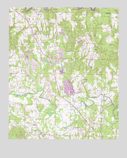
Manchester, AL USGS Topographic Map
Click on map above to begin viewing in our Map Viewer.

This topographic map contains these locations and features:
Feature Name Type Latitude Longitude GNIS ID View Map
Antioch ChurchChurchN33.9432°W87.3636°159076View Map
Bankhead Farmstead SchoolSchoolN33.8865°W87.2803°159111View Map
Bennett CemeteryCemeteryN33.9854°W87.3308°159148View Map
Bennett ChapelChurchN33.9621°W87.3292°162296View Map
Bennett Coal Bed MineMineN33.9848°W87.3236°161752View Map
Bennett School (historical)SchoolN33.9632°W87.3292°162297View Map
Blackwater Macedonia Church of ChristChurchN33.9376°W87.3675°162300View Map
Brakefield BendBendN33.8868°W87.3097°159245View Map
Camak Mills (historical)Populated PlaceN33.9076°W87.2883°162302View Map
Cedar Valley MineMineN33.9376°W87.3472°161751View Map
Charlies CreekStreamN33.9204°W87.3425°159370View Map
Crooked CreekStreamN33.9340°W87.3453°159464View Map
Cross Roads CemeteryCemeteryN33.8834°W87.3389°162308View Map
Crossroads Church of ChristChurchN33.8798°W87.3331°159468View Map
Dry CreekStreamN33.9176°W87.3739°159526View Map
EdgilPopulated PlaceN33.9021°W87.3550°162311View Map
Edgil ChurchChurchN33.9012°W87.3572°159557View Map
Edgil Grove CemeteryCemeteryN33.9015°W87.3578°162312View Map
Edward ChapelChurchN33.8887°W87.3445°159559View Map
Far Crooked CreekStreamN33.9407°W87.3375°159595View Map
Farmstead Baptist ChurchChurchN33.8921°W87.2806°162313View Map
Five PointsPopulated PlaceN33.8884°W87.2833°159602View Map
Friendship ChurchChurchN33.9896°W87.3558°159628View Map
Gaddy CemeteryCemeteryN33.9307°W87.3517°163896View Map
GamblePopulated PlaceN33.8796°W87.3345°159650View Map
Gamble StationLocaleN33.8812°W87.3514°159651View Map
Glory Hill ChurchChurchN33.9748°W87.3472°162315View Map
Gods ChurchChurchN33.9201°W87.3186°162316View Map
Harmony ChurchChurchN33.9332°W87.3220°162317View Map
Harris BridgeBridgeN33.9082°W87.3256°159727View Map
House of Prayer ChurchChurchN33.9329°W87.2739°162319View Map
Hudson SettlementPopulated PlaceN33.8854°W87.2992°159824View Map
I AMS TempleChurchN33.9129°W87.3106°162320View Map
Jasper Gas FieldOilfieldN33.8868°W87.2522°154948View Map
Johnsey BridgeBridgeN33.9187°W87.3445°159861View Map
Jones CemeteryCemeteryN33.9184°W87.3606°159869View Map
Lamon Chapel Baptist ChurchChurchN33.9934°W87.3431°159909View Map
Little Spring CreekStreamN33.9209°W87.2628°159986View Map
MacedoniaPopulated PlaceN33.9373°W87.3667°162325View Map
Macedonia Number 5 MineMineN33.9229°W87.3458°161750View Map
Macedonia School (historical)SchoolN33.9368°W87.3675°160024View Map
Mammouth ChurchChurchN33.8904°W87.3695°162326View Map
ManchesterPopulated PlaceN33.9065°W87.3014°160027View Map
Manchester ChurchChurchN33.9051°W87.2997°163904View Map
Manchester DivisionCivilN33.9529°W87.3043°165985View Map
Manchester MineMineN33.9223°W87.3056°161749View Map
MarigoldPopulated PlaceN33.9382°W87.3150°160037View Map
Marigold MinesMineN33.9390°W87.3153°162327View Map
Mount Zion ChurchChurchN33.9598°W87.2786°160190View Map
Mount Zion Fire and RescueBuildingN33.9587°W87.2930°2683479View Map
Mount Zion Volunteer Fire and RescueBuildingN33.9668°W87.2828°2683251View Map
Musgrove Country ClubLocaleN33.9057°W87.2839°164391View Map
New Hope ChurchChurchN33.9318°W87.2911°160240View Map
New Jerusalem ChurchChurchN33.9712°W87.2872°162332View Map
New Zion ChurchChurchN33.9054°W87.3675°163906View Map
Old Bennett CemeteryCemeteryN33.9626°W87.3289°160295View Map
Pole BranchStreamN33.9696°W87.2770°160423View Map
Red Mill Junior High School (historical)SchoolN33.8798°W87.3389°160480View Map
Russell Fire TowerTowerN33.9646°W87.2617°164409View Map
Shields BridgeBridgeN33.9087°W87.2570°162339View Map
South LowellPopulated PlaceN33.9101°W87.2695°160647View Map
South Lowell CemeteryCemeteryN33.9107°W87.2689°163916View Map
Spring CreekStreamN33.9148°W87.2614°160658View Map
Strip Pit CreekStreamN33.9087°W87.2928°160688View Map
ThachPopulated PlaceN33.9737°W87.3472°162343View Map
Thach Volunteer Fire DepartmentBuildingN33.9767°W87.3470°2682983View Map
Thatch ChapelChurchN33.9857°W87.3247°160734View Map
Thatch Junior High SchoolSchoolN33.9748°W87.3461°160735View Map
Trinity ChurchChurchN33.9065°W87.3020°163917View Map
Twin Lakes Golf CourseLocaleN33.8784°W87.2503°162345View Map
Union Grove ChurchChurchN33.8829°W87.3397°160776View Map
Union Hill ChurchChurchN33.9723°W87.3472°162346View Map
Walker County Airport-Bevill FieldAirportN33.9040°W87.3155°2676305View Map
West Jasper Gas FieldOilfieldN33.8868°W87.3131°154952View Map

Note: Coordinates in the location and feature list above are referenced to NAD83 datum.


Copyright (C) 2008-2024 Ryan Niemi / Sunset Dynamics ... All Rights Reserved