TopoQuest Logo
Do you find TopoQuest useful?
Help keep TopoQuest running and adding new maps/features by donating!
Bitcoin:  19c7KJd3qBynnjoSw5npx9KScwjBe4ifkT
Litecoin:  LXs6TkuXGGXo1vDsWCkWVdjQX94eUKd6ui
Home View Maps Find Maps Find Places Resources & Links


Bayou Sauveur, Louisiana Topographic Map

USGS Map Title: Bayou Sauveur, LA
USGS Map MRC: 29090C7
DRG (GeoTIFF) Download: o29090c7.tif


Neighboring USGS Topographic Map Quads:


  Lake Penchant, LA  
29090D8
 

  Lake Theriot, LA  
29090D7
 

  Dulac, LA  
29090D6
 

  Lake Mechant, LA  
29090C8
 

  Bayou Sauveur, LA  
29090C7
 

  Lake Quitman, LA  
29090C6
 

  Grand Bayou du Large, LA  
29090B8
 

  Dog Lake, LA  
29090B7
 

  Cocodrie, LA  
29090B6


Map MRC Location:

N30°
W91°
N30°
W90°
H8 H7 H6 H5 H4 H3 H2 H1
G8 G7 G6 G5 G4 G3 G2 G1
F8 F7 F6 F5 F4 F3 F2 F1
E8 E7 E6 E5 E4 E3 E2 E1
D8 D7 D6 D5 D4 D3 D2 D1
C8 C7 C6 C5 C4 C3 C2 C1
B8 B7 B6 B5 B4 B3 B2 B1
A8 A7 A6 A5 A4 A3 A2 A1
N29°
W91°
N29°
W90°

Bayou Sauveur, LA USGS 1:24K Topographic Map Preview:
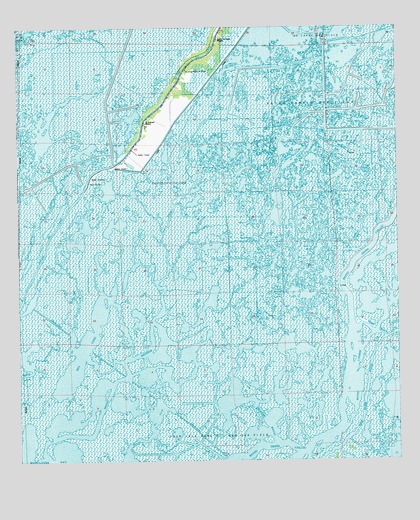
Bayou Sauveur, LA USGS Topographic Map
Click on map above to begin viewing in our Map Viewer.

This topographic map contains these locations and features:
Feature Name Type Latitude Longitude GNIS ID View Map
Bay LongBayN29.2861°W90.8525°553388View Map
Bayou du Large Baptist MissionChurchN29.3719°W90.8084°553450View Map
Bayou du NordBayN29.2612°W90.8314°532415View Map
Bayou JonesBayN29.2751°W90.8742°532645View Map
Bayou RambioBayN29.3306°W90.7542°532749View Map
Bayou Rambio Oil and Gas FieldOilfieldN29.3511°W90.7604°553513View Map
Bayou SauveurBayN29.2738°W90.8426°532771View Map
Bourgs Camp (historical)LocaleN29.3308°W90.7545°551894View Map
Du Large House of PrayerChurchN29.3633°W90.8193°1796353View Map
Fohs CanalBayN29.3452°W90.7685°535018View Map
Four Island BayouBayN29.2521°W90.7735°535061View Map
Immaculate Conception ChurchChurchN29.3499°W90.8306°535896View Map
Lewis BayouBayN29.2877°W90.7598°536416View Map
Little Lewis BayouGutN29.2999°W90.7740°536575View Map
Mound BayouBayN29.3506°W90.7500°537276View Map
Saint Andrews Episcopal MissionChurchN29.3477°W90.8329°538796View Map
Sauveur Bayou Gas FieldOilfieldN29.3372°W90.8093°551951View Map
Terrebonne ParishCivilN29.3374°W90.8376°559517View Map
Treasure BayouBayN29.2726°W90.7910°539978View Map

Note: Coordinates in the location and feature list above are referenced to NAD83 datum.


Copyright (C) 2008-2025 Ryan Niemi / Sunset Dynamics ... All Rights Reserved