TopoQuest Logo
Do you find TopoQuest useful?
Help keep TopoQuest running and adding new maps/features by donating!
Bitcoin:  19c7KJd3qBynnjoSw5npx9KScwjBe4ifkT
Litecoin:  LXs6TkuXGGXo1vDsWCkWVdjQX94eUKd6ui
Home View Maps Find Maps Find Places Resources & Links


Lake Theriot, Louisiana Topographic Map

USGS Map Title: Lake Theriot, LA
USGS Map MRC: 29090D7
DRG (GeoTIFF) Download: o29090d7.tif


Neighboring USGS Topographic Map Quads:


  Bayou Cocodrie, LA  
29090E8
 

  Humphreys, LA  
29090E7
 

  Houma, LA  
29090E6
 

  Lake Penchant, LA  
29090D8
 

  Lake Theriot, LA  
29090D7
 

  Dulac, LA  
29090D6
 

  Lake Mechant, LA  
29090C8
 

  Bayou Sauveur, LA  
29090C7
 

  Lake Quitman, LA  
29090C6


Map MRC Location:

N30°
W91°
N30°
W90°
H8 H7 H6 H5 H4 H3 H2 H1
G8 G7 G6 G5 G4 G3 G2 G1
F8 F7 F6 F5 F4 F3 F2 F1
E8 E7 E6 E5 E4 E3 E2 E1
D8 D7 D6 D5 D4 D3 D2 D1
C8 C7 C6 C5 C4 C3 C2 C1
B8 B7 B6 B5 B4 B3 B2 B1
A8 A7 A6 A5 A4 A3 A2 A1
N29°
W91°
N29°
W90°

Lake Theriot, LA USGS 1:24K Topographic Map Preview:
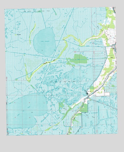
Lake Theriot, LA USGS Topographic Map
Click on map above to begin viewing in our Map Viewer.

This topographic map contains these locations and features:
Feature Name Type Latitude Longitude GNIS ID View Map
Bayou Dularge Fire DepartmentBuildingN29.4113°W90.7828°2332400View Map
Congo IslandIslandN29.4744°W90.8626°534081View Map
Du Large Gas FieldOilfieldN29.3866°W90.7776°554278View Map
DuLarge Elementary SchoolSchoolN29.4591°W90.7504°551901View Map
East Lake De Cade Gas FieldOilfieldN29.4280°W90.8168°551906View Map
Falgout CanalBayN29.4019°W90.7565°534894View Map
Falgout Canal BayouBayN29.4202°W90.8074°534895View Map
Falgout Canal MarinaLocaleN29.4152°W90.7843°551909View Map
Lake De CadeBayN29.3969°W90.8652°558183View Map
Lake TheriotBayN29.4667°W90.8299°556230View Map
Lower Bayou du Large School (historical)SchoolN29.3908°W90.8009°536763View Map
Marmande CanalCanalN29.4619°W90.7843°536903View Map
Marmande RidgeRidgeN29.4472°W90.8259°536904View Map
Minors CanalBayN29.4878°W90.8032°537154View Map
South Sunrise Oil and Gas FieldOilfieldN29.4786°W90.7554°556094View Map
TheriotPopulated PlaceN29.4613°W90.7515°556229View Map
Ward TenCivilN29.4469°W90.7945°545228View Map

Note: Coordinates in the location and feature list above are referenced to NAD83 datum.


Copyright (C) 2008-2024 Ryan Niemi / Sunset Dynamics ... All Rights Reserved