TopoQuest Logo
Do you find TopoQuest useful?
Help keep TopoQuest running and adding new maps/features by donating!
Bitcoin:  19c7KJd3qBynnjoSw5npx9KScwjBe4ifkT
Litecoin:  LXs6TkuXGGXo1vDsWCkWVdjQX94eUKd6ui
Home View Maps Find Maps Find Places Resources & Links


Union Point, Oregon Topographic Map

USGS Map Title: Union Point, OR
USGS Map MRC: 44122C8
DRG (GeoTIFF) Download: o44122c8.tif


Neighboring USGS Topographic Map Quads:


  Halsey, OR  
44123D1
 

  Brownsville, OR  
44122D8
 

  Waterloo, OR  
44122D7
 

  Indian Head, OR  
44123C1
 

  Union Point, OR  
44122C8
 

  Crawfordsville, OR  
44122C7
 

  Coburg, OR  
44123B1
 

  Mohawk, OR  
44122B8
 

  Marcola, OR  
44122B7


Map MRC Location:

N45°
W123°
N45°
W122°
H8 H7 H6 H5 H4 H3 H2 H1
G8 G7 G6 G5 G4 G3 G2 G1
F8 F7 F6 F5 F4 F3 F2 F1
E8 E7 E6 E5 E4 E3 E2 E1
D8 D7 D6 D5 D4 D3 D2 D1
C8 C7 C6 C5 C4 C3 C2 C1
B8 B7 B6 B5 B4 B3 B2 B1
A8 A7 A6 A5 A4 A3 A2 A1
N44°
W123°
N44°
W122°

Union Point, OR USGS 1:24K Topographic Map Preview:
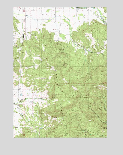
Union Point, OR USGS Topographic Map
Click on map above to begin viewing in our Map Viewer.

This topographic map contains these locations and features:
Feature Name Type Latitude Longitude GNIS ID View Map
Bald MountainSummitN44.2698°W122.9337°1136028View Map
Brownsville DivisionCivilN44.3470°W122.9577°1937970View Map
Cougar RidgeRidgeN44.2807°W122.8915°1119387View Map
Courtney Creek School (historical)SchoolN44.3418°W122.9212°1119400View Map
Cubehole Airport (historical)AirportN44.3664°W122.9608°2650884View Map
Diamond HillSummitN44.2857°W122.9934°1158206View Map
Diamond Hill Post Office (historical)Post OfficeN44.2804°W122.9956°1165157View Map
Horse RockPillarN44.3012°W122.8854°1122018View Map
McKercher BridgeBridgeN44.3623°W122.8837°1162195View Map
McKercher County ParkParkN44.3582°W122.8901°1162197View Map
Owl CreekStreamN44.2637°W122.8768°1133221View Map
Union Point (historical)Populated PlaceN44.3485°W122.9856°1136857View Map
Union Point Post Office (historical)Post OfficeN44.3485°W122.9856°1166085View Map

Note: Coordinates in the location and feature list above are referenced to NAD83 datum.


Copyright (C) 2008-2025 Ryan Niemi / Sunset Dynamics ... All Rights Reserved